Elizabethton in Carter County, Tennessee — The American South (East South Central)
Muster of the Overmountain Men

Photographed by Mark Parker, March 14, 2025
1. Muster of the Overmountain Men Marker
When the Watuagan leaders learned of Ferguson's threat, they ordered their militia companies mustered at Sycamore Shoals. On September 25, 1780, 1,100 militiamen from westem North Carolina and Virginia gathered at the Shoals. The next day, leaving some 200 behind to guard against the Cherokee, the rest - swearing to "wield the Sword of the Lord and of Gideon"
this page online
"[These were] the most powerful men ever beheld, tall, rawboned, sinewy." "[They were]from the extreme backwoods... whom no labor could tire and whose rifles seldom missed their mark." Loyalist officers at Kings Mountain
"We were all of us blue hen's chickens, real fighters and no mistake." Robert Henry Patriot militiaman.
"[Kings Mountain] was immediately productive of the worst consequences... And unhappily proved the link in a chain of evils that followed each other in regular succession until they at the last ended in the total loss of America." British General Sir Henry Clinton
(Map caption)
The historic route of the overmountain men to Kings Mountain. After Ferguson's defeat,
Photographed by Mark Parker, March 14, 2025
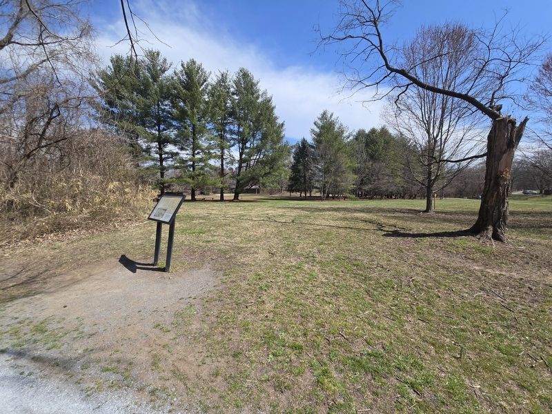
2. Muster of the Overmountain Men Marker looking back towards open field
(Photo caption)
On muster day, September 25, 1780, hundreds of men from the mountain valleys of western North Carolina and southwestern Virginia assembled at Sycamore Shoals. "Gathering of the Mountain Men at Sycamore Shoals", a painting by Lloyd Branson, Tennessee State Museum Collection. (Marker Number Stop 4.)
Topics. This historical marker is listed in this topic list: War, US Revolutionary. A significant historical date for this entry is September 25, 1780.
Location. 36° 20.58′ N, 82° 15.317′ W. Marker is in Elizabethton, Tennessee, in Carter County. It is on West Elk Avenue (U.S. 321) west of Franklin Springs Circle, on the right when traveling west. The marker is along a walking trail next to the Watauga River approximately .2 of a mile from the parking lot. Touch for map. Marker is at or near this postal address: 1651 W Elk Ave, Elizabethton TN 37643, United States of America. Touch for directions.

Regionally, this marker is in East Tennessee and in the Tri-Cities Area. It is also in the American South, specifically in the Upper South, in Appalachia, and specifically in Southern Appalachia. Globally, it is in North America, the Western Hemisphere, the Western World, and the Anglosphere. Historically, it finds itself in what was once the original Cherokee Nation, the territory of the Mississippian Culture, one of the Confederate States of America, the State of Franklin, and the Antebellum South.
Other nearby markers. At least 8 other markers are within walking distance of this marker: Revolutionary War Patriots (within shouting distance of this marker); Sycamore Shoals on the Watauga (about 300 feet away, measured in a direct line); Fort Watauga and the Cherokee War (about 700 feet away); Valentine Sevier, "The Immigrant" (approx. 0.2 miles away); Dedicated to the Spirit of the Overmountain Men (approx. 0.2 miles away); Sycamore Shoals State Historic Area (approx. 0.2 miles away); John Crockett: Frontier Ranger (approx. 0.2 miles away); David Crockett (approx. 0.2 miles away). Touch for a list and map of all markers in Elizabethton.
More about this marker. The marker is the fourth stop of an interactive trail that circles the park's property.
Credits. This page was last revised on March 19, 2025. It was originally submitted on March 18, 2025, by Mark Parker of Hickory, North Carolina. This page has been viewed 484 times since then and 97 times this year. Photos: 1. submitted on March 18, 2025, by Mark Parker of Hickory, North Carolina. 2. submitted on March 19, 2025, by Mark Parker of Hickory, North Carolina. • James Hulse was the editor who published this page.
