
Lewes & Rehoboth Hundred in Dewey Beach in Sussex County, Delaware — The American Northeast (Mid-Atlantic)
Decades of Defense
Photographed by Ian Lefkowitz, May 4, 2024
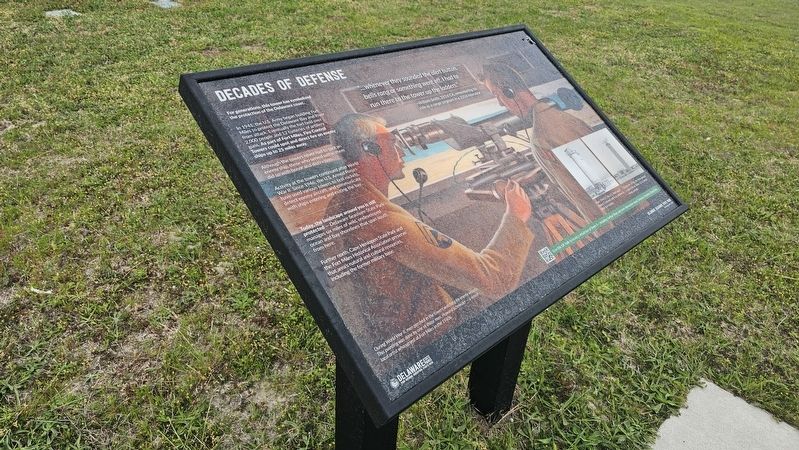
1. Decades of Defense Marker
—William Smith, 261st CA, remembering his role as a range sergeant in a 2004 interview
For generations, this tower has symbolized the protection of the Delaware coast.
In 1941, the U.S. Army began building Fort Miles to protect the Delaware Bay and River from attack. Eventually the fort held over 2,000 people and 12 batteries of artillery guns. As part of Fort Miles, Fire Control Towers could spot and direct fire on enemy ships up to 25 miles away.
Although the towers never had to spot an enemy ship, those who served within them did so with honor and distinction.
Activity at the towers continued after World War II. Since 1946, the U.S. Armed Forces have used various towers to test rockets, detect enemy aircraft, and communicate with ships entering and exiting the bay.
Today, the landscape around you is still protected — Delaware Seashore State Park manages six miles of wild, undeveloped ocean and bay shorelines that span south from here.
Further north, Cape Henlopen State Park
this page online
[Caption] During World War II, men perched in the towers watching for enemy vessels. This painting was done by one of those men, Howard Schroeder — a noted local artist who served at Fort Miles in the 1940s.
[Caption] From 1946-47, the U.S. Navy used Towers 5 (shown) and 6 as stations to track test rockets.
[Caption] During the 1950s, the Army placed a radar dish on Tower 12 to detect enemy aircraft.
Erected by Delaware State Parks.
Topics. This historical marker is listed in these topic lists: Communications • War, World II.
Location. 38° 40.691′ N, 75° 4.26′ W. Marker is in Dewey Beach, Delaware, in Sussex County. It is in Lewes & Rehoboth Hundred. It is on Tower Road. The historical marker is located near Tower #3. Enter at the corner of Coastal Highway and Tower Road, and drive north until reaching the parking lot. Touch for map. Marker is at or near this postal address: 39036 Tower Rd, Rehoboth Beach DE 19971, United States of
Photographed by Ian Lefkowitz, May 4, 2024
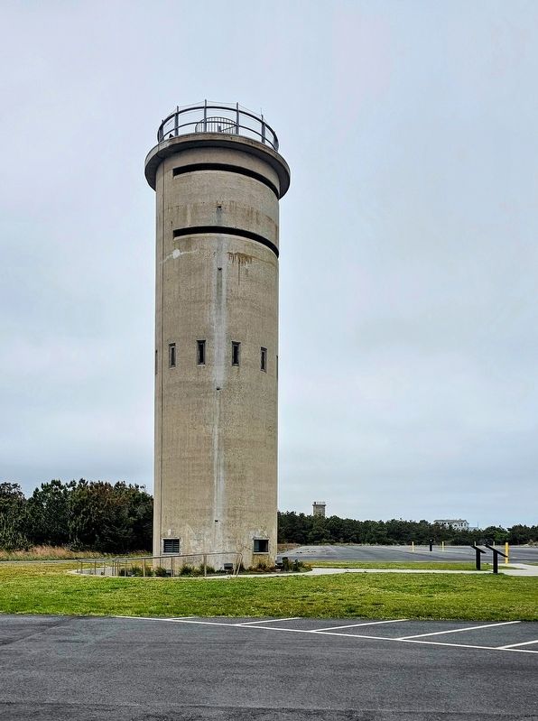
2. Tower #3
Tower #3 is free and open to the public. Tower #4 can be seen in the distance.

Regionally, this marker is on Delaware’s Beaches. It is also in the American Mid-Atlantic, on the Delmarva Peninsula, and on the Eastern Seaboard. Globally, it is in the North Atlantic Region, North America, the Western Hemisphere, the Western World, and the Anglosphere. Historically, it finds itself in what was once New Netherland, one of the original Thirteen Colonies, and the Antebellum South.
Other nearby markers. At least 8 other markers are within 3 miles of this marker, measured as the crow flies: Standing Guard (a few steps from this marker); History of Lake Comegys and Silver Lake (approx. 2.1 miles away); World War I Memorial (approx. 2½ miles away); Funland (approx. 2½ miles away); The Anna Hazzard House (approx. 2.7 miles away); City of Rehoboth Beach (approx. 2.7 miles away); The Bandstand (approx. 2.7 miles away); Veterans Memorial (approx. 2.7 miles away).
Another marker is no longer nearby. Ocean Facts (was approx. 2.7 miles away but has been replaced with another marker now near it).
Credits. This page was last revised on June 5, 2026. It was originally submitted on March 19, 2025, by Ian Lefkowitz of New York, New York. This page has been viewed 118 times since then and 18 times this year. Photos: 1, 2. submitted on March 19, 2025, by Ian Lefkowitz of New York, New York. • Bill Pfingsten was the editor who published this page.
