Monnickendam in Waterland, North Holland, Netherlands — Northwestern Europe
Watersnood 1916
⎯⎯⎯
Flood of 1916
Photographed by Andrew Ruppenstein, March 19, 2025
1. Watersnood 1916 / Flood of 1916 Marker

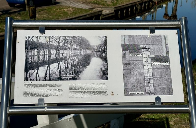
In de eerste weken van januari 1916 waaide het stevig uit westelijke richting en viel er veel regen. Op dinsdag 11 januari 1916 stormde het eerst twaalf uur lang uit het noordwesten. Daarna draaide de wind naar het zuidwesten, waardoor er maar weinig water door Het Kanaal afstroomde naar de oceaan.
Hierdoor bleef de waterstand in de Noordzee en de Zuiderzee hoog. Donderdag 13 januari 1916 blies een harde zuidwesten wind eerst de Gouwzee leeg. Toen de wind 's middags draaide kwam er een zware noordwesterstorm overheen. De harde wind blies in korte tijd grote massa's Noordzeewater de Zuiderzee in. Het water stroomde bij eb nauwelijks terug. De waterstand in de Gouwzee bereikte een recordhoogte. De golven beukten onophoudelijk tegen de Katwouder Zeedijk en de Waterlandse Zeedijk. De kruin van deze dijken lag op 3.20 meter + NAP. Ze waren door de vele regen al met water verzadigd.
Door de golfslag sloeg veel water over de dijken heen en kalfde het binnentalud snel af. Er was geen houden meer aan. In de nacht van donderdag 13 op vrijdag 14 januari 1916 bezweken de dijken bij Zuiderwoude en in Katwoude. Een enorme overstroming van het achterliggende land met de inliggende dorpen en steden en polders was het gevolg. Een groot gebied van 14000 ha kwam onder water te staan.
this page online
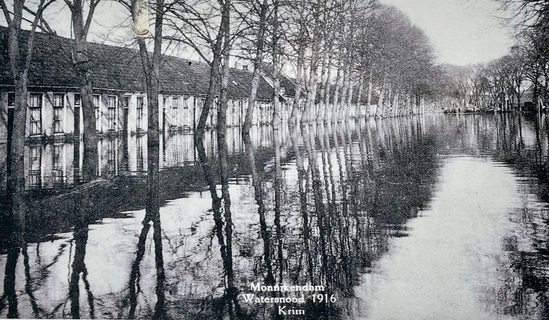
Bovenstaande foto geeft een beeld van de overstroming aan de Nieuwe Zijds Burgwal (in de volksmond de Krim geheten). Rechts een foto van een plank, waarop verschillende stormvloedhoogten zijn aangegeven. Met de vinger wordt rechts de hoogste stand van 2.87 m + NAP aangegeven, in Monnickendam gemeten op 14 januari 1916. Overigens is die nacht in de Gouwzee een maximale waterstand van 3.02 meter + NAP gemeten. De eerdere recordstand was 2.66 m + NAP, gemeten op 12/13 december 1883.
Flood of 1916
In the first weeks of January 1916, there was a strong wind from the west and a lot of rain. On Tuesday 11 January 1916, there was a storm from the northwest for twelve hours. Then the wind turned to the southwest, which meant that only a small amount of water flowed down the Channel to the ocean.
This kept the water level in the North Sea and the Zuiderzee high. On Thursday 13 January 1916, a strong south-westerly wind first blew the Gouwzee empty. When the wind changed in the afternoon, a heavy north-westerly storm came over it. The strong wind blew large masses of North Sea water into the Zuiderzee in a short time. The water hardly flowed back at low tide. The
Photographed by Andrew Ruppenstein, March 19, 2025
2. Watersnood 1916 / Flood of 1916 Marker - wider view
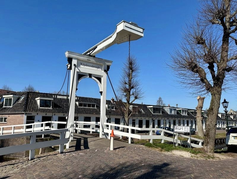
The marker is located by the Lijnbaenbrugh, a pedestrian bridge connecting the Oude Zijds Burgwal to Niuewe Zijds Burgwal.
The waves caused a lot of water to overflow the dikes and the inner slope quickly eroded. There was no stopping it. In the night of Thursday 13 to Friday 14 January 1916, the dikes at Zuiderwoude and in Katwoude collapsed. The result was an enormous flooding of the land behind it with the villages, towns and polders in it. A large area of 14,000 hectares was flooded. Monnickendam was one of them. The damage was enormous. The suffering was incalculable. A lot of cattle drowned. On (nearby) Marken, 16 inhabitants drowned.
The above photo shows the flooding at the Nieuwe Zijds Burgwal (popularly called the Krim). On the right is a photo of a plank, on which various storm surge heights are indicated. The finger on the right indicates the highest level of 2.87 m + NAP, measured in Monnickendam on 14 January 1916. Incidentally, that night a maximum water level of 3.02 metres + NAP was measured in the Gouwzee. The previous record level was 2.66 m + NAP, measured on 12/13 December 1883.
Topics. This historical marker is listed in this topic list: Disasters. A significant historical date for this entry is January 13, 1916.
Location. 52° 27.492′ N,
Photographed by Andrew Ruppenstein, March 19, 2025
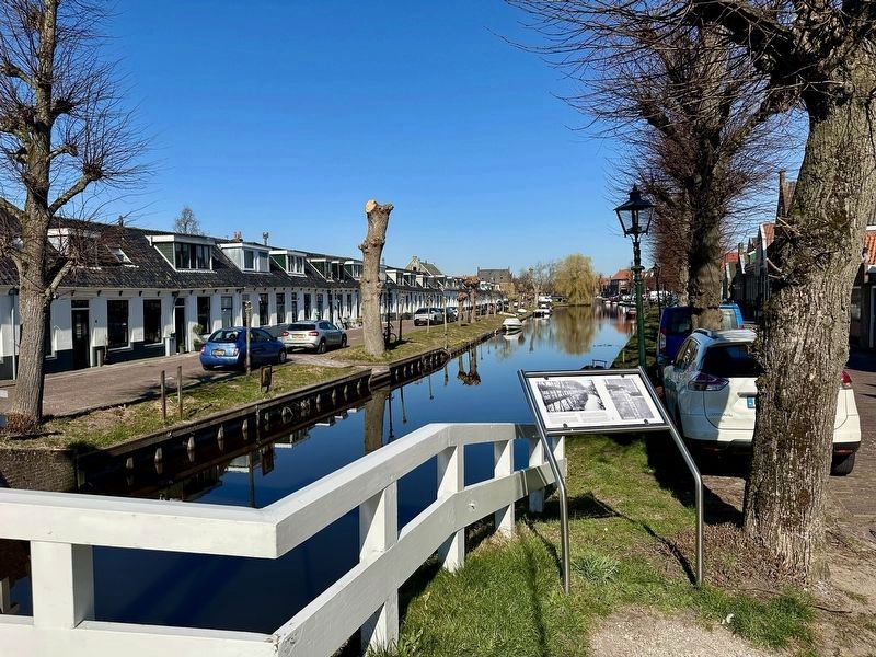
3. Flood of 1916 Marker - wide view with Nieuwe Zijds Burgwal

Regionally, it is in Europe, the European Union, Atlantic Europe, the Benelux Low Countries, the Schengen Area, Western Europe, and the Western World. Historically, it finds itself in what was once the Holy Roman Empire.
Other nearby markers. At least 8 other markers are within walking distance of this marker: Leo Hordijk Memorial (within shouting distance of this marker); Het Zonnepad (within shouting distance of this marker); Toren / Tower (about 180 meters away, measured in a direct line); Het Kerkhof / The Church Cemetery (about 180 meters away); Weezenland 17 (about 180 meters away); Voormalig Hervormd Burger Weeshuis / Former Protestant Orphanage (about 180 meters away); Andries Witmond (about 210 meters away); Philip Benjamin Witmond (about 210 meters away). Touch for a list and map of all markers in Monnickendam.
Also see . . . Fotoalbum Waternood 1916 (Vereniging Oud Monnickendam). A photo album of 26 photos of the 1916 flood in Monnickendam. No text. (Submitted on March 19, 2025.)

4. Marker photo: historical flood levels
Note the marker and graphic use a somewhat localized measure, meters “+ NAP”, which is short for meters above the Normaal Amsterdams Peil, approximately the mean water level for Amsterdam, which is slightly below sea level.
1916
5. Marker photo: Nieuwe Zijds Burgwal during the flood

Photographed by Andrew Ruppenstein, March 19, 2025
6. When not flooded, looking north from the bridge
Credits. This page was last revised on March 19, 2025. It was originally submitted on March 19, 2025, by Andrew Ruppenstein of Lamorinda, California. This page has been viewed 208 times since then and 31 times this year. Photos: 1, 2, 3, 4, 5, 6. submitted on March 19, 2025, by Andrew Ruppenstein of Lamorinda, California.
