Near Weatherford in Parker County, Texas — The American South (West South Central)
Spring Creek Community
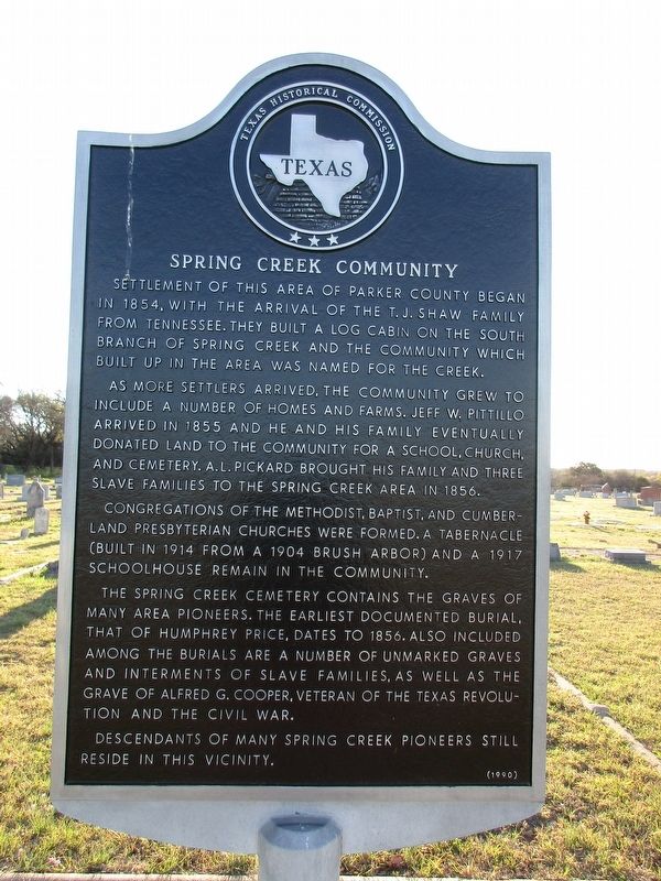
Photographed by Jeff Leichsenring, March 24, 2025
1. Spring Creek Community Marker
As more settlers arrived, the community grew to include a number of homes and farms. Jeff W. Pittillo arrived in 1855 and he and his family eventually donated land to the community for a school, church, and cemetery. A.L. Pickard brought his family and three slave families to the Spring Creek area in 1856.
Congregations of the Methodist, Baptist, and Cumberland Presbyterian churches were formed. A tabernacle (built in 1914 from a 1904 brush arbor) and a 1917 schoolhouse remain in the community.
The Spring Creek Cemetery contains the graves of many area pioneers. The earliest documented burial, that of Humphrey Price, dates to 1856. Also, included among the burials are a number of unmarked graves and interments of slave families, as well as the grave of Alfred G. Cooper, veteran of the Texas Revolution and the Civil War. Descendants of many Spring Creek pioneers still reside
this page online
Erected 1990 by Texas Historical Commission. (Marker Number 5015.)
Topics. This historical marker is listed in this topic list: Settlements & Settlers. A significant historical year for this entry is 1854.
Location. 32° 39.142′ N, 97° 46.634′ W. Marker is near Weatherford, Texas, in Parker County. It is at the intersection of Granbury Highway (State Highway 51) and Spring Creek Road, on the right when traveling north on Granbury Highway. Touch for map. Marker is in this post office area: Weatherford TX 76087, United States of America. Touch for directions.

Regionally, this marker is in the Prairies & Lakes Region and in the Dallas-Fort Worth Metropolitan Area. Globally, it is in North America, a Gulf of Mexico state, the Western Hemisphere, the Western World, and the Anglosphere. Historically, it finds itself in what was once New Spain, the Republic of Texas, and one of the Confederate States of America.
Other nearby markers. At least 8 other markers are within 7 miles of this marker, measured as the crow flies: Colonel Alfred G. Cooper (within shouting distance of this marker); Parker County Poor Farm and Cemetery

Photographed by Jeff Leichsenring, March 24, 2025
2. Spring Creek Community Marker

Photographed by Matthew G French, April 12, 2025
3. Spring Creek Community Marker
Credits. This page was last revised on April 14, 2025. It was originally submitted on March 25, 2025, by Jeff Leichsenring of Garland, Texas. This page has been viewed 321 times since then and 130 times this year. Photos: 1, 2. submitted on March 25, 2025, by Jeff Leichsenring of Garland, Texas. 3. submitted on April 12, 2025, by Matthew G French of Fort Worth, Texas. • James Hulse was the editor who published this page.
