Ville-Marie in Montréal, Québec — Central Canada (French-Canadian)
Le Tours des Sulpiciens
⎯⎯⎯
Sulpician Towers
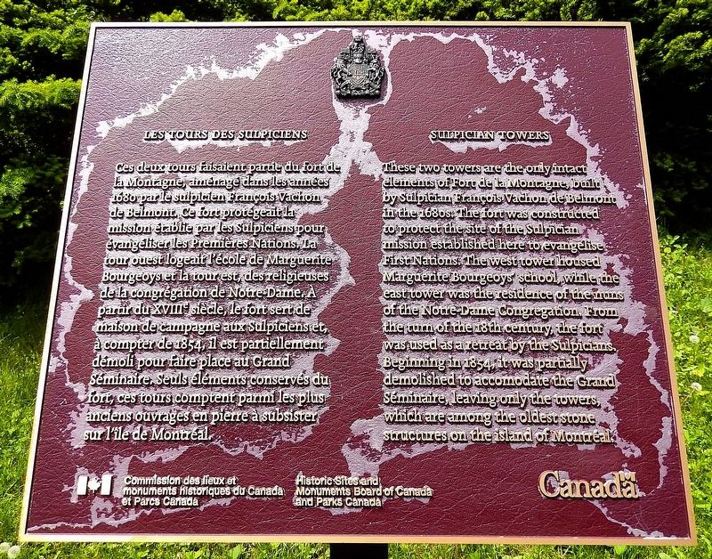
Photographed by Cosmos Mariner, May 23, 2024
1. Le Tours des Sulpiciens/Sulpician Towers Marker

this page online
Erected by Commission des lieux et monuments historiques du Canada et Parcs Canada/Historic Sites and Monuments Board of Canada and Parks Canada.
Topics and series. This historical marker is listed in these topic lists: Architecture • Education • Forts and Castles • Religion & Religious Structures. In addition, it is included in the Canada, Historic Sites and Monuments Board series list. A significant historical year for this entry is 1694.
Location. 45° 29.631′ N, 73° 35.068′ W. Marker is in Montréal, Québec. It is in Ville-Marie. It is at the intersection of Rue Sherbrooke Ouest (Québec Route 138) and Fort Street, on the right when traveling south on Rue Sherbrooke Ouest. The marker is located just inside the former Fort de la Montagne grounds, overlooking the subject towers. Touch for map. Marker is at or near this postal address: 2065 Rue Sherbrooke Ouest, Montréal QC H3H 1G6, Canada. Touch for directions.

Regionally, this marker
Photographed by Cosmos Mariner, May 23, 2024
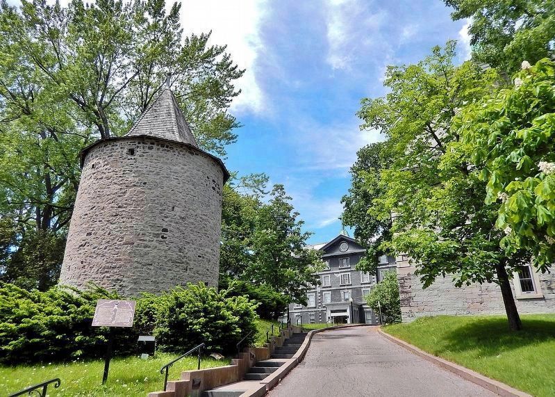
2. Le Tours des Sulpiciens/Sulpician Towers Marker
Looking northwest from Sherbrooke Street West. The marker and towers are just inside the stone fence, on the former Fort de la Montagne grounds. The marker [left] is located on the south side of the east tower.
Other nearby markers. At least 8 other markers are within walking distance of this marker: Domaine du Fort de la Montagne (within shouting distance of this marker); Le Temple Maçonnique / Masonic Memorial Temple (about 150 meters away, measured in a direct line); Marguerite Bourgeoys (approx. 0.3 kilometers away); Appartements Linton (approx. 0.4 kilometers away); Collège Dawson (approx. half a kilometer away); Concordia University: Our History and Presence / L'Université Concordia : une présence historique (approx. 0.6 kilometers away); The Church of Saint Andrew and Saint Paul (approx. 0.6 kilometers away); Alexander McFee Memorial (approx. 0.6 kilometers away). Touch for a list and map of all markers in Montréal.
Regarding Le Tours des Sulpiciens / Sulpician Towers. The towers were designated a national historic site of Canada in 1970, and are also listed on
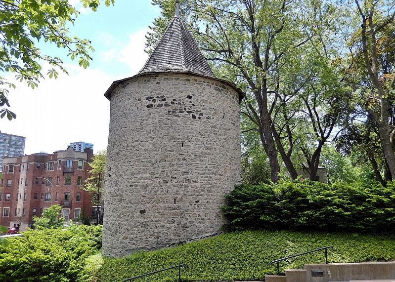
Photographed by Cosmos Mariner, May 23, 2024
3. East Tower (east elevation)
From the Canadian Register Statement of Significance:
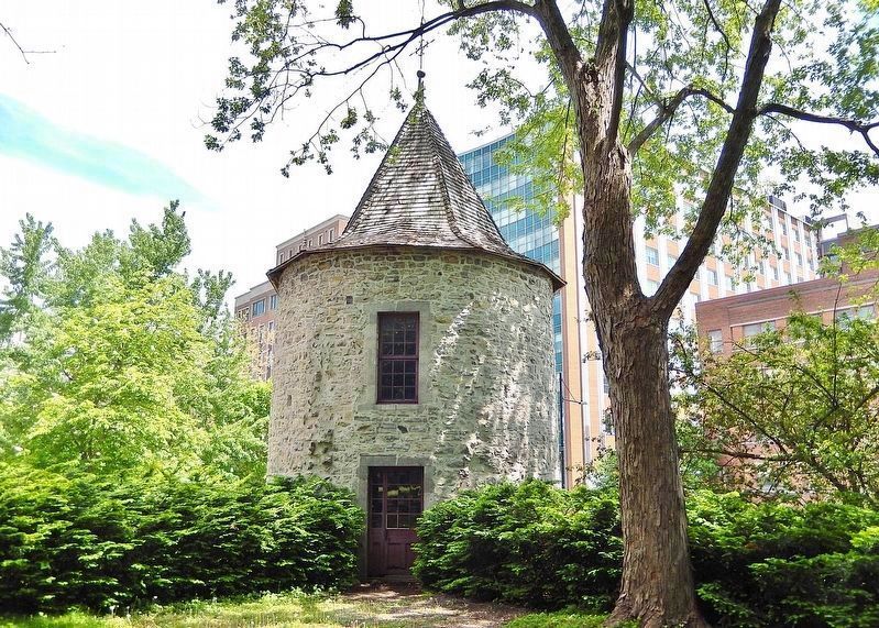
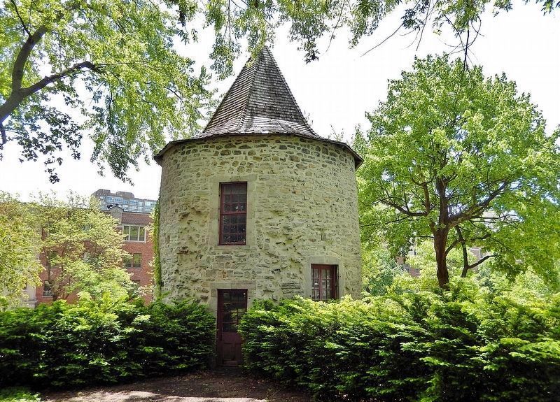
Key elements contributing to the heritage value of this site include: the original location of the towers on the Sherbrooke Street West, in downtown Montréal; its setting in front of the Collège de Montréal; the circular form and massing of the two 13-metre high towers; the stone construction of the towers, pierced with gun holes, that were originally an integral part of Fort de la Montagne; the eight-sided conical roofs, covered with cedar shingles and topped with a cross; the multi-paned doors and windows; the weathervane atop the west tower; the spatial relationship between the towers and the architectural remains of the fort, including parts of the curtain wall, foundations of the chapel and the horseshoe shaped front steps, and a vault; and viewscapes from the site to the original location of Fort de la Montagne.
Related markers. Click here for a list of markers that are related to this marker. Marguerite Bourgeoys
Also see . . .
1. Fort de la Montagne (Wikipedia).
Excerpt : Fort de la Montagne (also(Submitted on March 25, 2025, by Cosmos Mariner of Cape Canaveral, Florida.)called Fort des Messieurs or Fort Belmont) was an old fortification, the remaining structures of which are located on Sherbrooke Street. The fort was constructed in 1685 and parts of it were demolished in the mid-19th century. Two 13-metre (43 ft) high stone towers, built in 1694 as bastions of the fort, still remain.Photographed by Cosmos Mariner, May 23, 20244. East Tower (north elevation)
The mission to Christianize the native people was established in 1675 at the foot of Mont-Royal mountain. François Vachon de Belmont was sent to New France towards 1680 by his superiors, order of Saint-Sulpice priests in Paris to stop the spread of witchcraft and visions at the mission. To protect the mission from the Iroquois, a fort was constructed in 1685.
The fort contained four bastions and a series of ramparts and palisades, which were all destroyed in 1854 except for the two southern towers, during the building of the College of Montreal.
2. Sulpician Towers / Fort de la Montagne National Historic Site of Canada (Parks Canada).
Excerpt: Around 1676, the Sulpicians of Montréal Island founded a mission, known as the Mission(Submitted on March 25, 2025, by Cosmos Mariner of Cape Canaveral, Florida.)de la Montagne, intended for the instruction of local aboriginals and their conversion to Catholicism. In 1681, M. François Vachon de Belmont was named a superior of the mission which housed over 200 Iroquois, Hurons and Algonquins living in cabins within the fort.Photographed by Cosmos Mariner, May 23, 20245. West Tower (north elevation)
In 1694, a stone fort composed of four towers connected by a stone enclosure wall, was constructed to protect the new mission. The towers were built with gun-ports for the defence of the fort; however, they acted as a deterrent and were never used. With the increasing departure of the aboriginals between 1692 and 1705, the southeast tower was transformed into a chapel (1824) and the northwest and northeast towers were demolished.
3. Sulpician Towers / Fort de la Montagne (Canada Register of Historic Places).
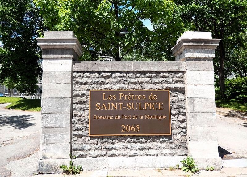
Excerpt: The site is comprised of two two-storey 13-metre high stone towers, built in 1694, that were part of the original Fort de la Montagne. They each have one entrance and a single door with square panes on the north side, above which is a single multi-paned window. Both(Submitted on March 25, 2025, by Cosmos Mariner of Cape Canaveral, Florida.)towers have eight-sided conical roofs topped with a cross.Photographed by Cosmos Mariner, May 23, 20246. Les Prêtres de Saint-Sulpice / The Priests of Saint-SulpiceTurn here to enter the former Fort de la Montagne grounds from Sherbrooke Street West.
Credits. This page was last revised on May 25, 2026. It was originally submitted on March 25, 2025, by Cosmos Mariner of Cape Canaveral, Florida. This page has been viewed 162 times since then and 45 times this year. Photos: 1, 2, 3, 4, 5, 6. submitted on March 25, 2025, by Cosmos Mariner of Cape Canaveral, Florida.
