
New Summerfield in Cherokee County, Texas — The American South (West South Central)
New Summerfield Methodist Church
Photographed by James Hulse, March 17, 2025
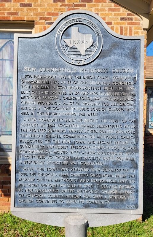
1. New Summerfield Methodist Church Marker
A new community built up about the turn of the century at this location. Named Summerfield after the pioneer Summers family, it gradually replaced the Union Chapel community. The Methodist Church relocated to the new town and became known as Summerfield Methodist Episcopal Church, South. The congregation moved into a new building in 1919. It continued to occupy that facility until 1931, when a new brick structure was completed.
When the town was renamed New Summerfield in 1938, the church's name changed once again. After the merger of the Methodist and Evangelical United Brethren denominations in 1968, it became known as New Summerfield United Methodist Church. A part of Cherokee County history for over a century, the church continues to serve its community.
Erected 1989 by Texas Historical Commission. (Marker Number 6977.)
Topics. This historical marker is listed in these topic lists: Education • Religion & Religious Structures. A significant historical year for this entry is 1878.
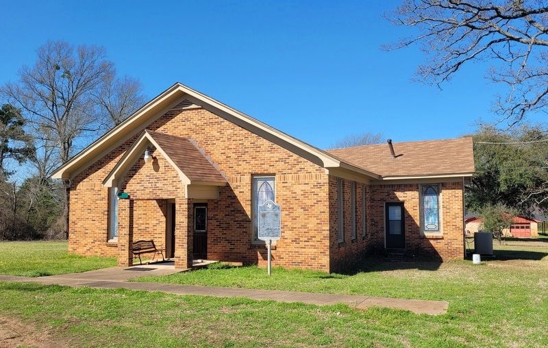
Location. 31° 58.863′ N, 95° 5.778′ W. Marker is in New Summerfield, Texas, in Cherokee County. It is on John Wesley Lane south of U.S. 79, on the right when traveling south. The marker is located in front of the church. Touch for map. Marker is at or near this postal address: 165 John Wesley Ln, Jacksonville TX 75766, United States of America. Touch for directions.

Regionally, this marker is in the American
this page online
Other nearby markers. At least 8 other markers are within 10 miles of this marker, measured as the crow flies: McDonald Cemetery (approx. 0.7 miles away); Ponta (approx. 5.8 miles away); Pleasant Grove Methodist Episcopal Church South Cemetery (approx. 7.9 miles away); Central Baptist Church of Jacksonville (approx. 8.2 miles away); First United Methodist Church of Jacksonville (approx. 8.7 miles away); First Baptist Church (approx. 9 miles away); Sardis Baptist Church (approx. 9.2 miles away); Craft Baptist Church (approx. 9.4 miles away). Touch for a list and map of all markers in New Summerfield.
Photographed by James Hulse, March 17, 2025
2. New Summerfield Methodist Church and Marker
Credits. This page was last revised on March 28, 2025. It was originally submitted on March 27, 2025, by James Hulse of Medina, Texas. This page has been viewed 214 times since then and 41 times this year. Photos: 1, 2. submitted on March 28, 2025, by James Hulse of Medina, Texas.
