West Redding in Fairfield County, Connecticut — The American Northeast (New England)
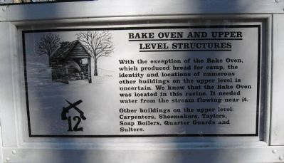
Bake Oven and Upper Level Structures
— Putnam Memorial State Park —
Other buildings on the upper level: Carpenters, Shoemakers, Taylors, Soap Boilers, Quarter Guards and Sulters.
Erected 2009 by Friends & Neighbors of Putnam Park. (Marker Number 12.)
Topics. This historical marker is listed in this topic list: War, US Revolutionary.
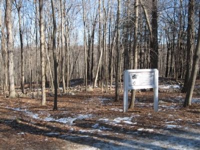
Location. 41° 20.363′ N, 73° 23.046′ W. Marker is in Redding, Connecticut, in Fairfield County. It is in West Redding. Marker can be reached from Putnam Park Road (Connecticut Route 58) near Connecticut Route 107, on the right when traveling south. Located in Putnam Memorial State Park. Touch for map. Marker is in this post office area: Redding CT 06896, United States of America. Touch for directions.
Other nearby markers. At least 8 other markers are within walking distance of this marker. Cemetery / Command Officer’s Quarters (within shouting distance of this marker); Company Street (Fireback Row) (about 400 feet away, measured in a direct line); Memorial Monument (about 400 feet away); Lake McDougall (about 500 feet away); Barlow Circle (about 700 feet away); Museum (about 700 feet away); Putnam Memorial State Park (about 800 feet away); Charles Burr Todd (about 800 feet away). Touch for a list and map of all markers in Redding.
Credits. This page was last revised on February 10, 2023. It was originally submitted on January 25, 2010, by Michael Herrick of Southbury, Connecticut. This page has been viewed 956 times since then and 7 times this year. Photos: 1, 2, 3. submitted on January 25, 2010, by Michael Herrick of Southbury, Connecticut. • Bill Pfingsten was the editor who published this page.


