New Cumberland in Hancock County, West Virginia — The American South (Appalachia)
Rockyside
⎯⎯⎯
The Black Stone Church
Photographed by Craig Doda, March 29, 2025
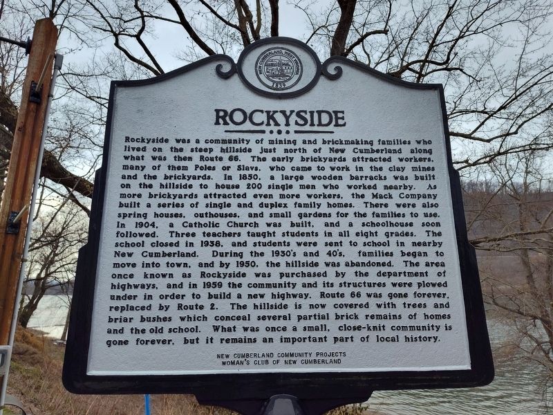
1. Rockyside side of marker
Rockyside. Rockyside was a community of mining and brick making families who lived on the steep hillside just north of New Cumberland along what was then Route 66. The early brickyards attracted workers, many of them Poles or Slavs, who came to work in the clay mines and the brickyards. In 1850, a large wooden barracks was built on the hillside to house 200 single men who worked nearby. As more brickyards attracted even more workers, the Mack Company built a series of single and duplex family homes. There were also spring houses, outhouses, and small gardens for the families to use. In 1904, a Catholic Church was built, and a schoolhouse soon followed. Three teachers taught students in all eight grades. The school closed in 1938, and students were sent to school in nearby New Cumberland. During the 1930's and 40's, families began to move into town, and by 1950, the hillside was abandoned. The area once known as Rockyside was purchased by the department of highways, and in 1959 the community and its structures were plowed under in order to build a new highway. Route 66 was gone forever, replaced by Route 2. The hillside
this page online
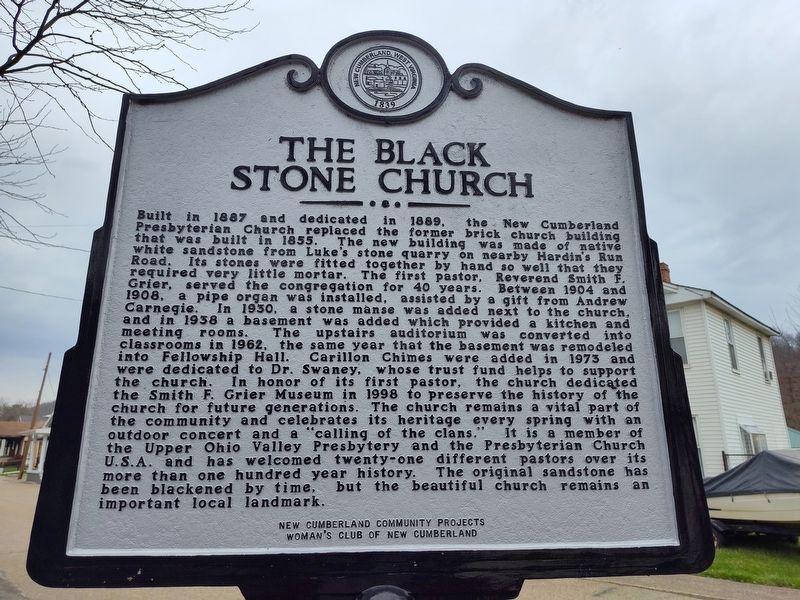
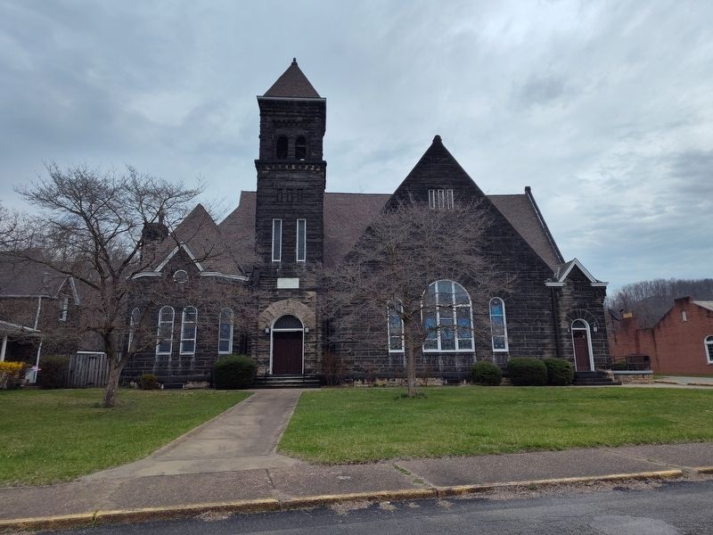
The Black Stone Church. Built in 1887 and dedicated in 1889, the Presbyterian Church replaced the former brick church building New Cumberland that was built in 1855. The new building was made of native white sandstone from Luke's stone quarry on nearby Hardin's Run Road. Its stones were fitted together by hand so well that they required very little mortar. The first pastor, Reverend Smith F. Grier, served the congregation for 40 years. Between 1904 and 1908, a pipe organ was installed, assisted by a gift from Andrew Carnegie. In 1930, a stone manse was added next to the church, and in 1938 a basement was added which provided a kitchen and meeting rooms. The upstairs auditorium was converted into classrooms in 1962, the same year that the basement was remodeled into Fellowship Hall. Carillon Chimes were added in 1973 and were dedicated to Dr. Swaney, whose trust fund helps to support the church. In honor of
Photographed by Craig Doda, March 29, 2025
2. The Black Stone Church side of marker
Erected by New Cumberland Community Projects Woman's Club Of New Cumberland.
Topics. This historical marker is listed in these topic lists: Architecture • Industry & Commerce • Religion & Religious Structures. A significant historical year for this entry is 1850.
Location. 40° 29.915′ N, 80° 36.658′ W. Marker is in New Cumberland, West Virginia, in Hancock County. It is on South River Avenue east of Jefferson Street, on the right when traveling south. Touch for map. Marker is at or near this postal address: 106 S River Ave, New Cumberland WV 26047, United States
Photographed by Craig Doda, March 29, 2025
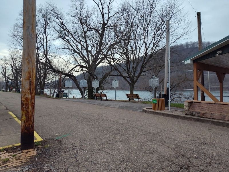
3. Arthur Jack Watson Overlook Pavilion

Regionally, this marker is in the Northern Panhandle and in the High Valley. It is also in the American South, specifically in the Upper South, in the Ohio River Valley, and in Appalachia. Globally, it is in North America, the Western Hemisphere, the Western World, and the Anglosphere. Historically, it finds itself in what was once the territory of the Mississippian Culture.
Other nearby markers. At least 8 other markers are within walking distance of this marker: Gravel Hill Academy (here, next to this marker); Contested County Seat (here, next to this marker); Captain John Porter / Chelsea China Company (a few steps from this marker); Old Town (a few steps from this marker); Flood of 1936 / Early Indians (a few steps from this marker); Brickyard Bend (within shouting distance of this marker); New Cumberland (within shouting distance of this marker); First Gas Well (within shouting distance of this marker). Touch for a list and map of all markers in New Cumberland.
Photographed by Craig Doda, March 29, 2025
4. First Presbyterian Church
Credits. This page was last revised on April 13, 2025. It was originally submitted on April 1, 2025, by Craig Doda of Napoleon, Ohio. This page has been viewed 132 times since then and 36 times this year. Photos: 1, 2, 3, 4. submitted on April 1, 2025, by Craig Doda of Napoleon, Ohio. • Devry Becker Jones was the editor who published this page.
