Newport News, Virginia — The American South (Mid-Atlantic)
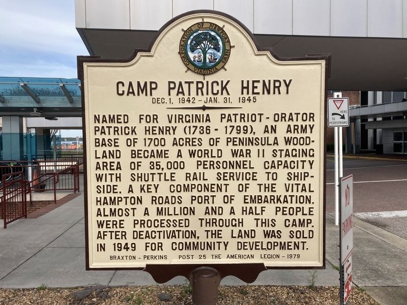
Camp Patrick Henry
Dec. 1, 1942 - Jan. 31, 1945
Photographed by Evan Dwyer, March 29, 2025
1. Camp Patrick Henry Marker
Braxton-Perkins Post 25 of the American Legion - 1979
Erected 1979 by Corporation of Newport News, Virginia.
Topics. This historical marker is listed in this topic list: War, World II. A significant historical year for this entry is 1942.
Location. 37° 7.82′ N, 76° 30.189′ W. Marker is in Newport News, Virginia. It is on Bland Boulevard 0.2 miles east of Patrick Henry Drive, on the left when traveling north. This marker is across from the terminal, accessible by the pick up/drop off area, at Newport News/Williamsburg International Airport (NNWIA). Touch for map. Marker is at or near this postal address: 900 Bland Blvd, Newport News VA 23602, United States of America. Touch for directions.

Regionally, this
this page online
Other nearby markers. At least 8 other markers are within 2 miles of this marker, measured as the crow flies: Two USCT Heroes (approx. 1.3 miles away); Church Bell (approx. 1.3 miles away); Providence Mennonite Church (approx. 1.7 miles away); Denbigh Parish (approx. 1.7 miles away); Mathews Mill (approx. 1.8 miles away); Young’s Mill (approx. 1.8 miles away); a different marker also named Young’s Mill (approx. 1.8 miles away); a different marker also named Young’s Mill (approx. 1.8 miles away). Touch for a list and map of all markers in Newport News.
Regarding Camp Patrick Henry. Camp
Photographed by Evan Dwyer, March 29, 2025
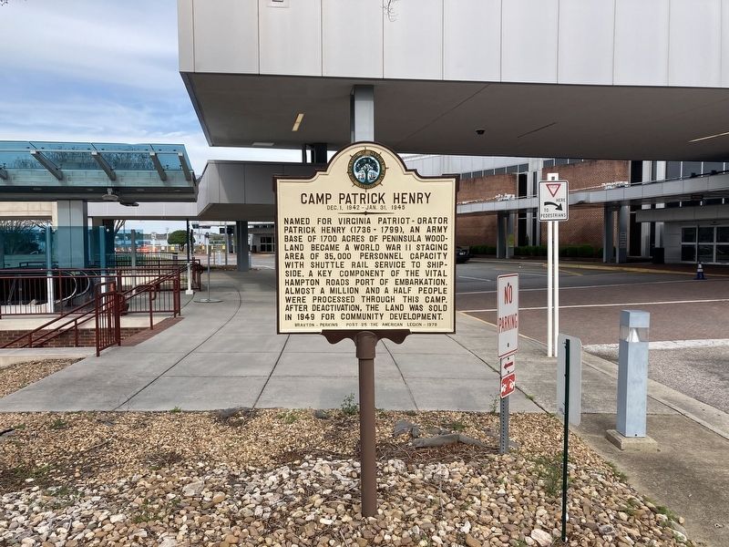
2. Camp Patrick Henry Marker
The eastern corner of the camp's road network can still be seen on Google Maps Satellite view, as the right-angle road corner at 37.132705, -76.492559. Those coordinates represent what was originally the corner of A Avenue and 3rd Street. 2nd Street, which was not as long as 3rd, is under the tarmac to the south. To the west, 12st street was partially destroyed by the construction of Mary Immaculate Hospital's eastern parking lot and retention pond. To the northeast, the camp ended just past Avenue A. To the south, a railyard extended beyond E Avenue (now McManus Blvd) to encompass the Newport News Public Schools facilities, two office parks, and airport parking. A portion of surviving
Photographed by Evan Dwyer
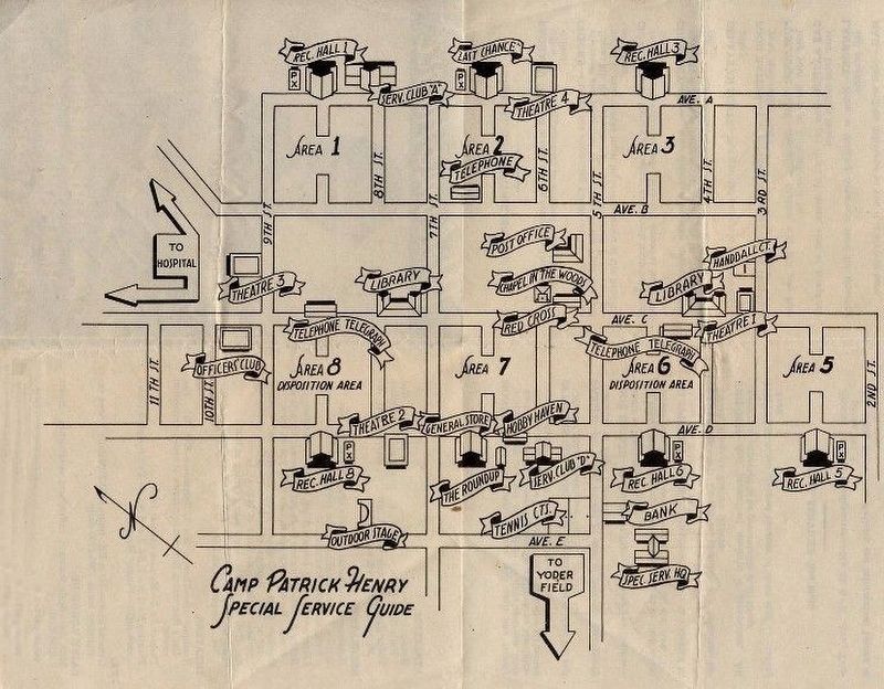
3. Illustrated brochure map of Camp Patrick Henry
WWII-vintage map (not to scale) showing some aspects of the camp.
Camp Patrick Henry featured two facilities within its boundaries that had their own administration. The first was a POW camp, situated between Camp Patrick Henry's 9th & 12th Streets, bordered north and south by C and D Avenues respectively. This corresponds to the wooded area southeast of Mary Immaculate, ending in the line formed by Turnberry Blvd's diagonal path. Nothing remains of the POW camp. The second facility within Camp Patrick Henry was the Station Hospital; this complex was to the north, roughly bounded by Denbigh Blvd & Old Denbigh. J Avenue still runs the route of the hospital's eastern road. J Avenue becomes a southbound camp road that adjoined with A Avenue in the primary camp.
Camp Patrick Henry was divided into numbered living areas, each with a theater, recreation hall, mess complex, and other commodities. The camp had multiple chapels, post offices, and libraries as well. Camp Headquarters
Photographed by Evan Dwyer, March 28, 2025
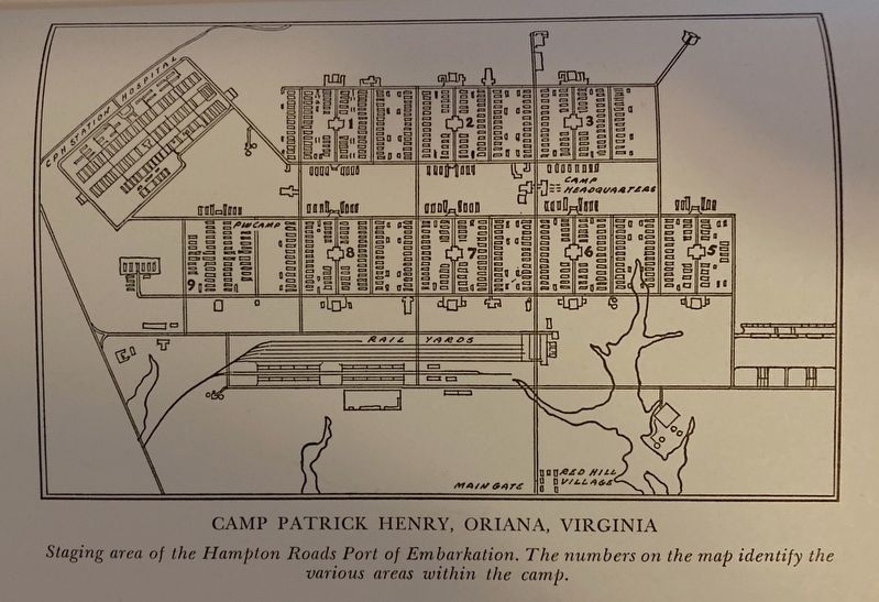
4. 1946 Map of Camp Patrick Henry
As shown in Volume I of the 1946 book "The Road to Victory" edited by Major W.R. Wheeler, Hampton Roads Port of Embarkation Historian. Note the location of the Station Hospital and the Railyard, neither of which are shown on the Special Service Guide maps originally given to visitors.
Photographed by Unknown, 1959
5. Camp Patrick Henry Marker
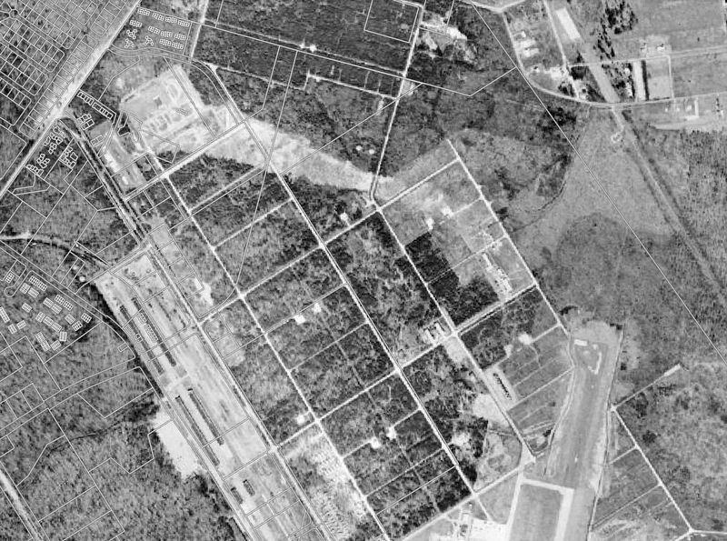
1959 Aerial Photography Overlay on the current road layout from Newport News GIS. This aerial view shows what remained of the camp 10 years after its sale to the City, including its road patterns, the bald areas (in the compact, center squares between C & D Avenues) where two messing complexes stood, the Nike Launch Site at the future site of Mary Immaculate Hospital (upper left), the Railyard still intact (Pale warehouse area lower left), and the slowly reforesting Station Hospital Area (top of photo). This image shows clearly how the runway for NNWIA cut across the southeastern part of the Camp.
Photographed by Evan Dwyer, March 29, 2025
6. Camp Patrick Henry Marker
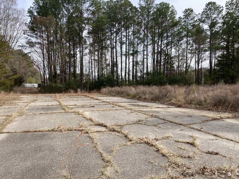
Paved remnants of the railyard at the corner of Turnberry Blvd & Patrick Henry Dr. Ringed by weeds, grass, and leaves to the right is the ruined foundation of a camp warehouse. Years ago, this foundation ran all the way to the airport; in recent years, most of it was destroyed to add Patrick Henry Dr. and commercial & government buildings.
Credits. This page was last revised on April 5, 2025. It was originally submitted on April 3, 2025, by Evan Dwyer of Richmond, Virginia. This page has been viewed 1,403 times since then and 407 times this year. Photos: 1, 2, 3, 4, 5, 6. submitted on April 3, 2025, by Evan Dwyer of Richmond, Virginia. • Bernard Fisher was the editor who published this page.
