Wormleysburg in Cumberland County, Pennsylvania — The American Northeast (Mid-Atlantic)
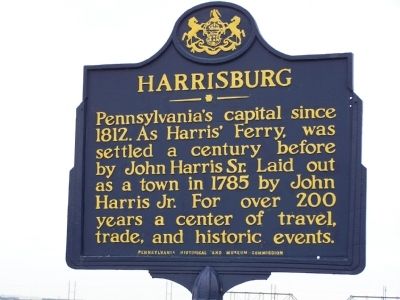
Harrisburg
Photographed by Bill Pfingsten, January 24, 2006
1. Harrisburg Marker
Erected by Pennsylvania Historical and Museum Commission.
Topics and series. This historical marker is listed in this topic list: Settlements & Settlers. In addition, it is included in the Pennsylvania Historical and Museum Commission (PHMC) series list. A significant historical year for this entry is 1812.
Location. 40° 15.189′ N, 76° 53.756′ W. Marker is in Wormleysburg, Pennsylvania, in Cumberland County. It is at the intersection of U.S. 15 and Market St., on the right when traveling north on U.S. 15. Touch for map. Marker is in this post office area: Lemoyne PA 17043, United States of America. Touch for directions.

Regionally, this marker is in South-Central Pennsylvania and in Greater Harrisburg. It is also in the American Northeast, in the Mid-Atlantic, in Appalachia, and specifically in Northern Appalachia. Globally, it is in North America, the Western Hemisphere, the Western World, and
this page online
Other nearby markers. At least 8 other markers are within walking distance of this marker: The Original Fire Bell (about 300 feet away, measured in a direct line); The Wormleysburg School (about 400 feet away); Lemoyne Veterans Memorial (approx. 0.2 miles away); Lemoyne - Bridgeport Heights (approx. 0.2 miles away); John Wormley (approx. 0.3 miles away); Wormleysburg (approx. 0.3 miles away); Evolution of Harrisburg's Skyline (approx. 0.4 miles away); Harrisburg Giants (approx. 0.4 miles away). Touch for a list and map of all markers in Wormleysburg.
Photographed by Bill Pfingsten, January 24, 2006
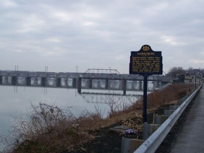
2. Harrisburg Marker
Photographed by Bill Pfingsten, January 24, 2006
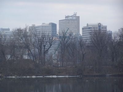
3. Harrisburg from the western shore of the Susquehanna River.
Credits. This page was last revised on June 16, 2016. It was originally submitted on January 28, 2010, by Bill Pfingsten of Bel Air, Maryland. This page has been viewed 932 times since then and 27 times this year. Photos: 1, 2, 3. submitted on January 28, 2010, by Bill Pfingsten of Bel Air, Maryland.
