
Castricum, North Holland, Netherlands — Northwestern Europe
V1 Lanceerplaats
⎯⎯⎯
V1 Launch Site
Photographed by Andrew Ruppenstein, March 21, 2025
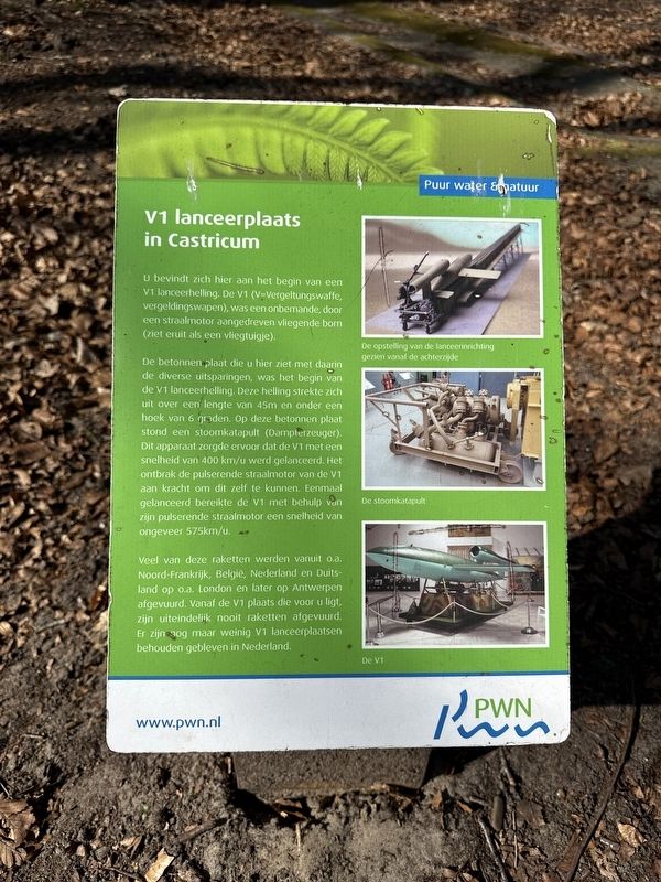
1. V1 Lanceerplaats / V1 Launch Site Marker

V1 lanceerplaats in Castricum
U bevindt zich hier aan het begin van een V1 lanceerhelling. De V1 (V=Vergeltungswaffe, vergeldingswapen), was een onbemande, door een straalmotor aangedreven vliegende bom (ziet eruit als een vliegtuigje).
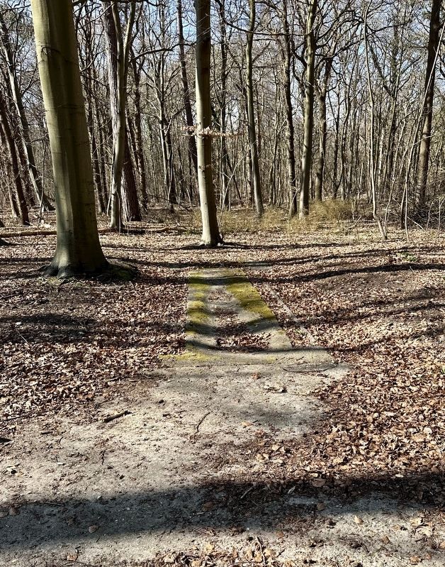
De betonnen plaat die u hier ziet met daarin de diverse uitsparingen, was het begin van de V1 lanceerhelling. Deze helling strekte zich uit over een lengte van 45m en onder een hoek van 6 graden. Op deze betonnen plaat stond een stoomkatapult (Dampierzeuger). Dit apparaat zorgde ervoor dat de V1 met een snelheid van 400 km/u werd gelanceerd. Het ontbrak de pulserende straalmotor van de V1 aan kracht om dit zelf te kunnen. Eenmaal gelanceerd bereikte de V1 met behulp van zijn pulserende straalmotor een snelheid van ongeveer 575km/u.
Veel van deze raketten werden vanuit o.a. Noord-Frankrijk, België, Nederland en Duitsland op o.a. London en later op Antwerpen afgevuurd. Vanaf de V1 plaats die voor u ligt, zijn uiteindelijk nooit raketten afgevuurd. Er zijn nog maar weinig V1 lanceerplaatsen behouden gebleven in Nederland.
V1 launch site in Castricum
You are here at the beginning of a V1 launch ramp. The V1 (V=Vergeltungswaffe, weapon of revenge), was an unmanned, jet-powered flying bomb (similar in appearance to a small airplane).
The concrete slab you see here with the various recesses was the beginning of the V1 launch ramp. This ramp stretched over a length of 45m and at an angle of 6 degrees. On this concrete slab stood a steam catapult (Dampierzeuger). This device ensured that the V1 was launched at a speed of 400 km/h. The pulse jet engine of the V1 lacked the power to be able to do this itself. Once launched, the V1 reached a speed of approximately 575 km/h with the help of its pulse jet engine.
Many of these rockets were launched from Northern France, Belgium, the Netherlands and Germany, among others, on London and later on Antwerp. From the V1 site that lies before you, no rockets were ever launched. There are only a few V1 launch sites preserved in the Netherlands.
Erected by the
this page online
Topics. This historical marker is listed in these topic lists: Air & Space • War, World II.
Location. 52° 32.691′ N, 4° 38.923′ E. Marker is in Castricum, Noord-Holland (North Holland). It is at the intersection of Willemslaan and Oude Schulpweg, on the right when traveling south on Willemslaan. The marker is less than 50 meters from where the path (“Willemslaan”) splits off from Oude Schulpweg. Touch for map. Marker is at or near this postal address: Oude Schulpweg 3, Castricum, Noord-Holland 1901 NV, Netherlands. Touch for directions.

Regionally, it is in Europe, the European Union, Atlantic Europe, the Benelux Low Countries, the Schengen Area, Western Europe, and the Western World. Historically, it finds itself in what was once the Roman Empire and specifically also the Holy Roman Empire.
Other nearby markers. At least 8 other markers are within walking distance of this marker: De Kunstbunker / The Art Bunker (about 180 meters away, measured in a direct line); Kogel / Cannonball (approx. one kilometer away); Dorpskerk Protestantse Gemeente / Protestant Community Village Church
Photographed by Andrew Ruppenstein, March 21, 2025
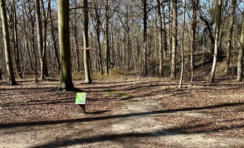
2. V1 Lanceerplaats / V1 Launch Site and marker
Also see . . . V-1 flying bomb (Wikipedia). (Submitted on April 5, 2025.)
Photographed by Andrew Ruppenstein, March 21, 2025
3. V1 launch site concrete pad
Credits. This page was last revised on April 5, 2025. It was originally submitted on April 5, 2025, by Andrew Ruppenstein of Lamorinda, California. This page has been viewed 173 times since then and 48 times this year. Photos: 1, 2, 3. submitted on April 5, 2025, by Andrew Ruppenstein of Lamorinda, California.
