Dublin's Docklands in County Dublin, Leinster, Ireland — Mid-East (and Dublin)
Scherzer Bridges/Droichid Scherzer
Photographed by William Fischer, Jr., April 3, 2025
1. Scherzer Bridges/Droichid Scherzer Marker

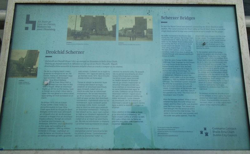
Scherzer Bridges
In 1817 the Royal Canal was opened, connecting the River Shannon with Dublin. The canal entered the River Liffey at North Wall Quay. A cast-iron single track swivel bridge was constructed to carry traffic on the quays.
As traffic increased in the Docks area during the 19th century, the bridge was weakened and in 1860 a decision was taken by the Ballast Board [responsible for running the Port of Dublin] to build a new improved double track bridge. This rolling drawbridge survived until the early 20th century, when its poor condition made it too slow in allowing vessels through and caused significant delays to traffic.
In 1910 Sir John Purser Griffith (1848- 1938) was Chief Engineer for the Dublin 1 Port and Docks Board [formerly the Ballast Board] when it was decided to construct twin bascule bridges to replace the rolling drawbridge. He contracted with Spencer and Company of Melksham, Wiltshire to erect the bridges, which were built to the design invented in 1893 by William Scherzer of Chicago. The Scherzer system reduced the time for suspension of traffic to four and
this page online
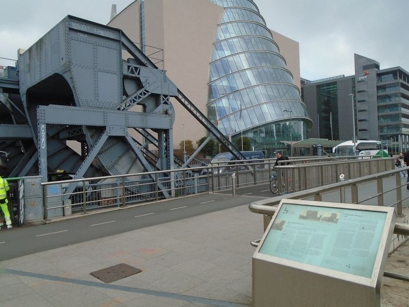
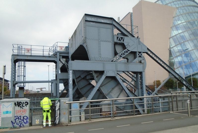
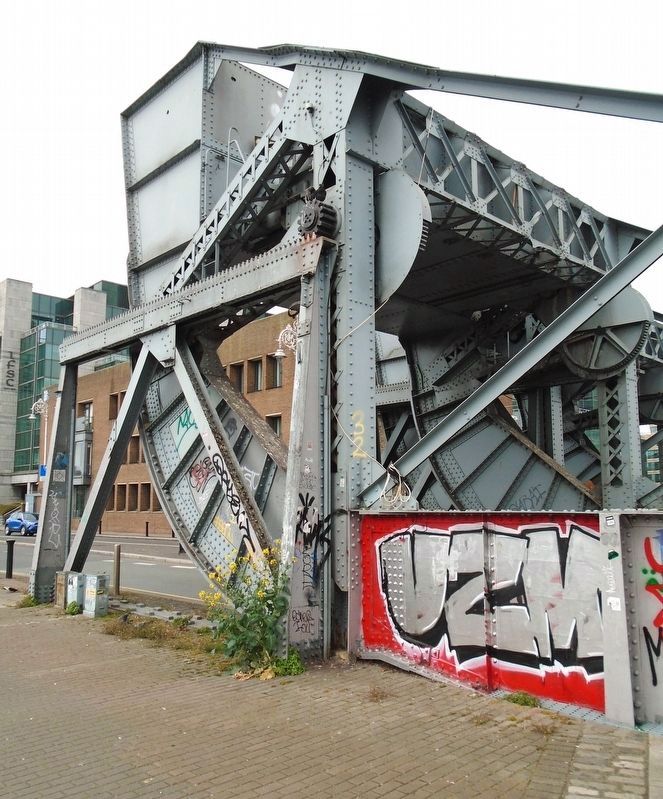
How the bridges worked: When a vessel entered the dock the outer bridge was raised, and the street traffic was diverted over the inner bridge. The vessel was then brought into the entrance until it almost touched the inner bridge. The water in the inner lock was lowered, and the outer sea gates opened. Then the street traffic was stopped and the inner bridge raised. The vessel entered the lock and as soon as the vessel cleared the outer bridge it was lowered and the street traffic diverted over it: The operations were reversed for a vessel leaving the dock.
To the western end of the bridge segmental girders are attached to the main girders. These form the "rolling" surfaces upon which the bridges work. These segmental girders are extended. so as to carry the counterweight box containing steel and concrete. The essential feature of this type of bridge is that the centre of gravity of the whole moveable structure, including the bridge and
Photographed by William Fischer, Jr., April 3, 2025
2. Scherzer Bridges/Droichid Scherzer and Marker
To prevent accidental displacement of the bridges on their paths the track plates had steel teeth incorporated in them. Corresponding recesses for the teeth were cut in the curved track plates of the segmental girders.
Osclaíodh an Chanáil Ríoga i 1817, ag ceangal na Sionainne le Baile Átha Cliath. Tháinig an chanáil isteach in Abhainn na Life ag Cé an Phoirt Thuaidh. Tógadh droichead sclóine aonráille le hiarann teilgthe chun an trácht a iompar ar na céanna.
De réir is a tháinig trácht i méid i gceantar na nDugai le linn an 19ú haoise, tháinig an droichead i laige agus sa bhliain 1860 rinneadh cinneadh[?] sa Bhord Ballasta [f(illegible)] (illegible)cht as Cuan Átha Cliath a bichead nua níos fearr le dhá raille a thógáil. Mhair an droichead tógála go dtí tús na 20ú haoise, nuair a d'éirigh
Photographed by William Fischer, Jr., April 3, 2025
3. Scherzer Bridges/Droichid Scherzer
Conas ar oibrigh na droichid: Nuair a tháinig bád isteach sa duga, ardaíodh an droichead seachtrach, agus rinneadh malairt sli ar an trácht sa sráid thar an ndroichead inmheánach. Bhí an bád treoraithe go dtí an bealach isteach go dtí go raibh sé gearr go leor don droichead inmheánach. Laghdaíodh uisce sa loc inmheánach, agus osclaíodh geatal na
Photographed by William Fischer, Jr., April 3, 2025
4. Scherzer Bridges/Droichid Scherzer at George's Dock
Ar thaobh thiar an droichid, ceanglaítear giarsaí teascánacha leis na príomh-ghiarsal. Comhdhéanann siad sin na dromchlaf "rollta” a oibríonn na droichid orthu. Tá síneadh leis na glarsaí teascánacha sin chun bosca frithmheáchain a lompar, ina bhfuil cruach agus coincréit. Is i feidhm lárnach an droichid seo ná gur ionann meáchanlár an struchtúir inbhogtha iomlán seo, lena n-áirítear an droichead agus an earra frithmheáchain agus lár an rolla. Ciallaíonn sin go bhfuil an droichead cothrom i ngach socrú. Bhí gach aon droichead oibrithe ag mótar leictreach. I gcás cliseadh sa chumhacht, bhí sé indéanta an droichead a oscailt le trealamh láimhe agus a oibriú le slabhra ó leibhéal an bhóthair.
Chun díláithriú trí thimpiste a chosc ar na droichid ar a mbealach, bhí fiacla cruach
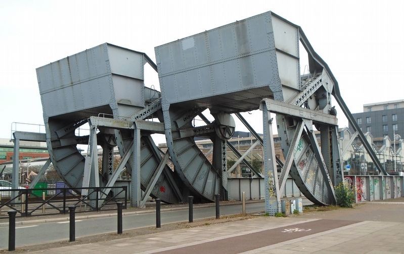
Photographed by William Fischer, Jr., April 3, 2025
5. Scherzer Bridges/Droichid Scherzer at George's Dock
Erected by Dublin City Council/Comhairle Cathrach Bhaile Átha Cliath.
Topics. This historical marker is listed in this topic list: Bridges & Viaducts. A significant historical year for this entry is 1817.
Location. 53° 20.846′ N, 6° 14.447′ W. Marker is in Dublin, Leinster, in County Dublin. It is in Dublin's Docklands. It is at the intersection of Guild Street and North Wall Quay (Leinster Route 801), on the left when traveling south on Guild Street. Marker is just south of the Scherzer Bridges, along the River Liffey waterfront, and just east of the Samuel Beckett Bridge. Touch for map. Marker is in this post office area: Dublin, Leinster D01 T1W6, Ireland. Touch for directions.

Regionally, this marker is in the Ancient East. Globally, it is on the Atlantic Ocean, in the North Atlantic Region, in Europe, on the Island of Ireland, on the Celtic Fringe, in the European Union, in Atlantic Europe, on one of the British Isles, in the Western World, and in the Anglosphere.
Other nearby markers. At least 8 other markers are within walking distance of this marker: Samuel Beckett Bridge Quotations (within shouting distance of this marker); S.S. Adela (approx. 0.3 kilometers away); Pairc Elizabeth O'Farrell Park (approx. half a kilometer away); Irish Seaman's National Memorial (approx. half a kilometer away); Human Rights and Poverty Stone (approx. 0.6 kilometers away); a different marker also named Human Rights and Poverty Stone (approx. 0.6 kilometers away); National Famine Way (approx. 0.6 kilometers away); Great Irish Famine Victims and Their Canadian Descendants (approx. 0.6 kilometers away). Touch for a list and map of all markers in Dublin.
Also see . . .
1. Scherzer rolling lift bridges, Dublin. (Submitted on April 7, 2025, by William Fischer, Jr. of Reynoldsburg, Ohio.)
2. Scherzer Rolling Lift Bridges. (Scherzer Rolling Lift Bridge Company, 1916). (Submitted on April 7, 2025, by William Fischer, Jr. of Reynoldsburg, Ohio.)
Credits. This page was last revised on April 8, 2025. It was originally submitted on April 7, 2025, by William Fischer, Jr. of Reynoldsburg, Ohio. This page has been viewed 191 times since then and 33 times this year. Photos: 1, 2, 3, 4, 5. submitted on April 7, 2025, by William Fischer, Jr. of Reynoldsburg, Ohio.
