Lyons in Burt County, Nebraska — The American Midwest (Upper Plains)
Lyons
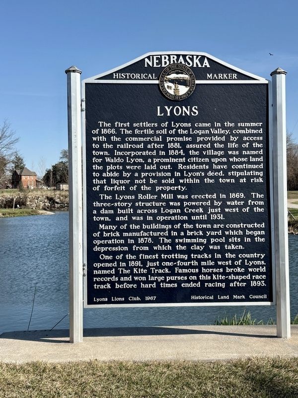
Photographed by Kris Morgan and James Schwartz, April 5, 2025
1. Lyons Marker
The Lyons Roller Mill was erected in 1869. The three-story structure was powered by water from a dam built across Logan Creek just west of the town, and was in operation until 1931.
Many of the buildings of the town are constructed of brick manufactured in a brick yard which began operation in 1878. The swimming pool sits in the depression from which the clay was taken.
One of the finest trotting tracks in the country opened in 1891, just one-fourth mile west of Lyons. named The Kite Track. Famous horses broke world records and won large purses on this kite-shaped race track before hard times ended racing after 1893.
Erected 1967
this page online
Topics and series. This historical marker is listed in these topic lists: Industry & Commerce • Settlements & Settlers • Sports. In addition, it is included in the Nebraska State Historical Society series list. A significant historical year for this entry is 1866.
Location. 41° 56.168′ N, 96° 28.93′ W. Marker is in Lyons, Nebraska, in Burt County. It can be reached from County Road Rs. The marker is close to the entrance to the ball field and Island Park Campground. Touch for map. Marker is in this post office area: Lyons NE 68038, United States of America. Touch for directions.

Regionally, this marker is in Eastern Nebraska. It is also in the American Midwest, in the Lewis & Clark Corridor, in the Corn Belt, and on the prairies. Globally, it is in North America, the Western Hemisphere, the Western World, and the Anglosphere. Historically, it finds itself in what was once the Louisiana Purchase.
Other nearby markers. At least 8 other markers are within 10 miles of this marker, measured as the crow flies: Victor Colson Homestead (approx. 6 miles away); Bancroft (approx. 6.2 miles away); M60A3 Tank (approx. 7 miles away); Governor Frederick Valdemar Erastus Peterson (approx. 7 miles away); John G. Neihardt Center (approx. 7.1 miles away); John G. Neihardt Study (approx. 7.1 miles away); The Founding of Oakland (approx. 7.3 miles away); The Logan Creek Site (approx. 9.2 miles away).
Credits. This page was last revised on November 22, 2025. It was originally submitted on April 8, 2025, by Kris Morgan and James Schwartz of Omaha, Nebraska. This page has been viewed 312 times since then and 81 times this year. Photo 1. submitted on April 8, 2025, by Kris Morgan and James Schwartz of Omaha, Nebraska. • Andrew Ruppenstein was the editor who published this page.
