Fort Calhoun in Washington County, Nebraska — The American Midwest (Upper Plains)
Fort Calhoun Schools at Washington Square
Photographed by Kris Morgan and James Schwartz, April 5, 2025
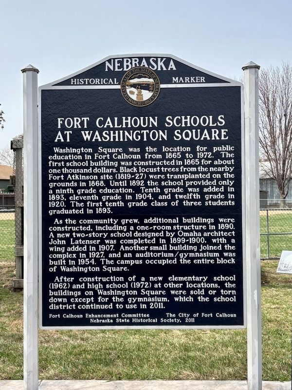
1. Fort Calhoun Schools at Washington Square Marker
Washington Square was the location for public education in Fort Calhoun from 1865 to 1972. The first school building was constructed in 1865 for about one thousand dollars. Black locust trees from the nearby Fort Atkinson site (1819-27) were transplanted on the grounds in 1868. Until 1892 the school provided only a ninth grade education. Tenth grade was added in 1893, eleventh grade in 1904, and twelfth grade in 1920. The first tenth grade class of three students graduated in 1893.
As the community grew, additional buildings were constructed, including a one-room structure in 1890. A new two-story school designed by Omaha architect John Latenser was completed in 1899-1900, with a wing added in 1907. Another small building joined the complex in 1927, and an auditorium/gymnasium was built in 1954. The campus occupied the entire block of Washington Square.
After construction of a new elementary school (1962) and high school (1972) at other locations, the buildings on Washington Square were sold or torn down except for the gymnasium, which the school district continued to use in 2011.
Erected 2011
this page online
Topics and series. This historical marker is listed in this topic list: Education. In addition, it is included in the Nebraska State Historical Society series list. A significant historical year for this entry is 1865.
Location. 41° 27.338′ N, 96° 1.354′ W. Marker is in Fort Calhoun, Nebraska, in Washington County. It is at the intersection of Monroe Street and South 11th Street, on the left when traveling west on Monroe Street. Touch for map. Marker is in this post office area: Fort Calhoun NE 68023, United States of America. Touch for directions.

Regionally, this marker is in Eastern Nebraska and in Greater Omaha. It is also in the American Midwest, in the Lewis & Clark Corridor, in the Corn Belt, and on the prairies. Globally, it is in North America, the Western Hemisphere, the Western World, and the Anglosphere. Historically, it finds itself in what was once the Louisiana Purchase.
Other nearby markers. At least 8 other markers are within walking distance of this marker: Metz Bros. Brewing Co. (approx. 0.2 miles away); Fort Atkinson (approx. 0.2 miles away); Washington County Bank of Fort Calhoun (approx. 0.2 miles away); Long Creek School - 1877 (approx. ¼ mile away); The Death of Marshal Suverkrubbe (approx. 0.3 miles away); Lewis and Clark Campsite (approx. 0.4 miles away); A Grinding Operation (approx. 0.4 miles away); The Fort Storehouse (approx. 0.4 miles away). Touch for a list and map of all markers in Fort Calhoun.
Credits. This page was last revised on April 21, 2025. It was originally submitted on April 8, 2025, by Kris Morgan and James Schwartz of Omaha, Nebraska. This page has been viewed 168 times since then and 27 times this year. Photo 1. submitted on April 8, 2025, by Kris Morgan and James Schwartz of Omaha, Nebraska. • Andrew Ruppenstein was the editor who published this page.
