Rhyolite in Nye County, Nevada — The American Mountains (Southwest)
Red-Light District
Rhyolite
Photographed by Craig Baker, April 5, 2025
1. Red-Light District Marker
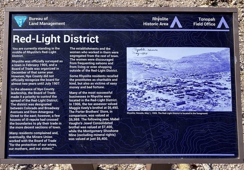
You are currently standing in the middle of Rhyolite's Red-Light District.
Rhyolite was officially surveyed as a town in February 1905, and a Board of Trade was organized in December of that same year. However, Nye County did not officially recognize the board for almost two years until July 1907.
In the absence of Nye County leadership, the Board of Trade made it a priority to control the spread of the Red-Light District. The district was designated between Colorado and Broadway Avenues and from Amargosa Street to the east; however, a few houses of ill-repute had crossed the boundaries to ply their trade in the more decent sections of town.
Many residents complained and, eventually, the Miners Union worked with the Board of Trade "for the protection of our wives, our mothers, and our sisters."
The establishments and the women who worked in them were segregated from the rest of town. The women were discouraged from frequenting saloons and from living or even shopping outside of the Red-Light District.
Some Rhyolite residents recalled the prostitutes as charitable
this page online
Many of the most successful businesses in Rhyolite were located in the Red-Light District. In 1906, the tax assessor valued Maggie Keely's brothel at $6,490. The Porter Brothers' Store, in comparison, was valued at $6,988. The following year, Mabel Vaughn's Jewel Consolidated brothel was valued at $7,400, while the Montgomery Shoshone Mine (excluding mineral rights) was valued at just $6,400.
Erected 2022 by Bureau of Land Management.
Topics. This historical marker is listed in these topic lists: Industry & Commerce • Settlements & Settlers. A significant historical year for this entry is 1905.
Location. 36° 54.008′ N, 116° 49.593′ W. Marker is in Rhyolite, Nevada, in Nye County. It is on MCR926493 Road 0.1 miles east of Rhyolite Road, on the left when traveling east. Touch for map. Marker is in this post office area: Beatty NV 89003, United States of America. Touch for directions.

Regionally, this marker is in the Mojave Desert and in Central Nevada. It is also in the American Southwest and in the Mountain West. Globally, it is in North America,

Photographed by Craig Baker, April 5, 2025
2. Red-Light District Marker
Other nearby markers. At least 8 other markers are within walking distance of this marker: Rhyolite Jail (a few steps from this marker); Miner's Cabin (within shouting distance of this marker); Mona Bell's Grave (about 300 feet away, measured in a direct line); Adobe Dance Hall (about 300 feet away); Porter Brothers' Store (about 800 feet away); Overbury Building (approx. 0.2 miles away); Senator Stewart (approx. 0.2 miles away); Miners Union Hall (approx. 0.2 miles away). Touch for a list and map of all markers in Rhyolite.
Credits. This page was last revised on April 8, 2025. It was originally submitted on April 8, 2025, by Craig Baker of Sylmar, California. This page has been viewed 336 times since then and 136 times this year. Photos: 1, 2. submitted on April 8, 2025, by Craig Baker of Sylmar, California.
