Homewood in Jefferson County, Alabama — The American South (East South Central)
Hallman Hill
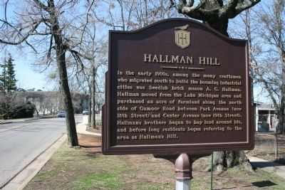
Photographed by Tim Carr, March 2, 2009
1. Hallman Hill Marker
Topics. This historical marker is listed in these topic lists: Industry & Commerce • Settlements & Settlers.
Location. 33° 28.668′ N, 86° 47.436′ W. Marker is in Homewood, Alabama, in Jefferson County. It is on Oxmoor Road west of 19th Street South, on the right when traveling west. Touch for map. Marker is in this post office area: Birmingham AL 35209, United States of America. Touch for directions.

Regionally, this marker is in the Birmingham Metropolitan Area. It is also in the American South and specifically in the Deep South. Globally, it is in North America, a Gulf of Mexico state, the Western Hemisphere,
this page online
Other nearby markers. At least 8 other markers are within walking distance of this marker: “We Love Homewood” (about 800 feet away, measured in a direct line); Homewood (approx. 0.2 miles away); Hollywood / Hollywood Town Hall / Hollywood Country Club (approx. 0.3 miles away); Rosedale (approx. 0.4 miles away); Shades Valley High School (approx. 0.6 miles away); Union Hill Cemetery (approx. 0.7 miles away); Union Hill Cemetery, Union Hill Methodist Episcopal Church, Union Hill School (approx. ¾ mile away); The Cascade (approx. one mile away). Touch for a list and map of all markers in Homewood.
Credits. This page was last revised on November 1, 2019. It was originally submitted on January 29, 2010, by Timothy Carr of Birmingham, Alabama. This page has been viewed 1,879 times since then and 54 times this year. Photo 1. submitted on January 29, 2010, by Timothy Carr of Birmingham, Alabama. • Bill Pfingsten was the editor who published this page.
