
Truckee in Nevada County, California — The American West (Pacific Coastal)
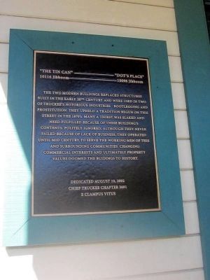
“The Tin Can”
10116 Jibboom
⎯⎯⎯
“Dot’s Place”
10098 Jibboom
Photographed by Syd Whittle, October 13, 2012
1. “The Tin Can” ----------- “Dot’s Place” Marker
Erected 2002 by Chief Truckee Chapter 3691, E Clampus Vitus.
Topics and series. This historical marker is listed in this topic list: Industry & Commerce. In addition, it is included in the E Clampus Vitus series list.
Location. 39° 19.735′ N, 120° 11.107′ W. Marker is in Truckee, California, in Nevada County. It is on Jibboom Street, on the right when traveling west. The marker is mounted on the front of the building located at 10098 Jibboom Street. Touch for map. Marker is at or near this postal address:
this page online

Regionally, this marker is in California’s Sierra Nevada. It is also in the American Mountain West. Globally, it is in North America, on the Ring of Fire, in the Pacific Rim, in the Western Hemisphere, in the Western World, and in the Anglosphere. Historically, it finds itself in what was once New Spain and also Mexico’s Alta California.
Other nearby markers. At least 8 other markers are within walking distance of this marker: Truckee’s Old Stone Garage and Site of Town’s First Dwelling (within shouting distance of this marker); Lincoln Highway Through Truckee (within shouting distance of this marker); First Log Cabin (about 400 feet away, measured in a direct line); Theodore Dehone Judah (about 500 feet away); First Transcontinental Railroad - Truckee (about 500 feet away); Truckee (about 500 feet away); Church of the Mountains Campus (about 600 feet away); Old Truckee Jail (about 600 feet away). Touch for a list and map of all markers in Truckee.
Photographed by Syd Whittle, October 13, 2012
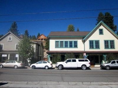
2. “The Tin Can” ----------- “Dot’s Place” Marker
The 10116 Jibboom site is where the smaller building on the left is seen and the 10098 Jibboom site is where the larger building on the right is located. The marker is mounted on the left front of the larger building.
Photographed by Syd Whittle, October 13, 2012
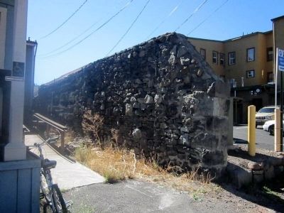
3. Historic Rock Wall
This rock wall, remains of a previous building, is found across the street from The Tin Can and Dottie's Place sites.
Credits. This page was last revised on April 13, 2025. It was originally submitted on November 5, 2012, by Syd Whittle of Mesa, Arizona. This page has been viewed 995 times since then and 31 times this year. Last updated on April 11, 2025, by E Gardner of Reno, Nevada. Photos: 1, 2, 3. submitted on November 5, 2012, by Syd Whittle of Mesa, Arizona. • Devry Becker Jones was the editor who published this page.
