Truckee in Nevada County, California — The American West (Pacific Coastal)
Church of the Mountains Campus

Photographed by E Gardner, April 11, 2025
1. Church of the Mountains Campus Marker
In the heart of Truckee's historic Church Street district, the Church of the Mountains Campus consists of three enduring structures. Erected in 1869, the Church of the Mountains proudly stands as Truckee's oldest church. This place of worship, bearing witness to the passage of time through occasional fires, steadfastly remains at its original location. Unique to the Church is its distinctive bell, cast by the McShane Bell Foundry, ringing in Truckee since 1890 and echoing through the town's history. Two adjacent buildings are the Elizabeth Danforth Cottage, a testament to Miss Danforth's unwavering dedication to the Truckee community throughout her lifetime, and the Rev. Sipes Parsonage that has faithfully served as an active parsonage over the years. Against the backdrop of this historical setting, the hardworking residents, primarily engaged in railroad and lumberyard occupations, have woven their stories into the rich tapestry of Truckee's past.
Landmark registered by Nevada County
February 20, 2024 - NEV, 24-01
Plaque dedicated 2024 by the Nevada County Historical Landmarks Commission
In cooperation with Kathleen
this page online
Erected 2024 by Nevada County Historical Landmarks Commission. (Marker Number NEV 24-01.)
Topics. This historical marker is listed in this topic list: Religion & Religious Structures. A significant historical year for this entry is 1869.
Location. 39° 19.744′ N, 120° 10.984′ W. Marker is in Truckee, California, in Nevada County. It is on Church Street, on the right when traveling east. Touch for map. Marker is at or near this postal address: 10079 Church Street, Truckee CA 96161, United States of America. Touch for directions.

Regionally, this marker is in the Sierra Nevada. It is also in the American Mountain West. Globally, it is in North America, on the Ring of Fire, on the Pacific Rim, in the Western Hemisphere, in the Western World, and in the Anglosphere. Historically, it finds itself in what was once New Spain and also Mexico’s Alta California.
Other nearby markers. At least 8 other markers are within walking distance of this marker: First Log Cabin (within shouting distance of this marker); Lincoln Highway Through Truckee (about 400 feet away, measured in a direct line); Truckee’s Old Stone Garage and Site of Town’s First Dwelling
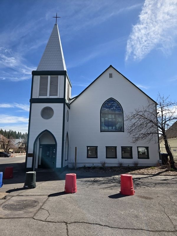
Photographed by E Gardner, April 11, 2025
2. Church of the Mountains
Another marker is no longer nearby. C.P.R.R. Truckee Round House (was within shouting distance of this marker but has been permanently removed).
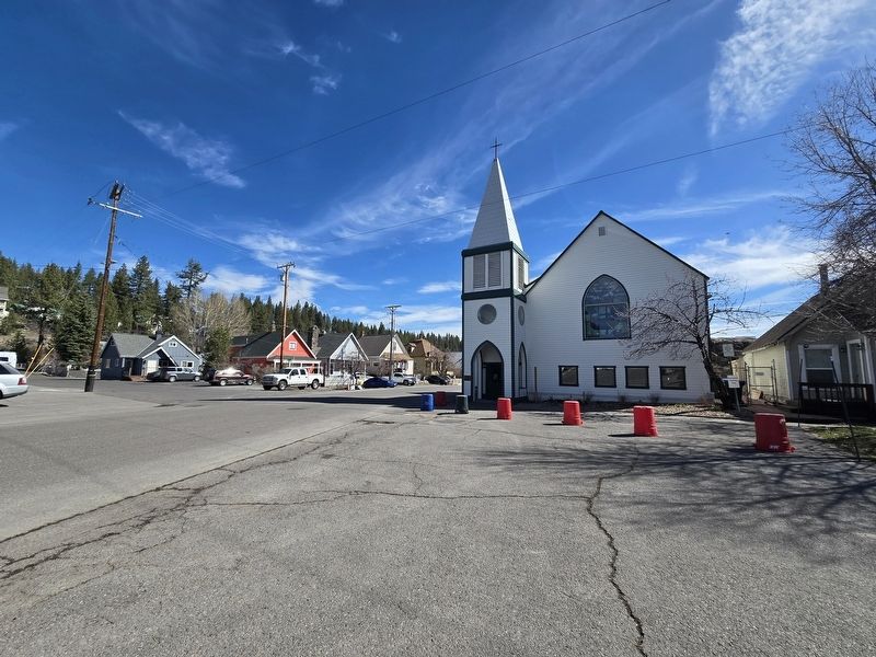
Photographed by E Gardner, April 11, 2025
3. General area view of Church of the Mountains
Credits. This page was last revised on April 15, 2025. It was originally submitted on April 11, 2025, by E Gardner of Reno, Nevada. This page has been viewed 179 times since then and 30 times this year. Photos: 1, 2, 3. submitted on April 11, 2025, by E Gardner of Reno, Nevada. • Andrew Ruppenstein was the editor who published this page.
