Yacht Point Cottage Area in Ashland County, Ohio — The American Midwest (Great Lakes)
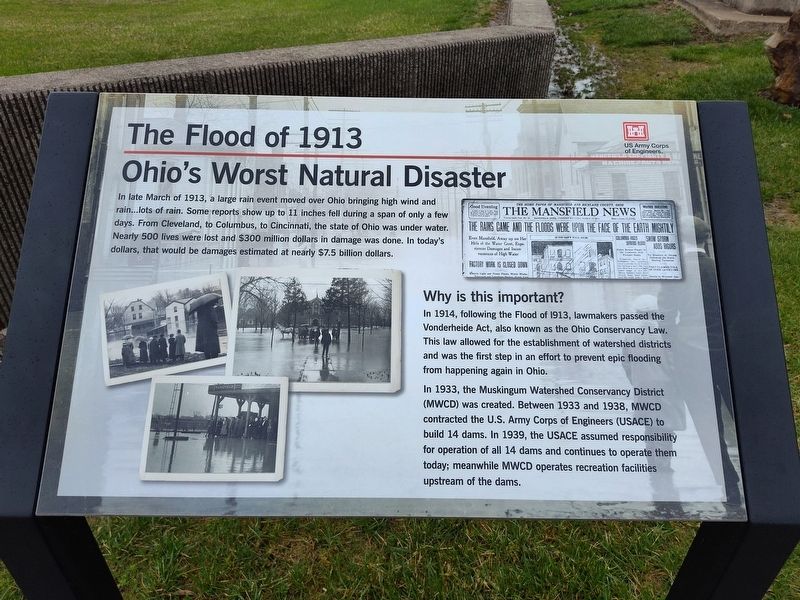
The Flood of 1913
Ohio's Worst Natural Disaster
Photographed by Craig Doda, April 5, 2025
1. The Flood of 1913 Marker
Why is this important?
In 1914, following the Flood of 1913, lawmakers passed the Vonderheide Act, also known as the Ohio Conservancy Law. This law allowed for the establishment of watershed districts and was the first step in an effort to prevent epic flooding from happening again in Ohio.
In 1933, the Muskingum Watershed Conservancy District (MWCD) was created. Between 1933 and 1938, MWCD contracted the U.S. Army Corps of Engineers (USACE) to build 14 dams. In 1939, the USACE assumed responsibility for operation of all 14 dams and continues to operate them today; meanwhile MWCD operates recreation facilities upstream of the dams.
Erected by US Army Corps of Engineers.
Topics. This historical marker is
this page online
Location. 40° 44.387′ N, 82° 21.475′ W. Marker is in Yacht Point Cottage Area, Ohio, in Ashland County. It is on Ohio Route 603 0.3 miles north of County Route 2256, on the right when traveling south. Touch for map. Marker is at or near this postal address: 2203 OH-603, Lucas OH 44843, United States of America. Touch for directions.

Regionally, this marker is in Amish Country. It is also in the American Midwest. Globally, it is in North America, the Western Hemisphere, the Western World, and the Anglosphere. Historically, it finds itself in what was once the Haudenosaunee (Iroquois) Confederacy, the territory of the Mississippian Culture, and the Northwest Territory.
Other nearby markers. At least 8 other markers are within 4 miles of this marker, measured as the crow flies: Charles Mill Dam (here, next to this marker); Frontier Violence During the War of 1812 (about 700 feet away, measured in a direct line); a different marker also named Charles Mill Dam (approx. ¼ mile away); Site of Copus Massacre Monument (approx. half a mile away);
Photographed by Craig Doda, April 5, 2025
2. The Flood of 1913 Marker
Credits. This page was last revised on April 18, 2025. It was originally submitted on April 12, 2025, by Craig Doda of Napoleon, Ohio. This page has been viewed 281 times since then and 39 times this year. Photos: 1, 2. submitted on April 12, 2025, by Craig Doda of Napoleon, Ohio. • Andrew Ruppenstein was the editor who published this page.
