Murrysville in Westmoreland County, Pennsylvania — The American Northeast (Mid-Atlantic)
Murrysville Historical Panels
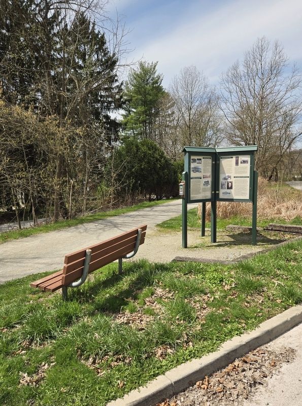
Photographed by Bradley Owen, April 9, 2025
1. Murrysville Historical Panels Marker
The Haymaker Well
The famous Haymaker Well sits along the banks of Turtle Creek near this spot. The story of the Haymaker Well starts with two local brothers seeking their fortunes. Michael and Obediah Haymaker grew up on their family farm in Newlonsburg (about 1.7 miles east of here). They heard stories about the growing oil industry in Northern Pennsylvania and decided to become oil drillers. While drilling in Clarion County, they recalled that there was gas seeping from the ground along Turtle Creek in Murrysville. They decided to try to strike it rich in their hometown. They leased farm land from Henry Remaley with the plan to drill for oil.
Finding money to fund the Haymaker Well was difficult, and the brothers had to scrape together second-hand drilling equipment wherever they could find it. The brothers drilled for over a year and were about to give up. Then, on November 3rd 1878, the Haymakers struck gas at 1400 feet. Without any warning the well blew, throwing rigging equipment and tools into the air. The roar of the escaping gas could be heard 15 miles away. Although the brothers were happy that their
this page online
In fact, the Haymakers had no way to control the flow of gas from their newly discovered well. Gas was escaping at over 30 million cubic feet per day. A local church had to cancel services because the roar of the well drowned out the minister's sermons.
People traveled from all over to see the famous well. In September 1881 an onlooker with a lantern got too close, setting off an explosion. The original blast was seen in Pittsburgh. The flame height settled to a consistent 100 feet, lighting the night sky of Murrysville. The burning well attracted tourists, including President Grover Cleveland who considered it a superb spectacle.
The flame burned for 18 months and was eventually extinguished by placing a 45 foot smokestack on top of the well. As famous as the well had become, the Haymaker brothers had still not profited from their discovery. A proposed sale to Chicago promoter Milton Weston for $20,000 fell through when
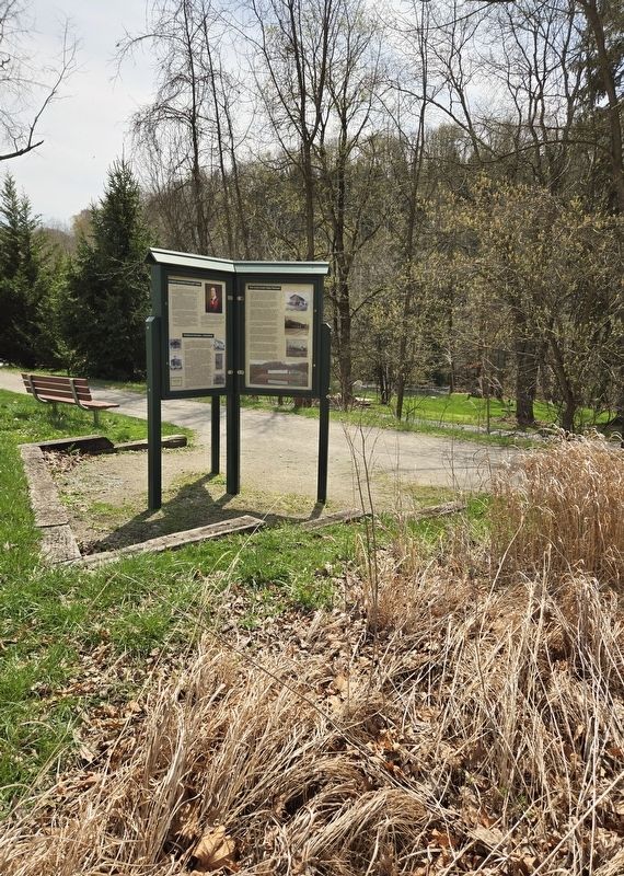
Photographed by Bradley Owen, April 9, 2025
2. Murrysville Historical Panels Marker
On November 26, 1883, after Pew and Emerson began laying pipe to Pittsburgh, a gang of about 50 men sent by Weston arrived in Murrysville. Armed with guns and bayonets, they attempted to seize the well. Michael and Obediah Haymaker, along with others from Murrysville, rushed the well and a fight ensued. Obediah Haymaker was stabbed 4 times by a bayonet and shot once. He died later that day at his home. The gang and its leaders were arrested by the Sherriff without incident. Ultimately, the gang leader and Milton Weston served brief prison sentences for the murder of Obediah Haymaker.
Eventually the value of natural gas as an energy source was recognized. Pew and Emerson developed other wells in the Murrysville area, forming Peoples Natural Gas Company. Local inventor and businessman George Westinghouse was fascinated by the Haymaker Well inspiring him to drill for gas in the backyard of his Homewood Mansion. He invested in the budding natural gas industry, forming Equitable Natural Gas Company. Hundreds of miles of pipeline were laid in the region, with gas from Murrysville fueling the rise of Pittsburgh's industries.
The Founding of Murrysville
Murrysville was first organized as Franklin Township sometime between 1785 and 1788. Franklin Township falls within Westmoreland County, which was formed in 1773. The first County Court (Seat) was held in Hanna's Town that same year. Hanna's Town, about 10 miles east of Murrysville, was destroyed by Indians and a band of British Soldiers from Canada on July 13, 1782. This was considered one of the last hostile act of the Revolutionary War and Chief Guyasuta's revenge for his defeat at Bushy Run. The County Court (Seat) was later moved to New Town (now Greensburg) in 1785.
Although not founded as Franklin Township until the 1780's, many settlers came to this area earlier than that. The first recorded settler was William Meanor who is said to have bought land from the Indians for a keg of tobacco and a rifle. He built a house a little over a mile north of where we now stand. Other settlers soon followed. The second home in the township was built in 1769 by Robert Hays.
Jeremiah Murry moved to this area from Ireland in 1781 at the age of 22. When Murry entered the Turtle Creek Valley he was struck by the area's beauty and decided to settle here. He walked to the Government Office in Pittsburgh and applied for his first land patent (claim) which was signed by Benjamin Franklin. Jeremiah Murry build a gristmill, sawmill and store along Turtle Creek. He later became the local Justice of the Peace. In 1819 the toll road, Northern Pike, was built and in 1820 Murry laid out and founded the town of Murrysville.
Through the operation of his general store Jeremiah Murry acquired much of his land as payment for merchandise. Anyone could use credit at the store if he owned or partially owned a farm. Murry acquired so much land that he could travel five miles in one direction and still be on his property. In all, Jeremiah Murry acquired 13 land patents (claims) exceeding 3,800 acres.
Jeremiah Murry died in 1835 at the age of 76 and is buried in the Murrysville Cemetery on North Hills Road.
(Captions):
Murrysville Post Office 1914 with Post Mistress Emma McCutcheon.
Miners from the Westmoreland Coal Company in Export pose with a young girl in 1930.
A 1784 portrait of Jeremiah Murry (1759-1835), founder of Murrysville.
Garage on Old William Penn Highway (1930's) operated by The Rings Family.
A woodcut of the Haymaker Well from Harper's Weekly Journal of Civilization.
Skelly Mine in Export (1908).
Thomas Mellon, From Local Immigrant to Founder of Mellon Bank
Thomas Mellon, whose family was Scotch-Irish, was just five years old when he and his family immigrated from Ireland, to Franklin Township (now Murrysville). In 1816, Andrew and Rebecca Mellon left Camp Hill, Ireland located in Lower Castletown, County Tyrone, where Thomas Mellon was born on February 3, 1813. Finally arriving in Franklin Township in 1819 Andrew, Thomas's father, purchased a 160-acre farm on Duff's Hill about a mile north of Old Duff Mill by Cline Hollow Road. The family moved into a rundown, vacant, log cabin located on the farm.
There were many struggles and hard financial times for the family. Thomas and his parents all worked very hard to make ends meet. Finally, things were looking up and when Thomas was 12 years old the family was able to buy more land. Thomas helped build a larger log home which is still located at the intersection of Cline Hollow Road and Hills Church Road.
Several events changed the course of young Thomas' life including a trip he took by himself at age nine. He walked to Pittsburgh where he was awed by all the wonders the prosperous city held. Another turning point was when, at age fourteen, Thomas Uncle gave Thomas the Autobiography of Benjamin Franklin. From its pages, seeing parallels between his life and Franklin's, Thomas drew ambition and wanted more than the life of a farmer. Andrew Mellon decided to buy the neighboring farm for his son, Thomas. On the day of the purchase, Thomas realized becoming a farmer was a mistake and ran 10 miles to Greensburg to stop the transaction.
Between 1828 and 1834 Mellon worked hard to become educated, learning Latin, geometry, history and grammar. October, 1834 Mellon enrolled at the Western University of Pennsylvania (University of Pittsburgh) and graduated with honors after three years of study. In 1838 Mellon began to study law and was appointed Chief Clerk of the Court of Common Pleas with a $20 per month salary. By the end of that year, Mellon received his license to practice law. In the years that followed, he built up a law practice and specialized in debt foreclosures. He began to buy and sell real estate and invested in the coal fields in Westmoreland County.
In 1869, T. Mellon & Sons' Bank was founded by Thomas Mellon and his sons, Andrew W. Mellon and Richard B. Mellon which became Mellon Bank in 1902 and ultimately became part of Bank of New York Mellon. The Mellon Family, through Mellon Bank, had direct involvement in financing the growth of many Pittsburgh Companies, including Alcoa, Westinghouse, U.S. Steel and Heinz. Mellon also financed Henry Clay Frick's coke oven enterprise, which provided coke to Andrew Carnegie. In addition, Mellon invested in the railroads and many other industries.
Thomas Mellon died on his 95th birthday on February 3, 1908, at his home in East liberty. He is buried in Pittsburgh's Allegheny Cemetery. At his death, he was considered one of America's wealthiest men.
The Sign on the Hill
In the 1930's, Frank Morse Sloan was looking for a way to put Murrysville on the map. Sloan, a local landowner, businessman and Boy Scout leader, decided that a sign made out of trees would draw attention to his town. In the spring of 1933 he directed Boy Scouts and others to plant 850 Scotch and Red Pines to spell out "MURRYSVILLE" on the hillside near here. The sign measures 650 feet by 125 feet, with the bottom leg of the "Y" positioned to point to the site of the Haymaker Gas Well - next to Turtle Creek near this spot.
For many years it was the largest arboreal sign in the world, and was featured in Ripley's "Believe It or Not". Before radar was commonly used by commercial airplanes, the large sign was a reference point for pilots on their way to Pittsburgh. In 1988, it was decided that as long as it is maintained by the community, the "MURRYSVILLE" Tree Sign will be part of the Municipal Park System.
(Captions):
Workers in front of an old coal mine electric motor car in Export.
Export Fireman's Military Band - first organized in 1928.
The Murrysville Tree Sign - first planted in 1933.
New locomotives for coal delivery in Export 1915-1918.
The Patty Brothers General Store operated on the Murrysville Town Square from 1910-1956. The building is believed to be the original store of Jeremiah Murry.
George Washington Slept Here
Not exactly here, but close by.
In the summer and fall of 1758, an army under the direction of British Brigadier General John Forbes made its way across Pennsylvania with the intention of seizing the French Fort Duquesne. Fort Duquesne was located at the Forks of the Ohio River (current day Pittsburgh) and the British considered it the key to securing the region for British settlement.
Instead of traveling the established Braddock Road from the south, General Forbes elected to cut a new path through the Pennsylvania wilderness. He established a series of forts along the way to supply and protect his troops. The last fort he established was the camp at Loyal Hannon (also known as Fort Ligonier). By mid-November 1758, the weather was turning to winter and the troops were weary. General Forbes along with his officers, including Colonels Henry Bouquet, Archibald Montgomery and George Washington, decided that it was too risky to attempt an assault on Fort Duquesne before winter. However, two days after they made their decision, a newly captured prisoner informed them that Fort Duquesne was low on supplies and soldiers. With that information, General Forbes and his officers reconsidered, and decided to attempt a rapid advance on the forks of the Ohio to seize Fort Duquesne.
Forbes' army was divided into three brigades, headed by Colonels Bouquet, Montgomery and Washington. On November 15th Colonel Washington, leading the 1st Virginia Regiment along with detachments from Delaware, Maryland and North Carolina left Camp Loyal Hannon (Fort Ligonier) as the advance force, opening the road for the rest of the army.
Over the next several days, Colonel Washington's Brigade advanced to an area in the hills just 2.5 miles from this spot and established a camp now known as "Washington's Camp". On the morning of November 21st 1758, Colonel George Washington led an advance party down from "Washington's Camp" and crossed Turtle Creek right near where you are standing.
The French learned that General Forbes' army was approaching. Realizing that they could not defend Fort Duquesne, on November 23, they set it on fire, detonated 60 barrels of power under the walls and evacuated the fort.
General Forbes' army continued their advance and took over the smoldering remains of the Fort on November 25th without a shot being fired. General Forbes renamed it Fort Pitt after British Secretary of State William Pitt. He had a garrison built near Fort Pitt and left a small detachment of troops to defend the area through the winter.
General Forbes, who was in poor health throughout the entire campaign, returned to Philadelphia. He died shortly after, on March 11th 1759. Pennsylvania honored him with an elaborate funeral in recognition of the significance of capturing Fort Duquesne.
Colonel George Washington returned to his native Virginia to await his next adventure.
Franklin Regional Longhorns
In the 1800's, education in Franklin Township (Murrysville) was delivered in the same way that it was across much of rural America in a collection of one-room schoolhouses. Dozens of these simple buildings were located in the region, frequently affiliated with a church. They taught a basic curriculum for a small fee and did not continue past 8th grade.
As the region's population grew, so did the demand for education. In 1915, the red brick Murrysville Grade School was built on Reed Boulevard. It still stands, less than 1/4 mile from this spot. At that time students who wanted to go to High School took the train to Wilkinsburg.
Community leaders recognized the need for a local High School, and in 1919-1920 a wood extension was added to the Murrysville Grade School. The first class of the Franklin Township High School graduated in 1921. Their mascot was the Longhorn and the school colors were blue and gold. High School students from Export would take the train utilizing, their "Monthly Scholar Railroad Ticket" to attend the Franklin Township School.
A new, larger Franklin Township High School in Newlonsburg (about 1.7 miles east of here and now part of Murrysville) was dedicated in 1929. Its first class of 23 students graduated in 1930. As the area's population grew, more schools were built. The New Salem School District (Delmont) became part of the Franklin Township schools in 1956. In 1962 Franklin Township High School merged with the Export School District. The "Panther" mascot from Export High School was adopted, replacing the Longhorn. The new district was initially called Franklin Area and in 1966 was renamed the Franklin Regional School District.
At that point there were several neighborhood elementary schools in the district, including Delmont, White Valley, Export (Duff) and Sardis. Eventually the schools were consolidated to the two current campus location - the main school complex on School Road, and the Sloan Elementary Campus on Sardis Road across from the Murrysville Municipal Building.
(Captions):
Franklin High School Basketball team 1928-1930 with Coach and School Principal Clyde Simpson.
Murrysville Grade School on Reed Boulevard in 1915. An extension for High School Students was added in 1919-1920.
Colonel George Washington, fighting for British Brigadier General John Forbes, led his troops across Turtle Creek near this spot on his way to Fort Duquesne on November 21st 1758.
Franklin School with teacher Mary Steel Stoops on Weistertown Road in the early 1900s.
Monthly Scholar's train ticket from April 1920. Students from Export would ride the train to and from the Franklin Township High Reed Boulevard.
1930 Senior Class of Franklin High School - the first class to graduate from the newly constructed High School in Newlonsburg.
The Turtle Creek Valley Railroad
The spur of rail behind you is all that remains of the Murrysville section of the Turtle Creek Valley Railroad. The train line was first chartered by George Westinghouse in 1886 to transport supplies and equipment to the Haymaker gas well and surrounding gas fields. Construction of the first 6.5 mile stretch of the Turtle Creek Valley Railroad - also known as Westinghouse Road began in 1888 in Trafford. It passed through Saunders and opened to Murrysville on September 28th, 1891. The Murrysville Train station (see photo on right) was located on Carson Street, near this spot.
Murrysville did not remain the terminus of the train line for long. With the rapid development of mining in the region, bituminous coal became the line's primary freight. To reach the coal fields the Turtle Creek Valley Railroad was extended to Export in 1892 and eventually through Delmont and Slickville to Saltsburg. It connected to the Conemaugh branch of the Pennsylvania Railroad in Saltsburg. The Pennsylvania Railroad purchased the line in 1903.
As the local population and industries expanded, so did travel on the Turtle Creek Valley Railroad. Initially, the trains were "mixed runs," with both passenger and freight cars. Freight and passenger runs were separated as train traffic grew. Passenger trains took five daily runs every weekday during the train's heyday in the early part of the twentieth century. The passenger runs originated in Export with stops at the Newlonsburg, Murrysville, Saunders, Blackburn, North Trafford and Trafford stations. Students from Export would use their "Monthly Scholar's Ticket" to attend the Franklin Area High School. On Saturday nights, a "Bummer Special" train left for Braddock and Pittsburgh, returning to Export at 1:00 a.m. A thousand tickets were sold each Saturday night at the height of its popularity. The Turtle Creek Valley Railroad had become a focal point of the community.
However, in the 1930's automobile traffic expanded, and interest in the train's passenger runs dwindled. The last passenger service to Murrysville was furnished by a single diesel-powered car known as a "Doodlebug." Passenger trains on the Turtle Creek Valley Railroad were finally discontinued in 1936.
The decline of passenger service on the Turtle Creek Valley Railroad was followed by a decrease in freight traffic. Pennsylvania produced more bituminous coal than any other state between 1890 and 1920. The mines of Export produced 4,794,835 tons of coal by 1913. At one point the Turtle Creek Valley Railroad transported 100 coal-filled cars a day from Export alone. However, in the 1930's and 1940's, mines in Export, Delmont and Slickville closed. The Westmoreland Coal Company shuttered the last of the Export mines in 1952.
With passenger service long discontinued, and the region's coal production diminished, the Turtle Creek Valley Railroad struggled to make a profit. The line east of Export was abandoned in 1972. In 1982, Conrail, which had taken over the line from the Pennsylvania Railroad, abandoned the line from Trafford to Export. Several businesses, including Dura-Bond Industries, Weyerhauser Lumber, National Aluminum and 84 Lumber still utilized the line to transport materials at that time.
Dura-Bond, an Export-based steel manufacturing and coating company, needed the rails to transport products that were too difficult to ship by truck. Dura-Bond purchased the line from Conrail in 1982 and renamed it the Turtle Creek Industrial Railroad. They also bought a 100-ton locomotive from the Johnstown and Stoney Creek Railroad. They operated the line to service the remaining industries with a small crew. Flooding from Turtle Creek presented ongoing maintenance issues. After significant damage from a flood on June 16th 2009, Dura-Bond filed for a discontinuation of service.
A partnership of local, county and regional organizations came together to preserve the rail line after Dura-Bond's decision. The train corridor was converted to a bike/hike trail through the tireless efforts of government officials and local volunteers. The Trafford to Murrysville section of the Westmoreland Heritage Trail officially opened on September 30th 2017 with plans to extend the trail to Export and beyond. In this way, the legacy of the area's industrial heritage will continue to benefit the region for generations.
(Captions):
The Murrysville Train Station (1891-1936) was located at the end of Carson Street near this spot.
Pennsylvania Railroad train in Export.
Working on the line near Export.
The 100 ton, 600 horse power 1949 EMD-SWI engine used by Dura-Bond to service local industries from 1982 until the line was discontinued in 2009.
Topics and series. This historical marker is listed in these topic lists: Education • Industry & Commerce • Railroads & Streetcars • Settlements & Settlers. In addition, it is included in the Former U.S. Presidents: #01 George Washington series list. A significant historical date for this entry is July 13, 1782.
Location. 40° 25.505′ N, 79° 41.762′ W. Marker is in Murrysville, Pennsylvania, in Westmoreland County. It is on Braun Avenue west of Carson Avenue, on the left when traveling west. Marker is located at the Westmoreland Heritage Trail Parking Lot. Touch for map. Marker is at or near this postal address: 3033 Braun Avenue, Murrysville PA 15668, United States of America. Touch for directions.

Regionally, this marker is in the Laurel Highlands and in Greater Pittsburgh. It is also in the American Northeast, in the Mid-Atlantic, in Appalachia, and specifically in Northern Appalachia. Globally, it is in North America, the Western Hemisphere, the Western World, and the Anglosphere. Historically, it finds itself in what was once the Viceroyalty of New France, the Haudenosaunee (Iroquois) Confederacy, and one of the original Thirteen Colonies.
Other nearby markers. At least 8 other markers are within 2 miles of this marker, measured as the crow flies: The Haymaker Gas Well (a few steps from this marker); Haymaker Well (within shouting distance of this marker); Haymaker Community Park (approx. 0.2 miles away); Murrysville Gas Well (approx. 0.2 miles away); Forbes Road (approx. ¼ mile away); 9/11 Memorial (approx. 0.7 miles away); Murrysville Military Monument Plaza (approx. 0.7 miles away); a different marker also named Forbes Road (approx. 1.1 miles away). Touch for a list and map of all markers in Murrysville.
Another marker is no longer nearby. World Wars Honor Roll (was approx. ¼ mile away but has been confirmed missing).
Credits. This page was last revised on July 19, 2025. It was originally submitted on April 12, 2025, by Bradley Owen of Morgantown, West Virginia. This page has been viewed 704 times since then and 197 times this year. Photos: 1, 2. submitted on April 15, 2025, by Bradley Owen of Morgantown, West Virginia.
