
Eastport in Annapolis in Anne Arundel County, Maryland — The American Northeast (Mid-Atlantic)
Lafayette’s Encampment
March – April 1781
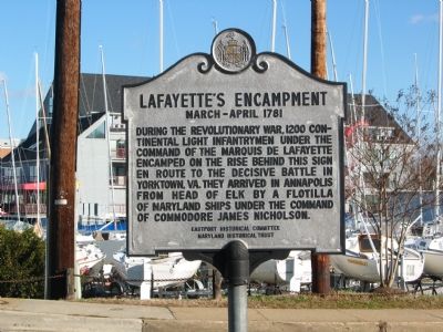
Photographed by F. Robby, December 30, 2003
1. Lafayette's Encampment Marker
Erected by Eastport Historical Committee, Maryland Historical Trust.
Topics and series. This historical marker is listed in this topic list: War, US Revolutionary. In addition, it is included in the Maryland Historical Trust series list. A significant historical month for this entry is March 1781.
Location. 38° 58.297′ N, 76° 29.12′ W. Marker is in Annapolis, Maryland, in Anne Arundel County. It is in Eastport. It is on 6th Street 0.2 miles south of Compromise Street, on the right when traveling south. Touch for map. Marker is at or near this postal address: 300 6th St, Annapolis MD 21403, United States of America. Touch for directions.

Regionally, this marker is in Central Maryland. It is also in the American Mid-Atlantic, in the Chesapeake Bay Region, and on the Eastern Seaboard. Globally, it is in the North
this page online
Other nearby markers. At least 8 other markers are within walking distance of this marker: A different marker also named Welcome to Eastport (within shouting distance of this marker); Eastport Veterans Park (about 500 feet away, measured in a direct line); Eastport's Old Main Street (about 600 feet away); Arnold C. Gay (about 700 feet away); a different marker also named A Tale of Three Bridges (about 700 feet away); "Burnside" (approx. 0.2 miles away); a different marker also named Three Great Boat Yards, One Location (approx. ¼ mile away); The Charles Carroll House (approx. ¼ mile away). Touch for a list and map of all markers in Annapolis.
Other markers no longer nearby. On to Yorktown (was within shouting distance of this marker but has been permanently removed); Welcome to Eastport (was within shouting distance of this marker but has been replaced with another marker now near it); A Tale of Three Bridges
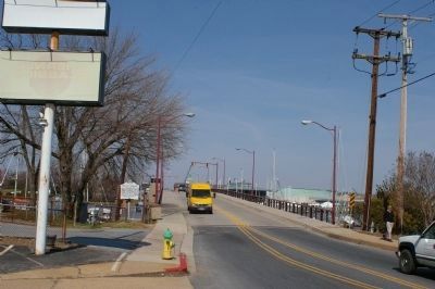
Photographed by Christopher Busta-Peck, March 13, 2008
2. Marker, with Annapolis in the background
Credits. This page was last revised on April 16, 2025. It was originally submitted on October 11, 2007, by F. Robby of Baltimore, Maryland. This page has been viewed 3,773 times since then and 131 times this year. Last updated on April 14, 2025, by Carl Gordon Moore Jr. of North East, Maryland. Photos: 1. submitted on October 11, 2007, by F. Robby of Baltimore, Maryland. 2. submitted on March 13, 2008, by Christopher Busta-Peck of Shaker Heights, Ohio. • Devry Becker Jones was the editor who published this page.
