Whitemarsh Township near Lafayette Hill in Montgomery County, Pennsylvania — The American Northeast (Mid-Atlantic)
Lafayette
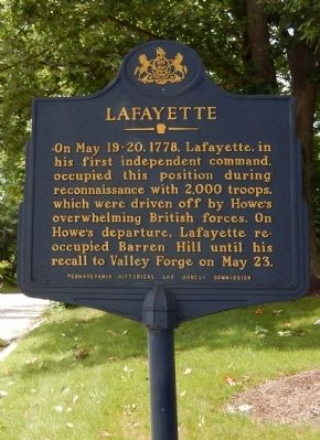
Photographed by Don Morfe, June 28, 2015
1. Lafayette Marker
Erected 1980 by Pennsylvania Historical & Museum Commission.
Topics and series. This historical marker is listed in this topic list: War, US Revolutionary. In addition, it is included in the Pennsylvania Historical and Museum Commission (PHMC) series list. A significant historical date for this entry is May 19, 1778.
Location. 40° 4.696′ N, 75° 14.986′ W. Marker is near Lafayette Hill, Pennsylvania, in Montgomery County. It is in Whitemarsh Township. It is on Ridge Pike. The marker stands across from Barren Hill Road (SR 3011) and is near Masons Village of Lafayette Hill. Touch for map. Marker is at or near this postal address: 2327 Barren Hill Rd, Lafayette Hill PA 19444, United States of America. Touch for directions.

Regionally, this marker is in Southeast Pennsylvania and in Greater Philadelphia. It is also in the American Northeast
this page online
Other nearby markers. At least 8 other markers are within 3 miles of this marker, measured as the crow flies: St. Peter's Church (approx. 0.3 miles away); Abolition Hall (approx. 2.3 miles away); Plymouth Friends Meetinghouse (approx. 2.3 miles away); Park Directory (approx. 2.3 miles away); Park Information (approx. 2.4 miles away); Valley Green Inn (approx. 2.4 miles away); Wissahickon Inn (approx. 2½ miles away); Buckley Park (approx. 2½ miles away).
Also see . . . Gilbert du Motier Marquis de Lafayette - Wikipedia. (Submitted on July 2, 2015, by Bill Pfingsten of Bel Air, Maryland.)
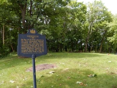
Photographed by Don Morfe, June 28, 2015
2. Lafayette Marker
Credits. This page was last revised on April 16, 2025. It was originally submitted on July 1, 2015, by Don Morfe of Baltimore, Maryland. This page has been viewed 1,433 times since then and 128 times this year. Last updated on April 15, 2025, by Carl Gordon Moore Jr. of North East, Maryland. Photos: 1, 2. submitted on July 1, 2015, by Don Morfe of Baltimore, Maryland. • Devry Becker Jones was the editor who published this page.
