Harpersfield in Ashtabula County, Ohio — The American Midwest (Great Lakes)
Harpersfield Covered Bridge
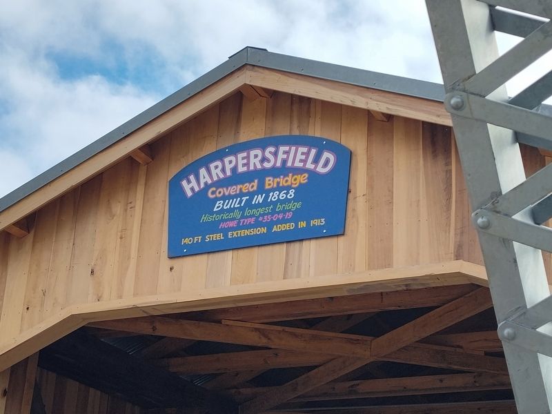
Photographed by Craig Doda, April 12, 2025
1. Harpersfield Covered Bridge Marker
Historically longest bridge
Howe type 35-04-19
140 ft. steel extension added in 1913
Topics and series. This historical marker is listed in this topic list: Bridges & Viaducts. In addition, it is included in the Covered Bridges series list. A significant historical year for this entry is 1868.
Location. 41° 45.393′ N, 80° 56.656′ W. Marker is in Harpersfield, Ohio, in Ashtabula County. It is on Harpersfield Road 0.2 miles north of State Road. Touch for map. Marker is at or near this postal address: 1122 Harpersfield Road, Geneva OH 44041, United States of America. Touch for directions.

Regionally, this marker is on Ohio’s Lake Erie Shore and in the Western Reserve. It is also in the American Midwest. Globally, it is in North America, on the Great Lakes, in the Western Hemisphere, in the Western World, and in the Anglosphere. Historically, it finds itself in what was once the Haudenosaunee (Iroquois) Confederacy, the territory of the Mississippian Culture, and the Northwest Territory.
Other nearby markers. At least 8 other markers are within 4 miles of this marker, measured as the crow
this page online
Another marker is no longer nearby. Harpersfield Covered Bridge (was about 300 feet away, measured in a direct line but has been confirmed missing).
Also see . . . Ohio SP Harpersfield Covered Bridge (National Archives Catalog). NRHP Statement of significance (extract):
At one time, covered wooden bridges of over 500' in length were not uncommon here in Ohio, but today, the Harpersfield Covered Bridge is of especial significance to us because at 243' it is the longest such bridge remaining in the state. It is said that this bridge was built in 1873 by a carpenter by the name of Potter. The bridge takes its - name from the village(Submitted on April 15, 2025.)of Harpersfield. This area was the site of a grist and saw mill and the mill stream enters the Grand River at the dam which is just to the east of the bridge. A waterworks which generated electricity was built here in 1901. The road became part of the state highway system in the early 1930's and was known as SRR 534. The state relocated the highway to the east and the bridge reverted to the county highway system in 1962. The county is now considering closing this bridge to traffic and turning it over to the adjacent county park system.Photographed by Craig Doda, April 12, 20252. Harpersfield Covered Bridge Marker

Credits. This page was last revised on April 15, 2025. It was originally submitted on April 15, 2025, by Craig Doda of Napoleon, Ohio. This page has been viewed 169 times since then and 20 times this year. Photos: 1, 2. submitted on April 15, 2025, by Craig Doda of Napoleon, Ohio. • Andrew Ruppenstein was the editor who published this page.
