Poolville in Parker County, Texas — The American South (West South Central)
Poolville
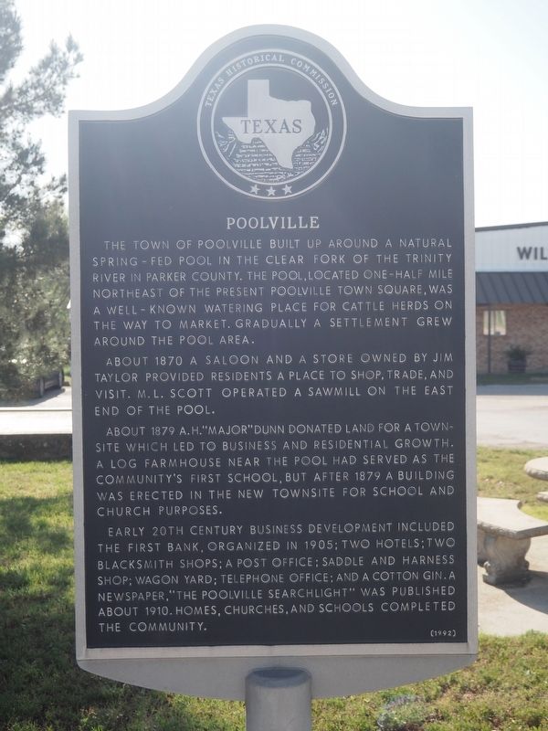
Photographed by Matthew G French, April 11, 2025
1. Poolville Marker
The town of Poolville built up around a natural spring-fed pool in the Clear Fork of the Trinity River in Parker County. The pool, located one-half mile northeast of the present Poolville Town Square, was a well-known watering place for cattle herds on the way to market. Gradually a settlement grew around the pool area.
About 1870 a saloon and a store owned by Jim Taylor provided residents a place to shop, trade, and visit. M.L. Scott operated a sawmill on the east end of the pool.
About 1879 A.H. "Major" Dunn donated land for a townsite which led to business and residential growth. A log farmhouse near the pool had served as the community's first school, but after 1879 a building was erected in the new townsite for school and church purposes.
Early 20th century business development included the first bank, organized in 1905; two hotels; two blacksmith shops; a post office; saddle and harness shop; wagon yard; telephone office; and a cotton gin. A newspaper, "The Poolville Searchlight" was published about 1910. Homes, churches, and schools completed the community.
Erected 1992 by Texas Historical Commission.
this page online
Topics. This historical marker is listed in these topic lists: Education • Industry & Commerce • Settlements & Settlers. A significant historical year for this entry is 1870.
Location. 32° 58.512′ N, 97° 51.503′ W. Marker is in Poolville, Texas, in Parker County. It is on Sparks (Farm to Market Road 920) south of West Ave, on the left when traveling north. Touch for map. Marker is at or near this postal address: 199 Sparks, Poolville TX 76487, United States of America. Touch for directions.

Regionally, this marker is in the Prairies & Lakes Region and in the Dallas-Fort Worth Metropolitan Area. Globally, it is in North America, a Gulf of Mexico state, the Western Hemisphere, the Western World, and the Anglosphere. Historically, it finds itself in what was once New Spain, the Republic of Texas, and one of the Confederate States of America.
Other nearby markers. At least 8 other markers are within 10 miles of this marker, measured as the crow flies: Poolville United Methodist Church (about 400 feet away, measured in a direct line); Dilbeck Cemetery (approx. 5.9 miles away); Peaster Cemetery

Photographed by Matthew G French, April 11, 2025
2. Poolville Marker
Credits. This page was last revised on August 10, 2026. It was originally submitted on April 18, 2025, by Matthew G French of Fort Worth, Texas. This page has been viewed 501 times since then and 120 times this year. Last updated on August 8, 2026, by Joe Lotz of Flower Mound, Texas. Photos: 1, 2. submitted on April 18, 2025, by Matthew G French of Fort Worth, Texas. • Devry Becker Jones was the editor who published this page.
