Center City in Toledo in Lucas County, Ohio — The American Midwest (Great Lakes)
Toledo
| — | Ohio Historical Marker | — |
Photographed by Dale K. Benington, January 31, 2010
1. Toledo Marker
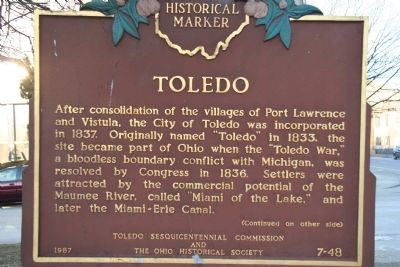
Close-up view of the south side of this marker.
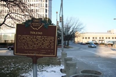
After consolidation of the villages of Fort Lawrence and Vistula, the City of Toledo was incorporated in 1837. Originally named "Toledo" in 1833, the site became part of Ohio when the "Toledo War," a bloodless boundary conflict with Michigan, was resolved by Congress in 1836. Settlers were attracted by the commercial potential of the Maumee River, called "Miami of the Lake," and later the Miami-Erie Canal.
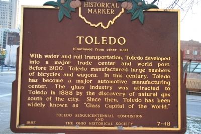
[Reverse Side of Marker, Facing North]:"Toledo"
With water and rail transportation, Toledo developed into a major trade center and world port. Before 1900, Toledo manufactured large numbers of bicycles and wagons. In this century, Toledo has become a major automotive manufacturing center. The glass industry was attracted to Toledo in 1888 by the discovery of natural gas south of the city. Since then, Toledo has been widely known as "Glass Capital of the World."
Erected 1987 by Toledo Sesquicentennial Commission and The Ohio Historical Society. (Marker Number 7-48.)
Topics and series. This historical marker is listed in these topic lists: Industry & Commerce
this page online
Location. 41° 39.291′ N, 83° 32.093′ W. Marker is in Toledo, Ohio, in Lucas County. It is in Center City. It is at the intersection of Jackson Road and North Huron Street, in the median on Jackson Road. This historical marker is located on the median strip, on the west side of the intersection, in front of the multi-storied building that houses Toledo's municipal government. Touch for map. Marker is in this post office area: Toledo OH 43604, United States of America. Touch for directions.

Regionally, this marker is on the Lake Erie Shore. It is also in the American Midwest and in the Corn Belt. Globally, it is in North America, on the Great Lakes, in the Western Hemisphere, in the Western World, and in the Anglosphere. Historically, it finds itself in what was once the Viceroyalty of New France, the Haudenosaunee (Iroquois) Confederacy, the territory of the Mississippian Culture, and the Northwest Territory.
Other nearby markers. At least 8 other
Photographed by Dale K. Benington, January 31, 2010
2. Toledo Marker
Close up view of the north side of this historical marker.
Also see . . . Toledo War. Excerpt:
The Toledo War (1835–1836), also known as the Michigan–Ohio War or Ohio–Michigan War, was a boundary dispute between the U.S. state of Ohio and the adjoining territory of Michigan over what is now known as the Toledo Strip. Control of the mouth of the Maumee River and the inland shipping opportunities it represented, and the good farmland to the west, were seen by both parties as valuable economic assets.(Submitted on May 24, 2025, by J.T. Lambrou of New Boston, Michigan.)
Photographed by Dale K. Benington, January 31, 2010
3. Toledo Marker
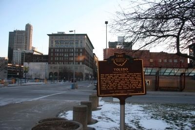
View looking south down North Huron Street of the historical marker.
Photographed by Dale K. Benington, January 31, 2010
4. Toledo Marker
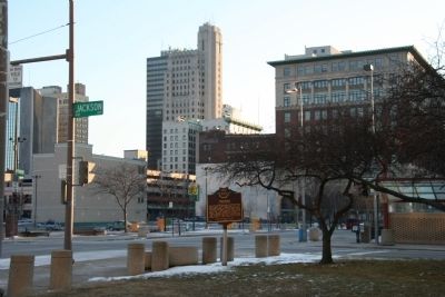
Another more distant view looking south towards North Huron Street and the historical marker, with some of the downtown area in the background.
Photographed by Dale K. Benington, January 31, 2010
5. Toledo Marker
View looking north up North Huron Street of the historical marker, with Toledo's "One Government Center" building in the left background.
Credits. This page was last revised on June 4, 2025. It was originally submitted on January 31, 2010, by Dale K. Benington of Toledo, Ohio. This page has been viewed 2,144 times since then and 72 times this year. Photos: 1, 2, 3, 4, 5. submitted on February 1, 2010, by Dale K. Benington of Toledo, Ohio.
