Lower Garden District in New Orleans in Orleans Parish, Louisiana — The American South (West South Central)
1347 Coliseum Street
Photographed by Cajun Scrambler, April 12, 2025
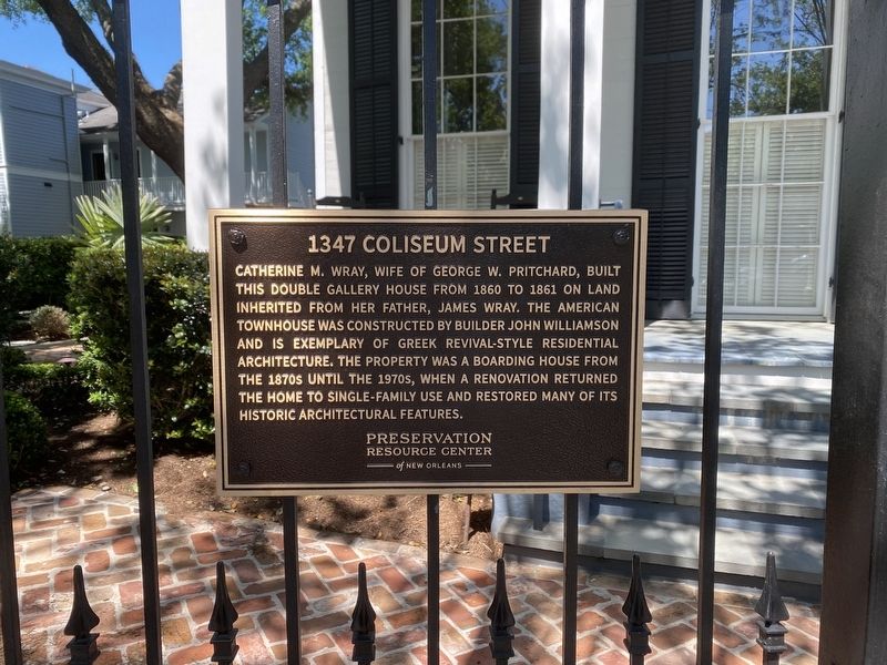
1. 1347 Coliseum Street Marker
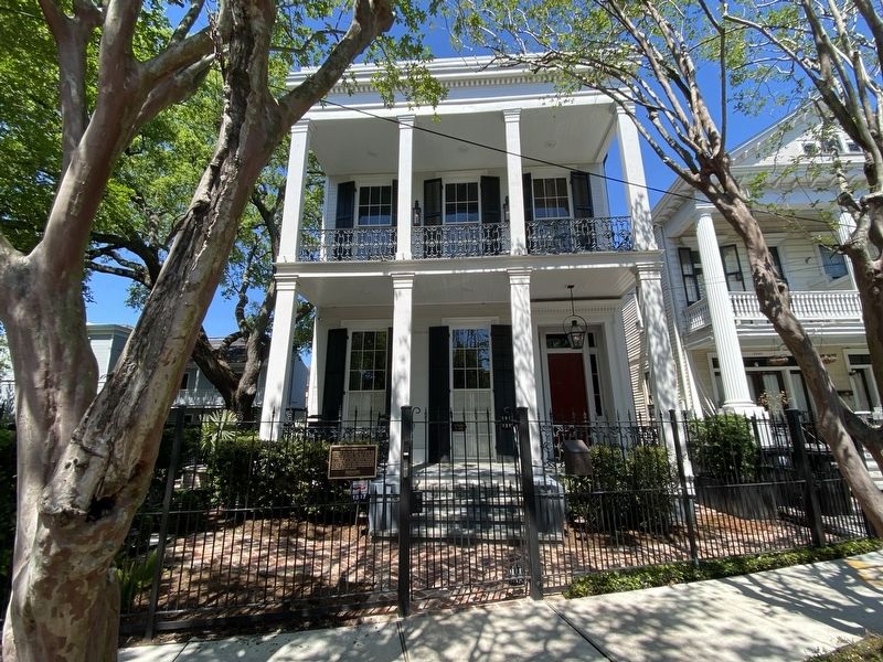
Catherine M. Wray, wife of George W. Pritchard, built this double gallery house from 1860 to 1861 on land inherited from her father, James Wray. The American Townhouse was constructed by builder John Williamson and is exemplary of Greek Revival-Style residential architecture. The property was a boarding house from the 1870s until the 1970s, when a renovation returned the home to single-family use and restored many of its historic architectural features.
Erected by Preservation Resource Center of New Orleans.
Topics. This historical marker is listed in this topic list: Architecture.
Location. 29° 56.245′ N, 90° 4.391′ W. Marker is in New Orleans, Louisiana, in Orleans Parish. It is in the Lower Garden District. It is on Coliseum Street west of Melpomene Street, on the right when traveling west. Touch for map. Marker is at or near this postal address: 1347 Coliseum St, New Orleans LA 70130, United States of America. Touch for directions.

Regionally, this marker is in one of Louisiana’s River Parishes. It is also in the American South, specifically
this page online
Other nearby markers. At least 8 other markers are within walking distance of this marker: E.T. Robinson Mansion (approx. 0.2 miles away); Saint Theresa of Avila Church (approx. 0.2 miles away); Zito Residence (approx. 0.2 miles away); Margaret's Place and Walk / Lower Garden District (approx. ¼ mile away); Moore-Goldstein House (approx. ¼ mile away); Hug Residence (approx. ¼ mile away); Higgins Boat (LCVP) (approx. ¼ mile away); Byrd Residence (approx. 0.3 miles away). Touch for a list and map of all markers in New Orleans.
Photographed by Cajun Scrambler, April 12, 2025
2. 1347 Coliseum Street Marker
Credits. This page was last revised on April 19, 2025. It was originally submitted on April 19, 2025, by Cajun Scrambler of Assumption, Louisiana. This page has been viewed 204 times since then and 55 times this year. Photos: 1, 2. submitted on April 19, 2025, by Cajun Scrambler of Assumption, Louisiana.
