Galway in County Galway, Connacht, Ireland — Irish West ((Éire) North Atlantic Ocean)
Salmon Weir Bridge/Droichead na mBradán
Galway Cathedral/Ardeaglais na Gaillimhe
| — | Galway Waterway Trails/ | — |
Photographed by William Fischer, Jr., April 6, 2025
1. Salmon Weir Bridge/Droichead na mBradán Marker

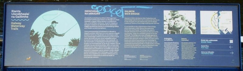
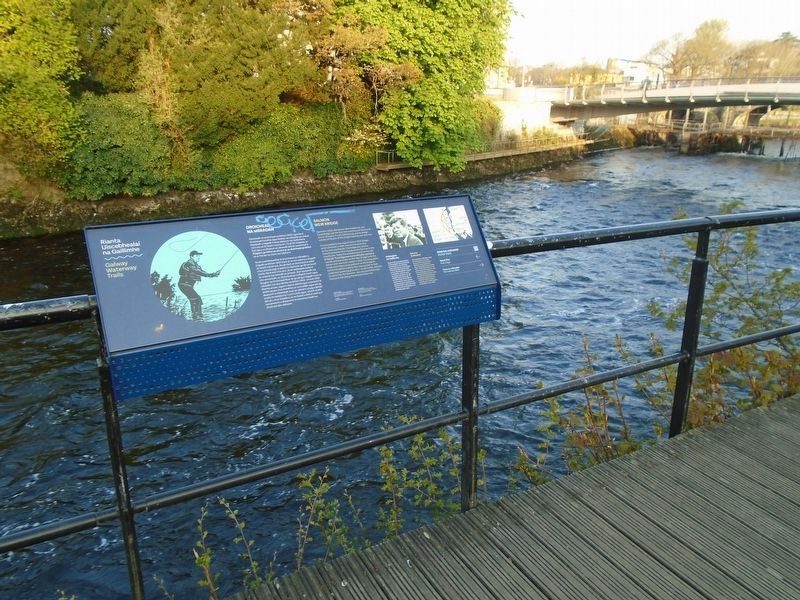
SALMON WEIR BRIDGE
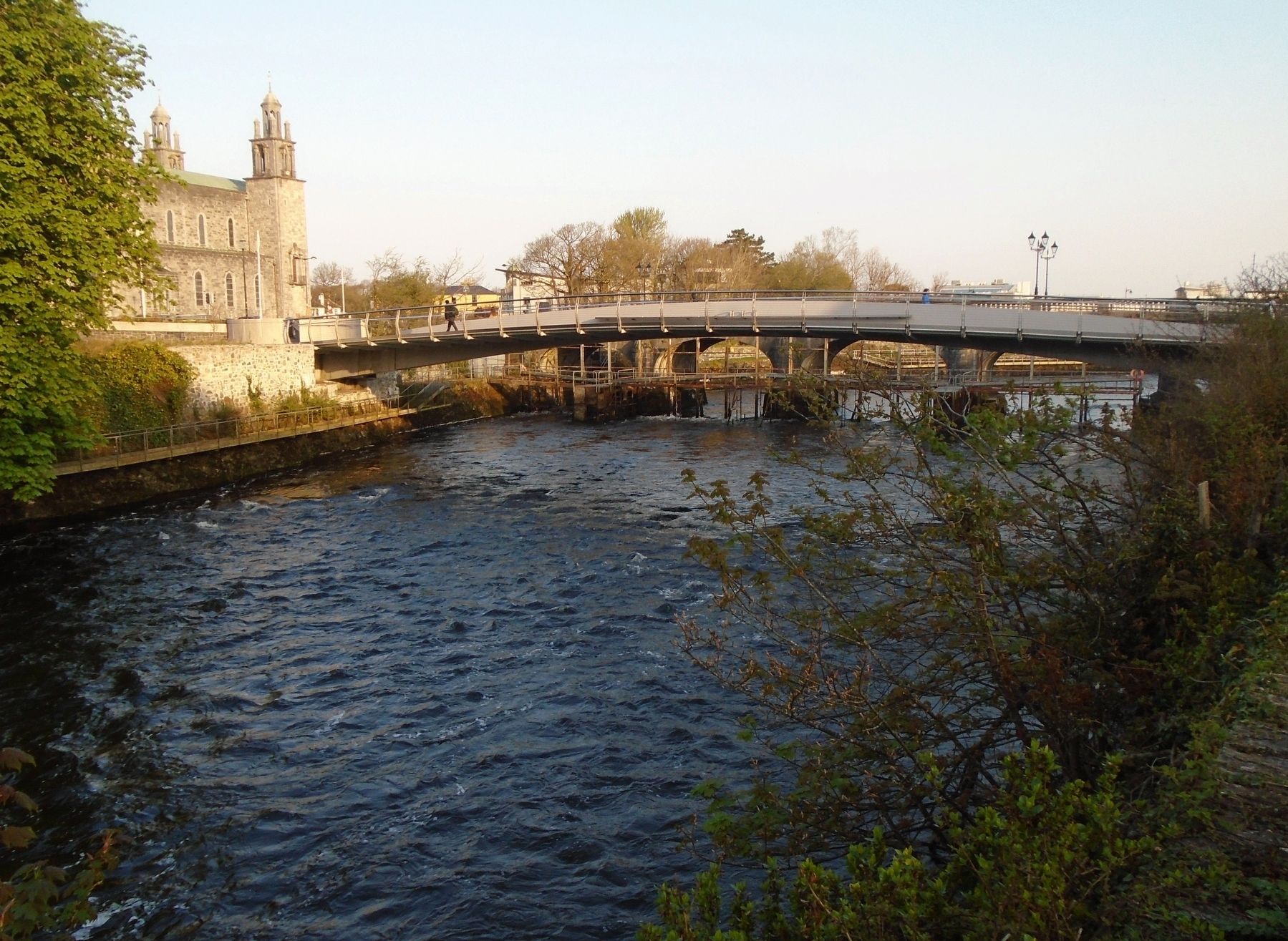
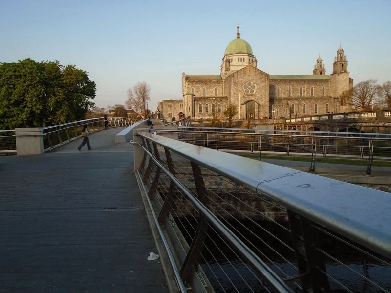
Opened in 2022, the Salmon Weir Pedestrian and Cycle Bridge was the first new crossing over the Corrib in over 30 years. It is 55 metres long, and its design creates an illusion of the bridge hovering over the river.
It runs parallel to the original Salmon Weir Bridge, which was built in 1819, around the same time as the new courthouse. The bridge was used to transfer prisoners from the jail across the river to the courthouse. Today the cathedral stands on the site of the jail. The bridge was never officially opened or named, and was known as the 'New Bridge' until the salmon weir was built nearby in 1852. For many years, locals and visitors have gathered on the bridge to watch the salmon making their way up-river to their traditional spawning grounds in Lough Corrib, and also to watch the fly fishermen, who are permitted under licence to fish along this stretch of the river.
Galway Cathedral
The cathedral is officially called the Cathedral of Our Lady Assumed into Heaven and St Nicholas, and it opened its doors to parishioners in October 1965. St Nicholas of Myra is the patron saint of
this page online
ABOVE RIGHT [Photo]:
The Visit of American President John F Kennedy to Ireland, July 1963
LEFT: Illustration by Steve Doogan.
Osclaíodh an droichead sa bhliain 2022 agus ba é Droichead Coisithe agus Rothar na mBradán an chéad bhealadh a tógadh trasna Abhainn na Gaillimhe le níos mó ná 30 bliain roimhe sin. Tá sé 55 mhéadar ar fad agus cruthaíonn an dearadh atá air seachmall a fhágann go bhfuil an chuma ar an droichead go bhfuil sé ar foluain os cionn na habhann.
Tá sé comhthreomhar le Droichead na mBradán a tógadh sa bhliain 1819 thart ar an am céanna a tógadh an teach cúirte nua. Ba ghnách an droichead a úsáid chun príosúnaigh a aistriú ón bpríosún go dtí an teach cúirte. Sa lá atá inniu ann, tá an ardeaglais suite ar an suíomh ina mbíodh an príosún. Níor osclaíodh, ná níor ainmníodh, an droichead go hoifigiúil riamh agus thugtaí 'an Droichead Nua' air go
Photographed by William Fischer, Jr., April 7, 2025
2. Salmon Weir Bridge/Droichead na mBradán Marker
Ardeaglais na Gaillimhe
Tugtar Ard-Eaglais Mhaighdean na Deastógála agus San Nioclás go hoifigiúil ar an ardeaglais agus osclaíodh do na paróistigh í imí Dheireadh Fómhair 1965. Is é San Nioclás Mhíora éarlamh na Gaillimhe. Deirtear gurb í an eaglais chloiche is mó í dar tógadh riamh san Eoraip. Ar an taobh istigh di, feicfidh tú roinnt mósáicí, lena n-áirítear cuimhneachán ar uachtarán na Stát Aontaithe, John F. Kennedy, a thug cuairt ar Ghaillimh ar an 29 Meitheamh, 1963.
THUAS AR DHEIS [GRIANGHRAIF]:
Cuairt Uachtarán Stáit Aontaithe Mheiriceá, John F Kennedy, ar Éirinn, lúil 1963.
AR CHLÉ: Léaráid le Steve Doogan.
Erected by Government of Ireland, Fáitle Ireland, Galway City Council, and Wild Atlantic Way.
Topics.
Photographed by William Fischer, Jr., April 7, 2025
3. Salmon Weir Bridge/Droichead na mBradán over River Corrib
Location. 53° 16.493′ N, 9° 3.326′ W. Marker is in Galway, Connacht, in County Galway. It can be reached from Newtownsmith. Marker is along the Waterway Trail, about 75 meters south of the Salmon Weir Pedestrian Bridge. Touch for map. Marker is in this post office area: Galway, Connacht H91 XKF4, Ireland. Touch for directions.

Regionally, it is on the Atlantic Ocean, in the North Atlantic Region, on the Atlantic Arc, in Europe, on the Island of Ireland, on the Celtic Fringe, in the European Union, in Atlantic Europe, on one of the British Isles, in the Western World, and in the Anglosphere.
Other nearby markers. At least 8 other markers are within walking distance of this marker: Peace and Democracy Arch (a few steps from this marker); "Death at Crane's Court" (a few steps from this marker); Alice Perry (within shouting distance of this marker); Father Peter Daly (within shouting distance of this marker); Hail and Farewell (about 120 meters away, measured in a direct line); Religious Sisters of Mercy/
Photographed by William Fischer, Jr., April 7, 2025
4. Salmon Weir Bridge/Droichead na mBradán
Credits. This page was last revised on August 25, 2026. It was originally submitted on April 19, 2025, by William Fischer, Jr. of Reynoldsburg, Ohio. This page has been viewed 183 times since then and 52 times this year. Photos: 1, 2, 3, 4. submitted on April 19, 2025, by William Fischer, Jr. of Reynoldsburg, Ohio.
