Bluff in San Juan County, Utah — The American Mountains (Southwest)
The Barton Cabin/West Wall of the Bluff Fort

Photographed by James Hulse, March 28, 2025
1. The Barton Cabin/West Wall of the Bluff Fort Marker
The stone remnants around the opening in the westernmost wall were part of the original fireplace. Fireplaces were the primary means for heating and cooking. Some cabins used a potbellied stove in lieu of a fireplace, but during their first years, this was generally an exception for the San Juan pioneers. Today the restored room has no visible means of heat. However, during the
this page online
Cottonwood was the only readily available timber in the immediate vicinity of Bluff. Pegs were used throughout the cabin to secure adjoining cottonwood logs which were prone to shrink and twist for many years.
Stone
To prevent ground moisture from rotting the base logs, the Bluff cabins were built on foundations of large sandstone rocks. Part of the foundation is visible on the south side of the cabin.
Captions
(Photo #1) The Fireplace
(Photo #2) Hand-hewn Pegs
Topics. This historical marker is listed in this topic list: Notable Buildings.
Location. 37° 17.011′ N, 109° 33.196′ W. Marker is in Bluff, Utah, in San Juan County. It is at the intersection of Black Locust Avenue and 5th E Street on Black Locust Avenue. The marker is located at the Bluff Fort Historic Site. Touch for map. Marker is at or near this postal address: 550 Black Locust Ave, Bluff UT 84512, United States of America. Touch for directions.

Regionally,

Photographed by James Hulse, March 28, 2025
2. The Barton Cabin/West Wall of the Bluff Fort and Marker

Other nearby markers. At least 8 other markers are within walking distance of this marker: The Barton's Well (here, next to this marker); Barton Family (a few steps from this marker); Sod Roofs on the Cabins of Bluff (a few steps from this marker); Farming Implements Used by the Settlers of Bluff (within shouting distance of this marker); Amasa Barton's Blacksmith Shop (within shouting distance of this marker); Henry & Sarah Ann Robinson Holyoak Wagon Encampment Display (within shouting distance of this marker); George Brigham Hobbs & Sisters (within shouting distance of this marker); Parley R. & Ency Camilla (Bayles) Butt (within shouting distance of this marker). Touch for a list and map of all markers in Bluff.
Also see . . . Bluff Fort Visitor Center.
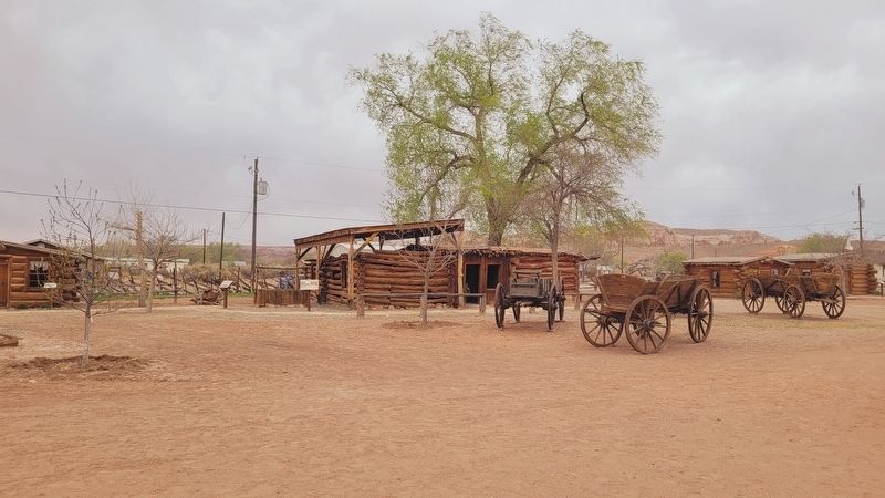
Photographed by James Hulse, March 28, 2025
3. The view of the Barton Cabin from across the fort compound
Credits. This page was last revised on June 23, 2025. It was originally submitted on April 20, 2025, by James Hulse of Medina, Texas. This page has been viewed 150 times since then and 33 times this year. Photos: 1, 2, 3. submitted on April 22, 2025, by James Hulse of Medina, Texas.
