Near Havre in Hill County, Montana — The American West (Mountains)
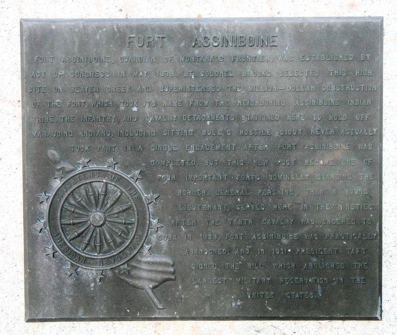
Fort Assiniboine

Photographed by Barry Swackhamer, August 15, 2019
1. Fort Assiniboine Marker
Erected by Daughters of the American Revolution.
Topics and series. This historical marker is listed in this topic list: Forts and Castles. In addition, it is included in the Daughters of the American Revolution (DAR), and the Former U.S. Presidents: #27 William Howard Taft
this page online
Location. 48° 29.915′ N, 109° 47.789′ W. Marker is near Havre, Montana, in Hill County. It is on Fort Circle near 82nd Avenue West, on the left when traveling east. Touch for map. Marker is at or near this postal address: 3797 Fort Cir, Havre MT 59501, United States of America. Touch for directions.

Regionally, this marker is in Montana’s Missouri River Country. It is also in the American Mountain West and in the Lewis & Clark Corridor. Globally, it is in North America, the Western Hemisphere, the Western World, and the Anglosphere. Historically, it finds itself in what was once Rupert’s Land and also the Louisiana Purchase.
Other nearby markers. At least 8 other markers are within walking distance of this marker: The Buffalo Soldiers at Fort Assinniboine (here, next to this marker); John A. Burns (here, next to this marker); Fort Assinniboine (here, next to this marker); a different marker also named Fort Assinniboine (here, next to this marker); Library (within shouting distance of this marker); Company Officers' Quarters (Apartments) (within shouting distance

Photographed by Barry Swackhamer, August 15, 2019
2. Fort Assiniboine Marker
This marker is at the center of the group.
More about this marker. This marker on the grounds of Fort Assinniboine.

Photographed by Barry Swackhamer, August 15, 2019
3. Parade Ground, markers on the right.
Photographed by Barry Swackhamer, August 15, 2019
4. Fort Assiniboine Marker
Credits. This page was last revised on August 6, 2026. It was originally submitted on November 18, 2019, by Barry Swackhamer of Brentwood, California. This page has been viewed 446 times since then and 51 times this year. Last updated on April 22, 2025, by Carl Gordon Moore Jr. of North East, Maryland. Photos: 1, 2, 3. submitted on November 18, 2019, by Barry Swackhamer of Brentwood, California. 4. submitted on August 6, 2026. • Devry Becker Jones was the editor who published this page.
