Auburn in Sangamon County, Illinois — The American Midwest (Great Lakes)
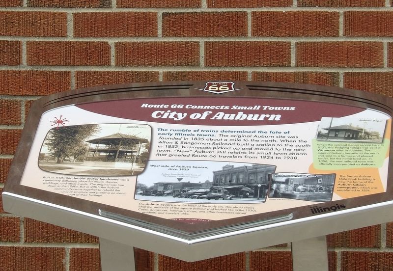
City of Auburn
Route 66 Connects Small Towns
Photographed by Duane and Tracy Marsteller, April 6, 2025
1. City of Auburn Marker
Photographs (left to right)
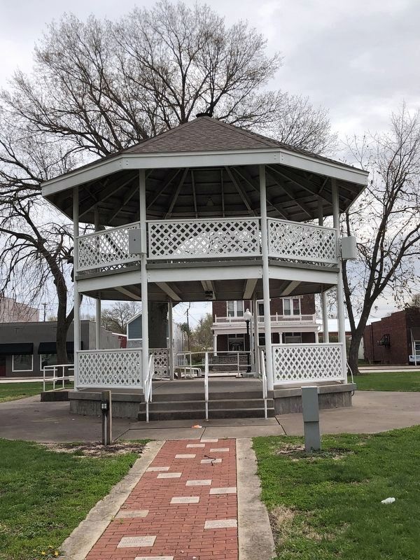
• Built in 1905, this double-decker bandstand was a community gathering place for music, dances, weddings and other events. The original was torn down in the 1960s. But in 2001, the Auburn community came together to rebuild the unique structure and preserve an iconic part of their heritage.
• West side of Auburn Square, circa 1930 Auburn State Bank, now home of the Auburn Citizen newspaper.
• The Auburn square was the heart of the early city. This photo shows what the west side of the square (behind you) looked like in the 1930s. Cafes, drugstores, hardware shops, and other businesses served residents and travelers alike.
• Inside Auburn State Bank The former Auburn State Bank building is now the home of the Auburn Citizen newspaper,
this page online
• Auburn Depot When the railroad began service here in 1852, this fledgling village was called Wineman after its founder. The original Auburn townsite to the north was sold to a former and plowed under, but the name lived on. In 1856, the new railroad town was officially incorporated as Auburn.
Erected by Illinois Route 66 Scenic Byway.
Topics and series. This historical marker is listed in these topic lists: Railroads & Streetcars • Settlements & Settlers. In addition, it is included in the U.S. Route 66 series list. A significant historical year for this entry is 1835.
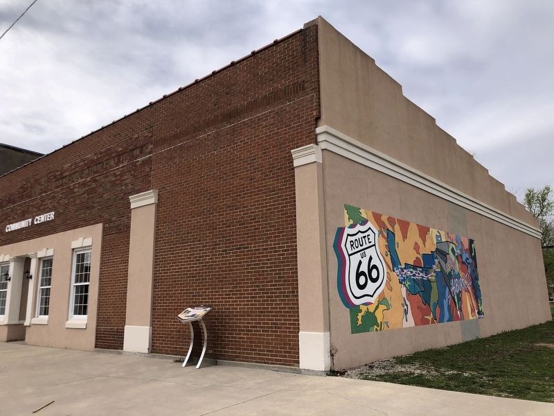
Location. 39° 35.495′ N, 89° 44.791′ W. Marker is in Auburn, Illinois, in Sangamon County. It is on North 5th Street south of West Jefferson Street, on the right when traveling south. Marker is in front of Auburn Community Center. Touch for map. Marker is at or near this postal address: 118 N 5th St, Auburn IL 62615, United States of America. Touch for directions.

Regionally, this marker is in Central Illinois and in Greater Springfield. It is also in the American Midwest and in the Corn Belt. Globally, it is in North America,
Photographed by Duane and Tracy Marsteller, April 6, 2025
2. City of Auburn Marker
Other nearby markers. At least 8 other markers are within 7 miles of this marker, measured as the crow flies: Lest We Forget (approx. 3.8 miles away); Pioneer Park (approx. 5.6 miles away); Veterans Memorial (approx. 6.2 miles away); a different marker also named Veterans Memorial (approx. 6.2 miles away); a different marker also named Veterans Memorial (approx. 6.2 miles away); Route 66 Coal Towns (approx. 6.3 miles away); Battle of Virden Monument (approx. 6.3 miles away); a different marker also named Veterans Memorial (approx. 6.3 miles away).
Also see . . . History of Auburn (PDF). The Auburn Historical Society created this booklet for the city's centennial in 1965. It contains personal narratives and accounts, historical photographs and other tidbits about the city's first century. (via City of Auburn, Illinois) (Submitted on April 25, 2025, by Duane and Tracy Marsteller of Murfreesboro, Tennessee.)
Photographed by Duane and Tracy Marsteller, April 6, 2025
3. Auburn's double-decker bandstand
It anchors the town square.
Credits. This page was last revised on April 25, 2025. It was originally submitted on April 25, 2025, by Duane and Tracy Marsteller of Murfreesboro, Tennessee. This page has been viewed 403 times since then and 124 times this year. Photos: 1, 2, 3. submitted on April 25, 2025, by Duane and Tracy Marsteller of Murfreesboro, Tennessee.
