Old Saybrook in Lower Connecticut River Valley Region, Connecticut — The American Northeast (New England)
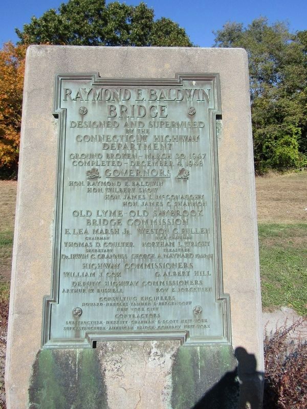
Raymond E. Baldwin Bridge
Photographed by Conrad Ward, October 19, 2024
1. Raymond E. Baldwin Bridge Marker
Designed and supervised by the Connecticut Highway Department
Ground Broken - March 30, 1947
Completed - December 4, 1948
Governors
Hon. Raymond E. Baldwin
Hon. Wilbert Snow
Hon. James L. McConaughy
Hon. James C. Sharon
Old Lyme - Old Saybrook Bridge Commission
E. Lea Marsh J. - Chairman
Weston G. Pullen - Vice-Chairman
Thomas D. Coulter - Secretery
Northam L. Wright - Treasurer
Dr. Irwin C. Cranniss
George A. Maynard 1945-47
Highway Commissioners
William J. Cox
G. Albert Hill
Deputy Highway Commissioners
Arthur W. Bushell
Roy E. Jorgensen
Consulting Engineers
Howard · Needles · Tammen · & · Bergendoff New York City
Contractors
Substructure · Merritt · Chapman · & · Scott New York
Superstructure · American · Bridge · Company New York
Erected 1948.
Topics. This historical marker is listed in this topic list: Bridges & Viaducts. A significant historical date for this entry is December 4, 1948.
Location. 41° 19.106′ N, 72° 21.201′ W. Marker is in Old Saybrook in Lower Connecticut River Valley Region, Connecticut. It is on Connecticut Turnpike (Interstate 95) west of Ferry Road, on the right when traveling
this page online

Regionally, this marker is in the Connecticut River Valley, on the Connecticut Shoreline, and in Mystic and the Eastern Shore. It is also in the American Northeast, in New England, and on the Eastern Seaboard. Globally, it is in the North Atlantic Region, North America, the Western Hemisphere, the Western World, and the Anglosphere. Historically, it finds itself in what was once Middlesex County and also one of the original Thirteen Colonies.
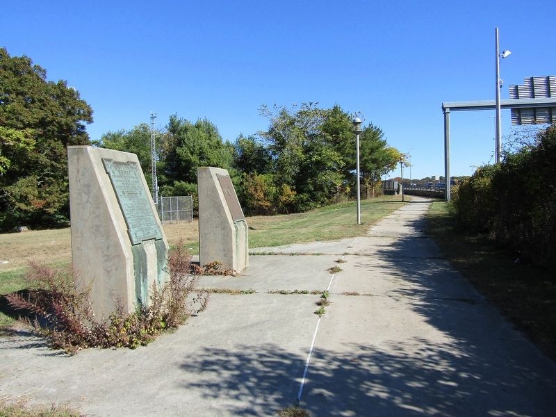
Other nearby markers. At least 8 other markers are within 2 miles of this marker, measured as the crow flies: New Raymond E. Baldwin Bridge (here, next to this marker); American Legion Post 113 Memorial (approx. ¼ mile away); Connecticut River (approx. half a mile away); British Raid 1814 (approx. 0.6 miles away); Anadromous Fish (approx. ¾ mile away); Osprey (approx. ¾ mile away); Dr. Roger Tory Peterson Wildlife Area at Great Island (approx. ¾ mile away); Humphrey (approx. 1.2 miles away). Touch for a list and map of all markers
Photographed by Conrad Ward, October 19, 2024
2. Raymond E. Baldwin Bridge Marker
Also see . . . Raymond E. Baldwin Bridge (Wikipedia). (Submitted on April 25, 2025.)
Credits. This page was last revised on May 19, 2026. It was originally submitted on April 25, 2025, by Conrad Ward of Guilford, Connecticut. This page has been viewed 180 times since then and 51 times this year. Photos: 1, 2. submitted on April 25, 2025, by Conrad Ward of Guilford, Connecticut. • Michael Herrick was the editor who published this page.
