Tubac in Santa Cruz County, Arizona — The American Mountains (Southwest)
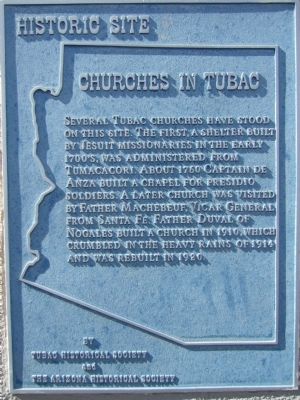
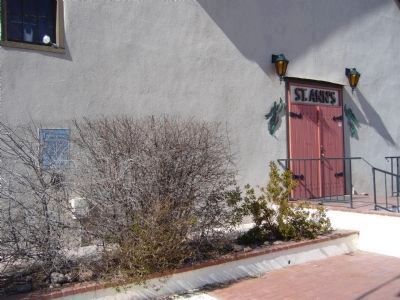
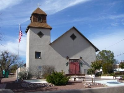
Churches in Tubac
Erected by Tubac Historical Society and the Arizona Historical Society.
Topics. This historical marker is listed in these topic lists: Churches & Religion • Notable Buildings • Settlements & Settlers. A significant historical year for this entry is 1760.
Location. 31° 36.746′ N, 111° 2.819′ W. Marker is in Tubac, Arizona, in Santa Cruz County. Marker is on Calle Iglesia, on the right when traveling east. Touch for map. Marker is at or near this postal address: 11 Calle Iglesia, Tubac AZ 85646, United States of America. Touch for directions.
Other nearby markers. At least 8 other markers are within 3 miles of this marker, measured as the crow flies. Tubac Schools (a few steps from this marker); Tubac Presidio (within shouting distance of this marker); Presidio of Tubac (within shouting distance of this marker); Juan Bautista de Anza (within shouting distance of this marker); Charles Debrille Poston (about 300 feet away, measured in a direct line); Baca Float Number 3 (about 500 feet away); Tubac (approx. 0.3 miles away); Mission San José de Tumacácori (approx. 3.1 miles away). Touch for a list and map of all markers in Tubac.
Credits. This page was last revised on June 16, 2016. It was originally submitted on February 3, 2010, by Bill Kirchner of Tucson, Arizona. This page has been viewed 936 times since then and 20 times this year. Photos: 1, 2, 3. submitted on February 3, 2010, by Bill Kirchner of Tucson, Arizona. • Syd Whittle was the editor who published this page.


