
Thorold in Niagara Region, Ontario — Central Canada (North America)
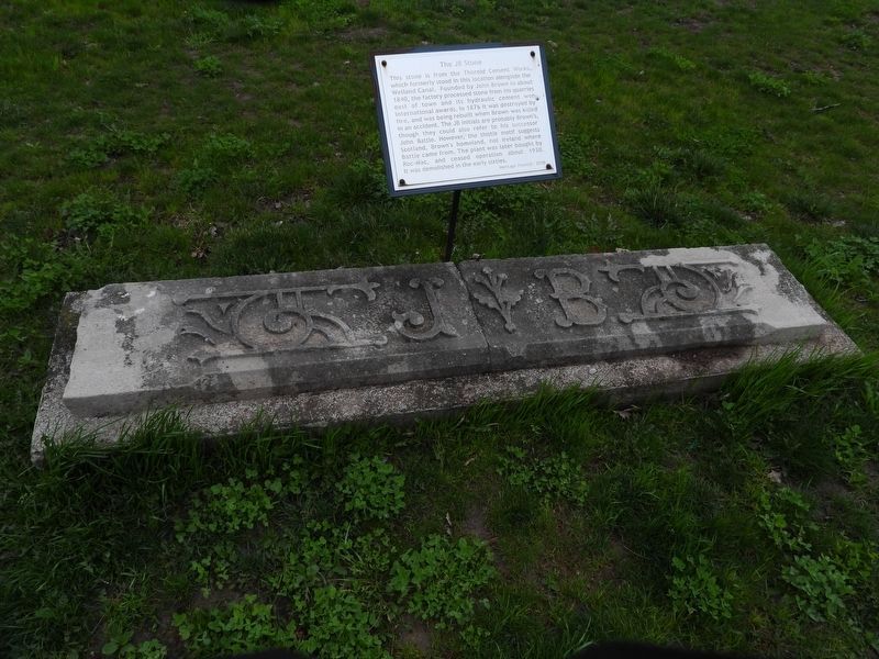
The JB Stone

Photographed by Kevin Westell, April 26, 2025
1. The JB Stone Marker
This stone is from the Thorold Cement Works, which formerly stood in this location alongside the Welland Canal. Founded by John Brown in about 1840, the factory processed stone from his quarries east of town and its hydraulic cement won international awards. In 1876 it was destroyed by fire, and was being rebuilt when Brown was killed in an accident. The JB initials are probably Brown's, though they could also refer to his successor John Battle. However, the thistle motif suggests Scotland, Brown's homeland, not Ireland where Battle came from. The plant was later bought by Roc-Mac, and ceased operation about 1930. It was demolished in the early sixties.
Erected 2010 by Heritage Thorold.
Topics. This historical marker is listed in this topic list: Industry & Commerce. A significant historical year for this entry is 1840.
Location. 43° 7.333′ N, 79° 12.048′ W. Marker is in Thorold, Ontario, in Niagara Region. It can be reached from Sullivan Avenue, on the right when traveling south. This sign is within Battle Of Beaverdams Park, along the walking trail. It is 80 yards south of the Battle Of Beaverdams
this page online

Regionally, this marker is on Ontario’s Golden Horseshoe and in Niagara Canada. It is also in Central Canada. Globally, it is in North America, on the Great Lakes, in the Western Hemisphere, in the Western World, and in the Anglosphere. Historically, it finds itself in what was once a British colony, the Viceroyalty of New France, the Haudenosaunee (Iroquois) Confederacy, and Rupert’s Land.
Other nearby markers. At least 8 other markers are within walking distance of this marker: In Memory of John Bean, Ph.D., M.D. (here, next to this marker); The 1827 Stone (here, next to this marker); The Founding of Thorold (within shouting distance of this marker); Lock 25 - Second Welland Canal 1841-1845 (within shouting distance of this marker); In Memory of Unknown American Soldiers (within shouting distance of this marker); Beaver Dams (within shouting distance of this marker); City of Thorold Time Capsule (within shouting distance of this marker); Laura Ingersoll Secord
Photographed by Kevin Westell, April 26, 2025
2. The JB Stone
Photographed by Kevin Westell, April 26, 2025
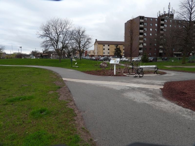
3. The JB Stone Marker in context, facing north
This cluster of exhibits is at a junction of walking paths, just north of the 2nd canal lock and the bandshell. The "JB stone" is on the left, beside the blue plaque.
Credits. This page was last revised on April 29, 2025. It was originally submitted on April 28, 2025, by Kevin Westell of St. Catharines, Ontario. This page has been viewed 128 times since then and 22 times this year. Photos: 1, 2, 3. submitted on April 28, 2025, by Kevin Westell of St. Catharines, Ontario. • Andrew Ruppenstein was the editor who published this page.
