Lakeview in Gallatin County, Montana — The American West (Mountains)
The Lake that Tilted
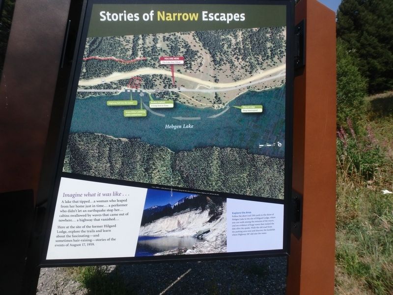
Stories of Narrow Escapes
Photographed by Martin Schrattenholzer, August 27, 2017
1. The Lake that Tilted Marker
Imagine what it was like…
A lake that tipped…a woman who leaped from her home just in time...a performer who didn't let an earthquake stop her…cabins swallowed by waves that came out of nowhere...a highway that vanished…
Here at the site of the former Hilgard Lodge, explore the trails and learn about the fascinating--and sometimes hair-raising--stories of the events of August 17, 1959.
Explore the Area
Follow the short trail 200 yards to the shore of Hebgen Lake to site of Hilgard Lodge, where you can walk among the remains of the resort, and see evidence of huge waves that rocked the lake after the quake. Walk the old road from the parking area west and discover the landslide where Highway 287 slid into the water.
Topics. This historical marker is listed in this topic list: Disasters. A significant historical date for this entry is August 17, 1959.
Location. 44° 51.355′ N, 111° 19.507′ W. Marker is in Lakeview, Montana, in Gallatin County. It can be reached from Hebgen Lake Dam (U.S. 287) 12 miles west of U.S. 191. Touch for map. Marker is at or near this postal address: 10041 Hebgen Lake Dam, West Yellowstone MT 59758,
this page online

Regionally, this marker is in Yellowstone Country and in Greater Bozeman. It is also in the American Mountain West and in the Lewis & Clark Corridor. Globally, it is in North America, the Rocky Mountains, the Western Hemisphere, the Western World, and the Anglosphere. Historically, it finds itself in what was once Rupert’s Land and also the Louisiana Purchase.
Other nearby markers. At least 8 other markers are within 8 miles of this marker, measured as the crow flies: Something is terribly wrong (a few steps from this marker); A Leap Just in Time (about 600 feet away, measured in a direct line); Sleep Interrupted (approx. ¼ mile away); The Night the Earth Cracked (approx. 1.4 miles away); Refuge Point (approx. 1.8 miles away); The Seismic Shake that Shaped this Lake (approx. 3.4 miles away); Raynolds' Pass (approx. 7.3 miles away); The Night’s Peace Was Shattered (approx. 7.6 miles away).
Credits. This page was last revised on May 2, 2025. It was originally submitted on February 17, 2018, by Martin Schrattenholzer of Renton, Washington. This page has been viewed 3,054 times since then and 189 times this year. Last updated on April 29, 2025, by Carl Gordon Moore Jr. of North East, Maryland. Photo 1. submitted on February 17, 2018, by Martin Schrattenholzer of Renton, Washington. • Devry Becker Jones was the editor who published this page.
