Lakeview in Gallatin County, Montana — The American West (Mountains)
Something is terribly wrong
Photographed by Martin Schrattenholzer, August 27, 2017
1. Something is terribly wrong Marker
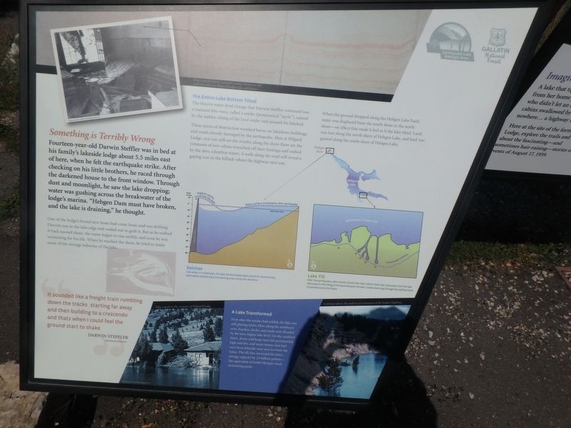
Something is Terribly Wrong
Fourteen-year-old Darwin Steffler was in bed in his family’s lakeside lodge about 5.5 miles east of here, when he felt the earthquake strike. After checking on his little brothers, he race through the darkened house to the front window. Through the dust and moonlight, he saw the lake dropping; water was gushing across the breakwater of the lodge’s marina. “Hebgen Dam must have broken, and the lake is draining,” he thought.
One of the lodge’s brand-new boats had come loose and was drifting. Darwin ran down to the lake edge and waded out to grab it. But as he walked it back to shore, the water began to rise swiftly, and soon he was swimming for his life. When he reached the shore, he tried to make sense of the strange behavior of the lake.
The Entire Lake Bottom Tilted
The bizarre water-level change Darwin Steffler had witnessed was a tsunami-like wave, called a seiche (pronounced “saysh”), caused by the sudden tilting of the land under and around the lakebed.
These waves of destruction wreaked havoc on lakeshore buildings and roads already damaged by the earthquake. Here at Hilgard
this page online
When the ground dropped along the Hebgen Lake Fault, water was displaced from the south shore to the north shore - an effect that made it feel like the lake had tilted. Land was lost along the north shore of Hebgen Lake, and land was gained along the south shore of Hebgen Lake.
It sounded like a freight train rumbling down the tracks starting far away then building to a crescendo and thats when I could feel the ground start to shake.
Darwin Steffler earthquake survivor
[Captions:]
Seiches
Like water in a tilted pan, the lake sloshed slowly back and forth several times, alternately swallowing and exposing area along the shoreline.
Lake Tilt
After the earthquake, cabin owners found that their cabins more than 500 yards from the lake shore due to the tilting of the land beneath the lake. Canals were dug through the uplifted land to provide access for boats.
A Lake Transformed
Even after the seiches had settled, the lake was still playing tricks. Here along the northwest arm, beaches, docks, and roads were flooded by the new, higher lake level. On the southern shore, docks and boats were left permanently high and dry, and many homes that had once been lakeside were now far from the water. The tilt also increased the lake’s storage capacity by 2.6 billion gallons-the equivalent of 6,640 Olympic-sized swimming pools.
Topics. This historical marker is listed in this topic list: Disasters. A significant historical date for this entry is August 17, 1959.
Location. 44° 51.365′ N, 111° 19.517′ W. Marker is in Lakeview, Montana, in Gallatin County. It can be reached from Hebgen Lake Dam (U.S. 287) 12 miles west of U.S. 191. Touch for map. Marker is at or near this postal address: 10020 Hebgen Lake Dam, West Yellowstone MT 59758, United States of America. Touch for directions.

Regionally, this marker is in Yellowstone Country and in Greater Bozeman. It is also in the American Mountain West and in the Lewis & Clark Corridor. Globally, it is in North America, the Rocky Mountains, the Western Hemisphere, the Western World, and the Anglosphere. Historically, it finds itself in what was once Rupert’s Land and also the Louisiana Purchase.
Other nearby markers. At least 8 other markers are within 8 miles of this marker, measured as the crow flies: The Lake that Tilted (a few steps from this marker); A Leap Just in Time (about 500 feet away, measured in a direct line); Sleep Interrupted (approx. ¼ mile away); The Night the Earth Cracked (approx. 1.4 miles away); Refuge Point (approx. 1.8 miles away); The Seismic Shake that Shaped this Lake (approx. 3.4 miles away); Raynolds' Pass (approx. 7.3 miles away); The Night’s Peace Was Shattered (approx. 7.6 miles away).
More about this marker. There is a second sign right next to it, which can be seen in the photo
Credits. This page was last revised on May 2, 2025. It was originally submitted on February 17, 2018, by Martin Schrattenholzer of Renton, Washington. This page has been viewed 1,287 times since then and 103 times this year. Last updated on April 29, 2025, by Carl Gordon Moore Jr. of North East, Maryland. Photo 1. submitted on February 17, 2018, by Martin Schrattenholzer of Renton, Washington. • Devry Becker Jones was the editor who published this page.
