Downtown West in Minneapolis in Hennepin County, Minnesota — The American Midwest (Upper Plains)
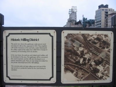
Historic Milling District
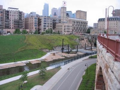
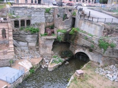
In the near future, the parkway and related park facilities will be developed in this area. The gatehouse will be uncovered, the canal reopened, and the mill ruins developed as an historic interpretive park. Plans are also being formulated for the private redevelopment of the mill buildings.
The concrete posts and pipe railings seen just east of this sign served as a protective barrier for the canal during its operation.
Topics and series. This historical marker is listed in these topic lists: Industry & Commerce • Waterways & Vessels. In addition, it is included in the Minnesota Historical Society series list. A significant historical year for this entry is 1945.
Location. 44° 58.837′ N, 93° 15.53′ W. Marker is in Minneapolis, Minnesota, in Hennepin County. It is in Downtown West. Marker can be reached from West River Parkway west of Portland Avenue South. Marker is near the west end of the Stone Arch Bridge. Touch for map. Marker is at or near this postal address: 1 Portland Avenue South, Minneapolis MN 55401, United States of America. Touch for directions.
Other nearby markers. At least 8 other markers are within walking distance of this marker. Stone Arch Bridge (within shouting distance of this marker); Giants in the Land: The Power of Minneapolis Mills and Millers (within shouting distance of this marker); Mills and Millraces (within shouting distance of this marker); Water: The waterpower harnessed from St. Anthony Falls gave life to the milling industry (within shouting distance of this marker); Bricks and Mortar (within shouting distance of this marker); New Uses for Old Mills (about 300 feet away, measured in a direct line); A Changing Landscape (about 300 feet away); The Falls of St. Anthony (about 400 feet away). Touch for a list and map of all markers in Minneapolis.
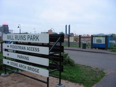
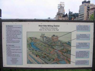
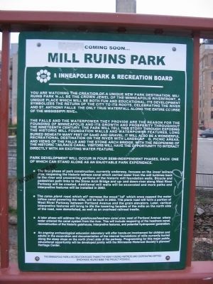
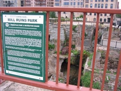
More about this marker. You are watching the creation of a unique new park destination. Mill Ruins Park will be the crown jewel of the Minneapolis riverfront, a unique place which will be both fun and educational. Its development symbolizes the return of the city to its roots, celebrating the river and St. Anthony Falls, the only true waterfall along the entire course of the Mississippi River.
The falls and the waterpower they provide are the reason for the founding of Minneapolis and its growth and prosperity throughout the Nineteenth Century. The park will tell this story through exposing the historic mill foundation walls and
waterpower features, long buried beneath many feet of sand and gravel. It will also be a wonderful recreational destination on the river with landscaping, picnic areas, and views of the falls and the Stone Arch Bridge. With the reopening of the historic tailrace canal, visitors will have the opportunity to interact directly with an exciting water feature.
Park development will occur in four semi-independent phases, each one of which can stand alone as an enjoyable park experience.
• The first phase of park construction, currently underway, focuses on the lower tailrace area, reopening the historic tailrace canal which carried water from the mill turbines back to the river and uncovering portions of the historic mill foundation walls. Bicycle and pedestrian path links to the Stone Arch Bridge and up- and down-river along West River Parkway will be created. Additional mill walls will be excavated and more paths and interpretive features will be installed in 2003.
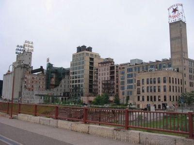
• The canal plank road, which will recreate the wood "lid" which once capped the water inflow canal powering the mills, will be built in 2002. The plank road will form a portion of West River Parkway between Portland Avenue and the grain elevators. Later, vertical interpretive features will bring to life the towering facades of the mills on the north side of the road, now demolished,
as well as an overhead railroad trestle.
• A later phase will address the gatehouse/headrace canal area, west of Portland Avenue where water entered the canal system from the river. This will include reopening of the headrace canal, reconstruction of the historic gatehouse, interpretive features, and potential hydropower generation.
• An ongoing archaeological education laboratory will offer hands-on involvement for children and adults in the excavation and documentation of the internal foundations of mills currently buried along the steep slope on the north (river) side of the parkway. Programming for this major public educational opportunity will be developed jointly with the Minnesota Historical Society's planned Heritage Center.
—Mill Ruins Park sign
Also see . . . Mills District, Minneapolis. Wikipedia entry. "Within decades, the riverfront was literally lined with flour mills - including future corporate giants General Mills and Pillsbury. At its zenith, Minneapolis’ Mill District was the largest producer of flour in the world." (Submitted on February 4, 2010.)
Credits. This page was last revised on April 24, 2024. It was originally submitted on February 4, 2010, by Keith L of Wisconsin Rapids, Wisconsin. This page has been viewed 1,079 times since then and 34 times this year. Photos: 1, 2, 3, 4, 5, 6, 7, 8. submitted on February 4, 2010, by Keith L of Wisconsin Rapids, Wisconsin. • Craig Swain was the editor who published this page.
