Charing in Kent, England, United Kingdom — Northwestern Europe (the British Isles)
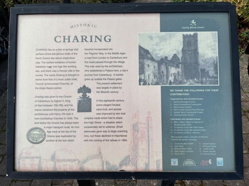
Historic Charing
Photographed by Ray Gurganus, March 27, 2025
1. Historic Charing Marker
Charing was given to the Church of Canterbury by Egbert II, King of Kent between 765-780, and the manor remained the property of the archbishops until Henry VIII took it from Archbishop Cranmer in 1545. The land below the Downs has always been a major transport route. An Iron Age track at the top of the Downs was duplicated by another at the foot which became incorporated into the Pilgrims' Way. In the Middle Ages a road from London to Canterbury and the coast passed through the village. This was used by the archbishops, who established a Palace here, a day's journey from Canterbury. A market grew up outside the Palace gates. The present settlement was largely in place by the fifteenth century.
In the eighteenth century some elegant houses were built,
this page online
Erected by Charing Parish Council.
Topics. This historical marker is listed in this topic list: Settlements & Settlers. A significant historical year for this entry is 1545.
Location. 51° 12.631′ N, 0° 47.73′ E. Marker is in Charing, England, in Kent. It is on Market Place. Touch for map. Marker is at or near this postal address: 5 Market Place, Charing, England TN27 0LP, United Kingdom. Touch for directions.

Regionally, this marker is in the Greater South East. Globally, it is on the Atlantic Ocean, in the North Atlantic Region, in Europe, in Atlantic Europe, on one of the British Isles, in the Western World, and in the Anglosphere. Historically, it finds itself in what was once the Roman Empire.
Other nearby markers. At least 8 other markers are within 10 kilometers of this marker, measured as the crow flies: A different marker also named Historic Charing (here, next to this marker); Corporal Frederick George Coppins VC (a few steps from this marker); In the Parish of Calehill with Westwell (within shouting distance of this marker); A medieval building (about 240 meters away, measured in a direct line); Ronald N. Stuart Victoria Cross (approx. 0.3 kilometers away); To mark the Centenary of the WW1 Armistice (approx. 0.3 kilometers away); Simone Weil (approx. 8.3 kilometers away); British Mark IV Female Tank, No 245 (approx. 8.5 kilometers away). Touch for a list and map of all markers in Charing.
Credits. This page was last revised on May 2, 2025. It was originally submitted on May 1, 2025, by Ray Gurganus of Washington, District of Columbia. This page has been viewed 80 times since then and 10 times this year. Photo 1. submitted on May 1, 2025, by Ray Gurganus of Washington, District of Columbia. • Andrew Ruppenstein was the editor who published this page.
Editor’s want-list for this marker. photo of the marker within its surroundings • Can you help?
