Downtown Springfield in Greene County, Missouri — The American Midwest (Upper Plains)
First School in Springfield
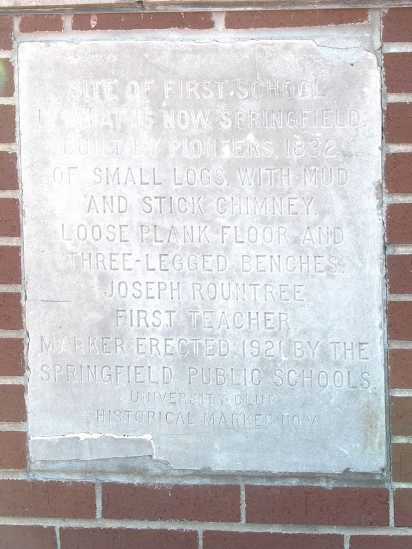
Photographed by Duane and Tracy Marsteller, April 7, 2025
1. First School in Springfield Marker
Erected 1921 by Springfield Public Schools • University Club. (Marker Number 5.)
Topics. This historical marker is listed in these topic lists: Education • Settlements & Settlers. A significant historical year for this entry is 1832.
Location. 37° 12.552′ N, 93° 17.803′ W. Marker is in Springfield, Missouri, in Greene County. It is in Downtown Springfield. It is on North Main Avenue north of West College Street, on the left when traveling north. Marker is on a low brick wall at the city's transit center. Touch for map. Marker is at or near this postal address: 209 N Main Ave, Springfield MO 65806, United States of America. Touch for directions.

Regionally, this marker is in the American Ozarks, in the Lewis & Clark Corridor, and in the Corn Belt. Globally, it is in North America, the Western Hemisphere, the Western World, and the Anglosphere. Historically, it finds itself in what was once the territory of the Mississippian
this page online
Other nearby markers. At least 8 other markers are within walking distance of this marker: Battle of Springfield (approx. 0.2 miles away); Yellow Bonnet Girl (approx. 0.2 miles away); Here Dave Tutt Fell (approx. ¼ mile away); Wild Bill's Shootout (approx. ¼ mile away); 1971 Tumbler (approx. ¼ mile away); Dedicated to the Loving Memory of Dr. R. Fred Schweitzer (approx. ¼ mile away); Butterfield Overland Stage (approx. ¼ mile away); History of Springfield Public Square (approx. ¼ mile away). Touch for a list and map of all markers in Springfield.
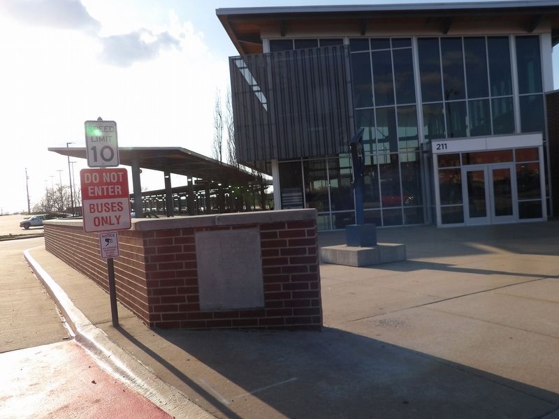
Photographed by Duane and Tracy Marsteller, April 6, 2025
2. First School in Springfield Marker
Credits. This page was last revised on June 23, 2026. It was originally submitted on May 1, 2025, by Duane and Tracy Marsteller of Murfreesboro, Tennessee. This page has been viewed 188 times since then and 76 times this year. Photos: 1, 2. submitted on May 1, 2025, by Duane and Tracy Marsteller of Murfreesboro, Tennessee.
