Houston Heights in Harris County, Texas — The American South (West South Central)
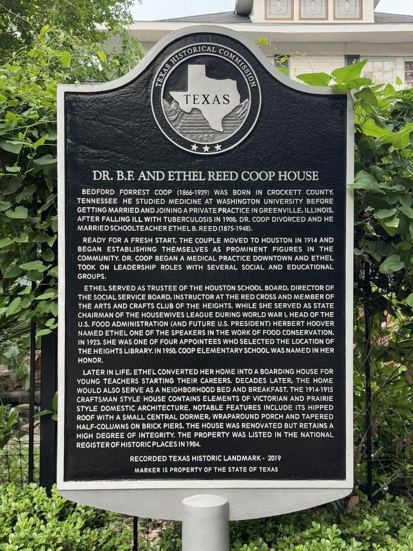
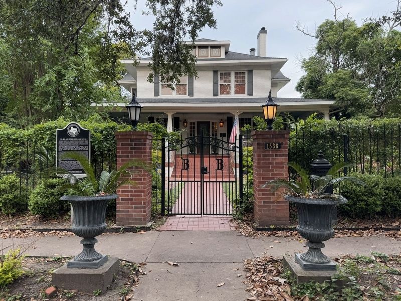
Dr. B.F. and Ethel Reed Coop House
Photographed by Alex Brogan, May 1, 2025
1. Dr. B.F. and Ethel Reed Coop House Marker
Ready for a fresh start, the couple moved to Houston in 1914 and began establishing themselves as prominent figures in the community. Dr. Coop began a medical practice downtown and Ethel took on leadership roles with several social and educational groups.
Ethel served as trustee of the Houston School Board, director of the Social Service Board, instructor at the Red Cross and member of the Arts and Crafts Club of the Heights. While she served as State Chairman of the Housewives League during World War I, head of the U.S. Food Administration (and future U.S. President) Herbert Hoover named Ethel one of the speakers in the work of food conservation. In 1923, she was one of four appointees who selected the location of the Heights Library. In 1950, Coop Elementary School was named in her honor.
Later in
this page online
Erected 2019 by Texas Historical Commission. (Marker Number 22413.)
Topics. This historical marker is listed in this topic list: Landmarks. A significant historical year for this entry is 1914.
Location. 29° 47.964′ N, 95° 23.859′ W. Marker is in Houston, Texas, in Harris County. It is in Houston Heights. It is on Heights Boulevard south of E 16th St, on the right when traveling north. Touch for map. Marker is at or near this postal address: 1536 Heights Boulevard, Houston TX 77008, United States of America. Touch for directions.

Regionally, this
Photographed by Alex Brogan, May 1, 2025
2. Dr. B.F. and Ethel Reed Coop House
Other nearby markers. At least 8 other markers are within walking distance of this marker: Heights Church of Christ (within shouting distance of this marker); Reagan Masonic Lodge No. 1037 A.F. & A.M. (about 300 feet away, measured in a direct line); David Barker House (about 300 feet away); Daniel Denton Cooley (approx. 0.2 miles away); Houston Heights Odd Fellows Lodge No. 225 Hall (approx. 0.2 miles away); St. Andrew's Episcopal Church (approx. ¼ mile away); Cooley School (approx. ¼ mile away); Matthews-Johnson House (approx. 0.3 miles away). Touch for a list and map of all markers in Houston.
Credits. This page was last revised on May 5, 2025. It was originally submitted on May 1, 2025, by Alex Brogan of Houston, Texas. This page has been viewed 191 times since then and 30 times this year. Photos: 1, 2. submitted on May 1, 2025, by Alex Brogan of Houston, Texas. • James Hulse was the editor who published this page.
