Soledad in Monterey County, California — The American West (Pacific Coastal)
The De Anza Expedition in Soledad
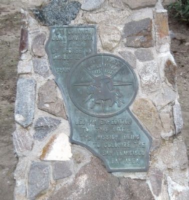
In the center of the marker is a circular motif, designed by Doris Birkland Beezley, of a rider superimposed upon a sun-like set of compass points, with the "De Anza Expedition 1775 1776" written above the rider.
Topics and series. This historical marker is listed in this topic list: Exploration. In addition, it is included in the Juan Bautista de Anza National Historic Trail series list. A significant historical year for this entry is 1775.
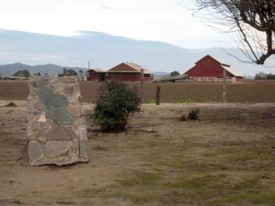
Location. 36° 24.295′ N, 121° 21.325′ W. Marker is in Soledad, California, in Monterey County. Marker can be reached from Fort Romie Road east of Mission Road. The marker is located in the quadrangle out behind the West Wing of Mission Nuestra Señora de la Soledad (Mission Soledad). Touch for map. Marker is at or near this postal address: 36641 Fort Romie Road, Soledad CA 93960, United States of America. Touch for directions.
Other nearby markers. At least 8 other markers are within 3 miles of this marker, measured as the crow flies. Padre Florencio Ibanez (a few steps from this marker); Jose Joaquin de Arrillaga (a few steps from this marker); Site of Original Church (within shouting distance of this marker); El Camino Real Bell (within shouting distance of this marker); Mission Nuestra Señora Dolorosísima de la Soledad (about 500 feet away, measured in a direct line); Railroad Station Site (approx. 2.1 miles away); Cesar Chavez Park (approx. 2.1 miles away); One Voice Murals Project (approx. 2.1 miles away). Touch for a list and map of all markers in Soledad.
More about this marker. The marker is mounted on a low stone monument. Although the marker is undated, it was likely installed in or around 1976, as were other markers of identical design and wording, as part of the De Anza bicentennial.
Regarding The De Anza Expedition in Soledad. In March, 1776, the De Anza Expedition passed through this area on the way to Monterey. This was fifteen years prior to the founding of the Mission, however, so although the marker is located at the Mission, the expedition could not have actually stayed there.
Credits. This page was last revised on November 6, 2019. It was originally submitted on February 5, 2010, by Andrew Ruppenstein of Lamorinda, California. This page has been viewed 1,073 times since then and 17 times this year. Photos: 1, 2. submitted on February 5, 2010, by Andrew Ruppenstein of Lamorinda, California. • Syd Whittle was the editor who published this page.

