Fort Snelling in Hennepin County, Minnesota — The American Midwest (Upper Plains)
Getting Around at the Fort
Photographed by McGhiever, October 21, 2024
1. Getting Around at the Fort Marker
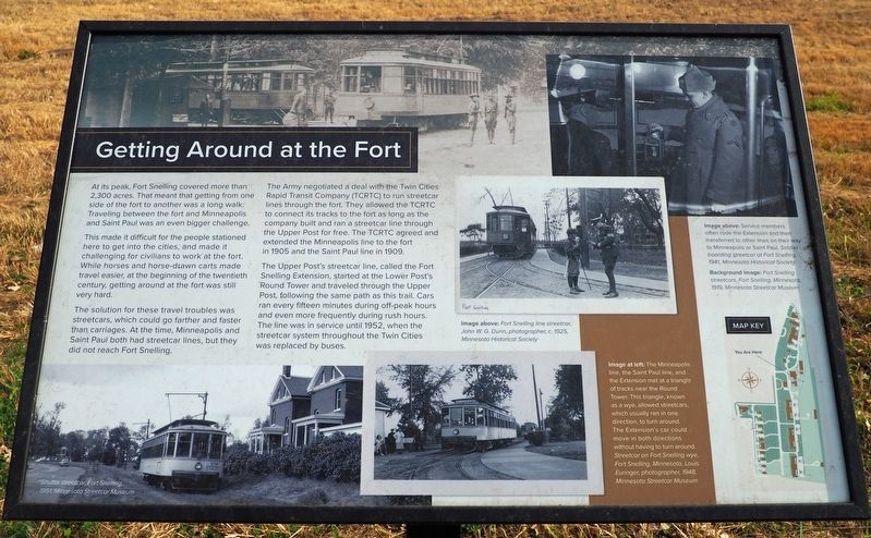
At its peak, Fort Snelling covered more than 2,300 acres. That meant that getting from one side of the fort to another was a long walk. Traveling between the fort and Minneapolis and Saint Paul was an even bigger challenge.
This made it difficult for the people stationed here to get into the cities, and made it challenging for civilians to work at the fort. While horses and horse-drawn carts made travel easier, at the beginning of the twentieth century, getting around at the fort was still very hard.
The solution for these travel troubles was streetcars, which could go farther and faster than carriages. At the time, Minneapolis and Saint Paul both had streetcar lines, but they did not reach Fort Snelling.
The Army negotiated a deal with the Twin Cities Rapid Transit Company (TCRTC) to run streetcar lines through the fort. They allowed the TCRTC to connect its tracks to the fort as long as the company built and ran a streetcar line through the Upper Post for free. The TCRTC agreed and extended the Minneapolis line to the fort in 1905 and the Saint Paul line in 1909.
The Upper Post's streetcar line, called the
this page online
Shuttle streetcar, Fort Snelling, 1951, Minnesota Streetcar Museum
Fort Snelling line streetcar, John W.G. Dunn, photographer, c. 1925, Minnesota Historical Society
The Minneapolis line, the Saint Paul line, and the Extension met at a triangle of tracks near the Round Tower. This triangle, known as a wye, allowed streetcars, which usually ran in one direction, to turn around. The Extension's cars could move in both directions without having to turn around. Streetcar on Fort Snelling wye, Fort Snelling, Minnesota, Louis Euringer, photographer, 1948, Minnesota Streetcar Museum
Service members often rode the Extension and then transferred to other lines on their way to Minneapolis or Saint Paul. Soldier boarding streetcar at Fort Snelling, 1941, Minnesota Historical Society
Background image: Fort Snelling streetcars, Fort Snelling, Minnesota, 1919, Minnesota Streetcar Museum
Topics.
Photographed by McGhiever, October 21, 2024
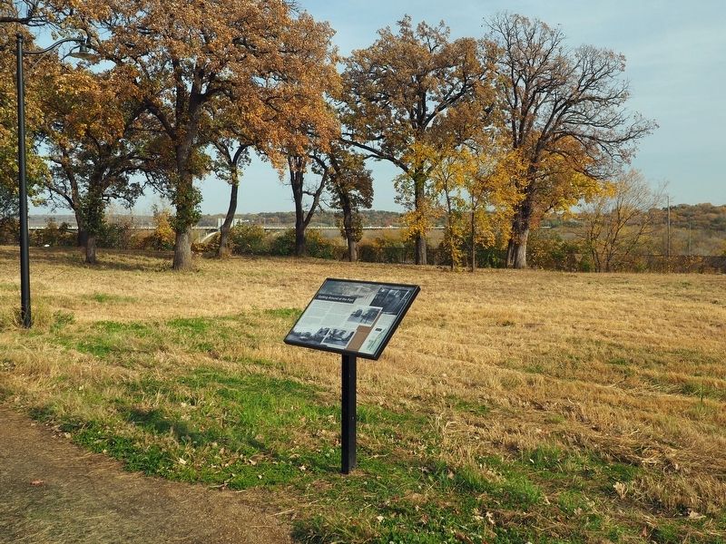
2. Getting Around at the Fort Marker facing the Minnesota River Valley
Location. 44° 53.196′ N, 93° 11.348′ W. Marker is in Fort Snelling, Minnesota, in Hennepin County. It can be reached from the intersection of Sibley Avenue and Colville Avenue, on the left when traveling south. The marker is between the row of fort buildings and the highway, behind the swimming pool. Touch for map. Marker is at or near this postal address: 6375 Sibley Avenue, Saint Paul MN 55111, United States of America. Touch for directions.

Regionally, this marker is in the Twin Cities Metropolitan Area. It is also in the American Midwest, in the Corn Belt, and in the Great River Road Region. Globally, it is in North America, the Western Hemisphere, the Western World, and the Anglosphere. Historically, it finds itself in what was once Rupert’s Land, the territory of the Mississippian Culture, and the Louisiana Purchase.
Other nearby markers. At least 8 other markers are within walking distance of this marker: Quartermaster Shops (within shouting distance of this marker); The Upper Post at Fort Snelling (about 400 feet away, measured in a direct line); Military Intelligence Service Language School (about 500 feet away); Military Units of Fort Snelling (about 600 feet away); Women at Work (about 600 feet away); Fun at the Fort (about 700 feet away); Medicine at the Fort (approx. 0.2 miles away); Military Training at Fort Snelling (approx. 0.2 miles away). Touch for a list and map of all markers in Fort Snelling.
Credits. This page was last revised on May 4, 2025. It was originally submitted on May 4, 2025, by McGhiever of Minneapolis, Minnesota. This page has been viewed 118 times since then and 29 times this year. Photos: 1, 2. submitted on May 4, 2025, by McGhiever of Minneapolis, Minnesota.
