Pinto in Washington County, Utah — The American Mountains (Southwest)
Pinto
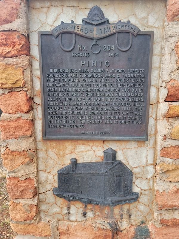
Photographed by Jeremy Snow, May 5, 2025
1. Pinto Marker
Erected 1954 by Daughters of Utah Pioneers. (Marker Number 204.)
Topics and series. This historical marker is listed in these topic lists: Religion & Religious Structures • Settlements & Settlers. In addition, it is included in the Daughters of Utah Pioneers series list. A significant historical year for this entry is 1856.
Location. 37° 32.352′ N, 113° 31.014′ W. Marker is in Pinto, Utah, in Washington County. It is at the intersection of North Centre Street and North Diagonal Street, on the right when traveling west on North Centre Street. Touch for map.
this page online

Regionally, this marker is in Color Country. It is also in the American Southwest, in the Mountain West, and on the Colorado Plateau. Globally, it is in North America, the Rocky Mountains, the Western Hemisphere, the Western World, and the Anglosphere. Historically, it finds itself in what was once New Spain and also Mexico’s Alta California.
Other nearby markers. At least 8 other markers are within 8 miles of this marker, measured as the crow flies: Hamblin Village (approx. 5 miles away); Page Ranch House (approx. 5½ miles away); Old Irontown (approx. 5.6 miles away); In Honored Remembrance (approx. 6.8 miles away); The Mountain Meadows Massacre (approx. 6.8 miles away); Jefferson Hunt (approx. 6.9 miles away); a different marker also named Mountain Meadows Massacre (approx. 7.2 miles away); a different marker also named Mountain Meadows Massacre (approx. 7.2 miles away).
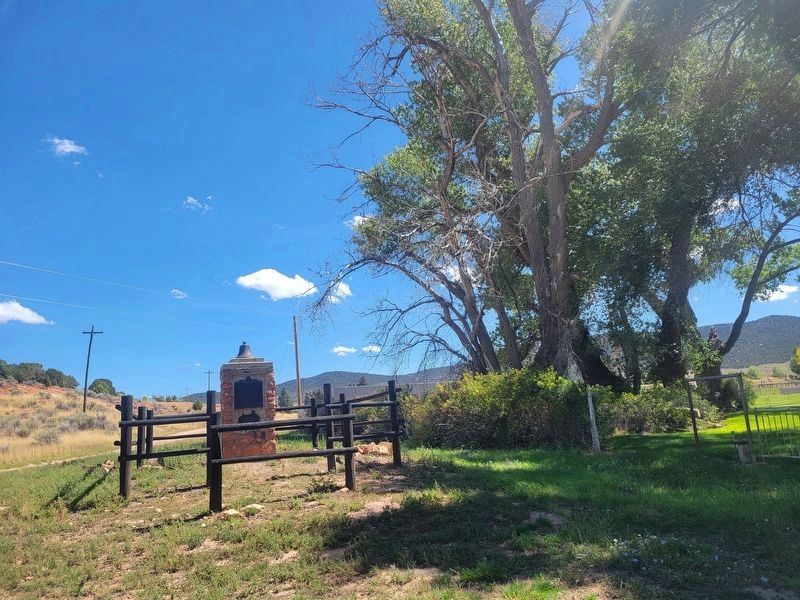
Photographed by Jeremy Snow, September 11, 2025
2. Pinto Marker
Credits. This page was last revised on September 16, 2025. It was originally submitted on May 5, 2025, by Jeremy Snow of Cedar City, Utah. This page has been viewed 256 times since then and 78 times this year. Photos: 1. submitted on May 5, 2025, by Jeremy Snow of Cedar City, Utah. 2. submitted on September 11, 2025, by Jeremy Snow of Cedar City, Utah. • Andrew Ruppenstein was the editor who published this page.
