Fort Howard in Edgemere in Baltimore County, Maryland — The American Northeast (Mid-Atlantic)
Civilian Contractors at Fort Howard
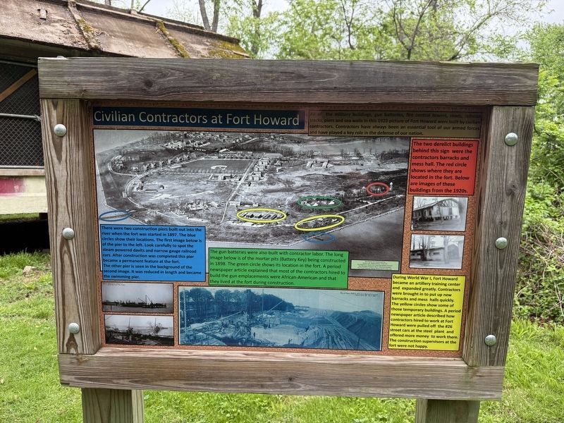
All of the military buildings, gun batteries, fire control towers, roads, railroad tracks, piers and sea walls in this 1923 picture of Fort Howard were built by civilian contractors. Contractors have always been an essential tool of our armed forces and have played a key role in the defense of our nation.
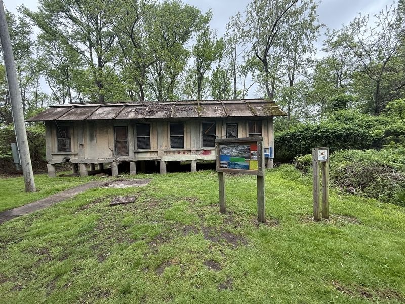
The two derelict buildings behind this sign were thee contractors barracks and mess hall. The red circle shows where they are located in the fort. Below are images of the buildings from the 1920s.
There were two construction piers built out into the river when the fort was started in 1897. The blue circles show their locations. The first image below is of the pier to the left. Look carefully to spot the steam powered davits and narrow gauge railroad cars. After construction was completed this pier became a permanent feature at the fort. The other pier is seen in the background of the second image. It was reduced in length and became the swimming pier.
The gun batteries were also built with contractor labor. The long image below is of the mortar pits (Battery Key) being constructed in 1898. The green circle shows
this page online
During World War I, Fort Howard became an artillery training center and expanded greatly. Contractors were brought in to put up new barracks and mess halls quickly. The yellow circles show some of those temporary buildings. A period newspaper article describes how contractors hired to work at Fort Howard were pulled off the #26 street cars at the steel plant and offered more money to work there. The construction supervisors at the fort were not happy.
Erected by Jacob LUre, Eagles Cout, Troop 427; The Edgemere Sparrows Point Recreation Council; The Dundalk Patapsco Neck Historical Society; The Coast Defense Study Group.
Topics. This historical marker is listed in these topic lists: African Americans • Forts and Castles • Industry & Commerce • Military. A significant historical year for this entry is 1923.
Location. 39° 11.935′ N, 76° 26.437′ W. Marker is in Edgemere, Maryland, in Baltimore County. It is in Fort Howard.

Regionally, this marker is in the Baltimore Metro Region and in Central Maryland. It is also in the American Mid-Atlantic, in the Chesapeake Bay Region, and on the Eastern Seaboard. Globally, it is in the North Atlantic Region, North America, the Western Hemisphere, the Western World, and the Anglosphere. Historically, it finds itself in what was once one of the original Thirteen Colonies and also the Antebellum South.
Other nearby markers. At least 8 other markers are within walking distance of this marker: Fire Control Towers (a few steps from this marker); Battery Clagett (within shouting distance of this marker); Duc Huc (about 300 feet away, measured in a direct line); Harbor Defense: Controlled Mines and the Mine Casemate (about 500 feet away); Power House (about 500 feet away); Battery Key (about 600 feet away); Life at Fort Howard 1898-1917 (about 800 feet away); Fort Howard During World War I

Photographed by Evan Dwyer, March 7, 2026
3. Civilian Contractors' Mess Hall
Obscured by foliage in the spring & summer, the ruined mess hall described in the marker is just to the right of the barracks, housed within a retaining fence.
Another marker is no longer nearby. Battery Clagett (was within shouting distance of this marker but has been replaced with another marker now near it).
Credits. This page was last revised on March 18, 2026. It was originally submitted on May 5, 2025, by Devry Becker Jones of Washington, District of Columbia. This page has been viewed 131 times since then and 27 times this year. Photos: 1, 2. submitted on May 5, 2025, by Devry Becker Jones of Washington, District of Columbia. 3. submitted on March 8, 2026, by Evan Dwyer of Richmond, Virginia.
