Hilton Beach in Algoma District, Ontario — Central Canada (North America)
Carterton
Photographed by Cosmos Mariner, June 10, 2024
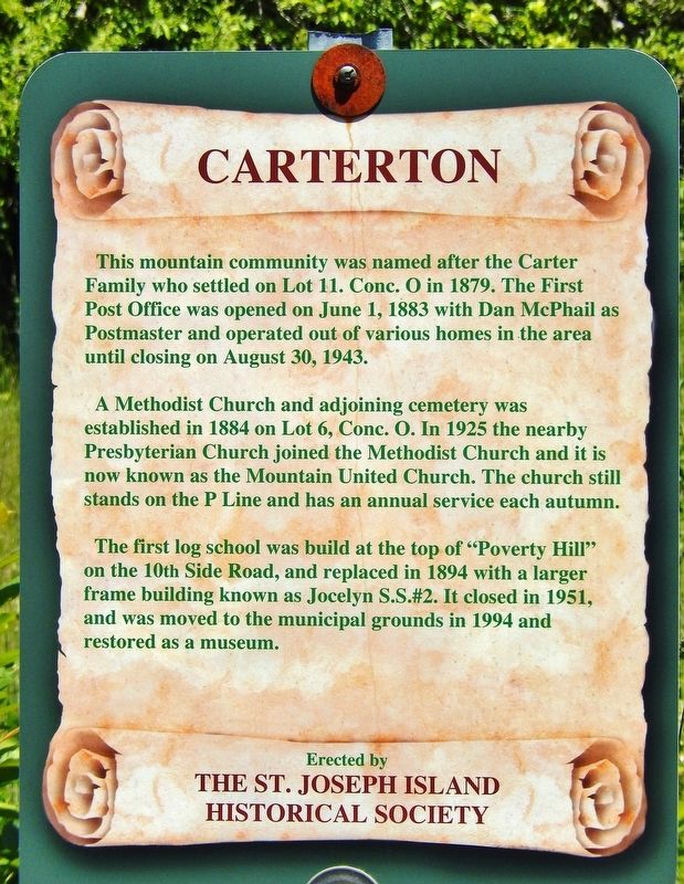
1. Carterton Marker
This mountain community was named after the Carter Family who settled on Lot 11. Conc. O in 1879. The First Post Office was opened on June 1, 1883 with Dan McPhail as Postmaster and operated out of various homes in the area until closing on August 30, 1943.
A Methodist Church and adjoining cemetery was established in 1884 on Lot 6, Conc. O. In 1925 the nearby Presbyterian Church joined the Methodist Church and it is now known as the Mountain United Church. The church still stands on the P Line and has an annual service each autumn.
The first log school was built at the top of “Poverty Hill” on the 10th Side Road, and replaced in 1894 with a larger frame building known as Jocelyn S.S.#2. It closed in 1951, and was moved to the municipal grounds in 1994 and restored as a museum.
Erected by St. Joseph Island Historical Society.
Topics. This historical marker is listed in these topic lists: Religion & Religious Structures • Settlements & Settlers. A significant historical date for this entry is June 1, 1883.
Location. 46° 11.922′ N, 83° 57.414′ W. Marker is in Hilton Beach, Ontario, in Algoma District. It is at the intersection
this page online

Regionally, this marker is in the Sault Ste. Marie and Algoma Area and in Northern Ontario. It is also in Central Canada. Globally, it is in North America, in the Great North Woods, on the Great Lakes, on Lake Superior’s North Shore, in the Western Hemisphere, in the Western World, and in the Anglosphere. Historically, it finds itself in what was once a British colony, the Viceroyalty of New France, the Haudenosaunee (Iroquois) Confederacy, and Rupert’s Land.
Other nearby markers. At least 8 other markers are within 16 kilometers of this marker, measured as the crow flies: Tenby Bay (approx. 9 kilometers away); Site of John Richards' Homestead (approx. 12.2 kilometers away); St. Joseph World War Memorial (approx. 12.3 kilometers away); Sailor's Encampment (approx. 13.4 kilometers away); Fort St. Joseph / Le Fort Saint-Joseph (approx. 14.9 kilometers away);
Photographed by Cosmos Mariner, June 10, 2024
2. Carterton Marker
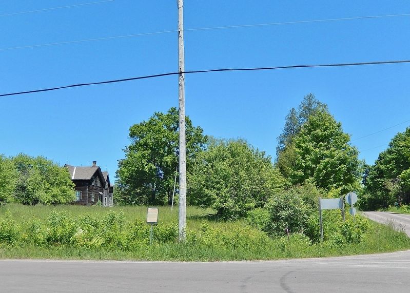
Looking east across 10th Side Road; P Line Road is on the right. The marker is on the left side of the utility pole.
Also see . . . St. Joseph Island (Wikipedia).
Excerpt: St. Joseph Island played an important role for First Nations and Europeans in the early fur trade and as a staging point for the first victory for British North America in the War of 1812. Its highest point, known colloquially and by surveyors as "the Mountain", is near the centre of the island near Carterton with an elevation of 345 m, which is about 169 m above Lake Huron.(Submitted on May 6, 2025, by Cosmos Mariner of Cape Canaveral, Florida.)

Photographed by Cosmos Mariner, June 10, 2024
3. Unidentified Wooden Frame House
Looking east from the marker.
Credits. This page was last revised on May 6, 2025. It was originally submitted on May 6, 2025, by Cosmos Mariner of Cape Canaveral, Florida. This page has been viewed 172 times since then and 38 times this year. Photos: 1, 2, 3. submitted on May 6, 2025, by Cosmos Mariner of Cape Canaveral, Florida.
