
Council Bluffs in Pottawattamie County, Iowa — The American Midwest (Upper Plains)
Scale…Connection…Resurrection…Pride
Photographed by McGhiever, November 16, 2024
1. Scale...Connection...Resurrection...Pride Marker
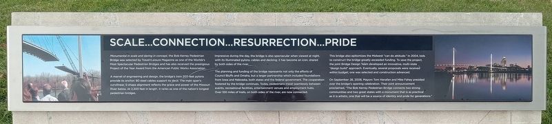
Monumental in scale and daring in concept, the Bob Kerrey Pedestrian Bridge was selected by Travel+Leisure Magazine as one of the Worlds's [sic] Most Spectacular Pedestrian Bridges and has also received the prestigious Project of the Year Award from the American Public Works Association.
A marvel of engineering and design, the bridge's twin 203-feet pylons provide its anchor; 80 steel cables support its deck. The main span's curvilinear, S-shape alignment reflects the grace and power of the Missouri River below. At 2,300 feet in length, it ranks as one of the nation's longest pedestrian bridges.
Impressive during the day, the bridge is also spectacular when viewed at night, with its illuminated pylons, cables and decking; it has become an icon, shared by both sides of the river.
The planning and funding of the bridge represents not only the efforts of Council Bluffs and Omaha, but a larger partnership which included foundations from Iowa and Nebraska, both states and the federal government. The cooperation fostered by the bridge continues. Today, pedestrians travel seamlessly between events, recreational facilities,
this page online
This bridge also epitomizes the Midwest "can do attitude." In 2004, bids to construct the bridge greatly exceeded funding. To save the project, the joint Bridge Design Team developed an innovative, multi-state "design build" approach. Eventually, several proposals were received within budget; one was selected and construction advanced.
On September 28, 2008, Mayors Tom Hanafan and Mike Fahey presided over the bridge's opening celebration. Their joint announcement proclaimed, "The Bob Kerrey Pedestrian Bridge connects two strong communities and two great states with a monument that is as practical as it is artistic, one that will be a source of identity and pride for generations."
Topics. This historical marker is listed in this topic list: Bridges & Viaducts. A significant historical year for this entry is 2008.
Location. 41° 15.793′ N, 95° 55.063′ W. Marker is in Council Bluffs, Iowa, in Pottawattamie County. It can be reached from the intersection of Rivers Edge Parkway and Avenue A. The marker is in Tom Hanafan River's

Photographed by McGhiever, November 16, 2024
2. Scale...Connection...Resurrection...Pride Marker (left) in Tom Hanafan River's Edge Park

Regionally, this marker is in Western Iowa, in Loess Hills, and in Greater Omaha. It is also in the American Midwest, in the Lewis & Clark Corridor, and in the Corn Belt. Globally, it is in North America, the Western Hemisphere, the Western World, and the Anglosphere. Historically, it finds itself in what was once the territory of the Mississippian Culture and also the Louisiana Purchase.
Other nearby markers. At least 8 other markers are within walking distance of this marker: Power...Place...Partnerships...People (here, next to this marker); A River of Change (approx. 0.3 miles away in Nebraska); Missouri River Flood (approx. 0.3 miles away in Nebraska); Labor (approx. 0.3 miles away in Nebraska); Missouri River Flooding (approx. 0.3 miles away in Nebraska); Captain William Clark and Private Reuben Field (approx. 0.3 miles away in Nebraska); Westwardly by the Waters (approx. 0.3 miles away in Nebraska); Union Walk (approx. 0.3 miles away in Nebraska).
Credits. This page was last revised on May 11, 2025. It was originally submitted on May 10, 2025, by McGhiever of Minneapolis, Minnesota. This page has been viewed 140 times since then and 26 times this year. Photos: 1, 2. submitted on May 10, 2025, by McGhiever of Minneapolis, Minnesota.
