Wedgefield in Sumter County, South Carolina — The American South (South Atlantic)
Wedgefield Presbyterian Church
Photographed by Mike Stroud, 2010
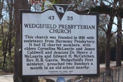
1. Wedgefield Presbyterian Church Marker
This church was founded in 1881 with assistance from Harmony Presbytery. It had 12 charter members, with elders Cornelius McLaurin and James Caldwell and deacons Dr. Henry J. McLaurin and Edward H. McCutchen. Rev. H.B. Garris, Wedgefield’s first minister, preached two Sundays a month in an old school nearby.
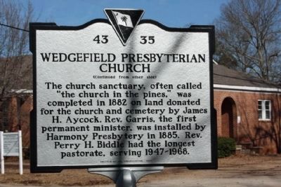
(Reverse text)
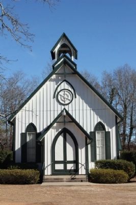
The church sanctuary, often called “the church in the pines,” was completed in 1882 on land donated for the church and cemetery by James H. Aycock. Rev. Garris, the first permanent minister, was installed by Harmony Presbytery in 1885. Rev. Perry H. Biddle had the longest pastorate, serving 1947-1968.
Erected 2006 by the Congregation. (Marker Number 43-35.)
Topics. This historical marker is listed in this topic list: Religion & Religious Structures. A significant historical year for this entry is 1881.
Location. 33° 53.496′ N, 80° 30.983′ W. Marker is in Wedgefield, South Carolina, in Sumter County. It is at the intersection of Presbyterian Drive and South Carolina Highway 43-420, on the right when traveling south on Presbyterian Drive. Touch for map. Marker is in this
this page online

Regionally, this marker is in South Carolina’s Pee Dee. It is also in the American South and specifically in the Deep South. Globally, it is in North America, the Western Hemisphere, the Western World, and the Anglosphere. Historically, it finds itself in what was once the territory of the Mississippian Culture, one of the original Thirteen Colonies, one of the Confederate States of America, and the Antebellum South.
Other nearby markers. At least 8 other markers are within 5 miles of this marker, measured as the crow flies: Site of Manchester (approx. 3.6 miles away); William Tennent (approx. 3.7 miles away); Early Charleston Road (approx. 3.8 miles away); Battle of Stateburg (approx. 4 miles away); Joel Roberts Poinsett (approx. 4.4 miles away); Church of the Holy Cross Stateburg / Holy Cross Churchyard (approx. 4.4 miles away); Church of the Holy Cross (approx. 4.4 miles away); a different marker also named Church of the Holy Cross (approx. 4.4 miles away).
Another marker is no longer nearby. Cane Savannah Plantation (was
Photographed by Mike Stroud, January 19, 2010
2. Wedgefield Presbyterian Church Marker, reverse side
Photographed by Mike Stroud, January 19, 2010
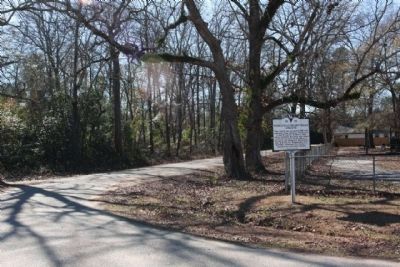
3. Wedgefield Presbyterian Church Marker
seen at the intersection of Presbyterian Dr and State Road 43-420
Photographed by Mike Stroud, January 19, 2010
4. Wedgefield Presbyterian Church
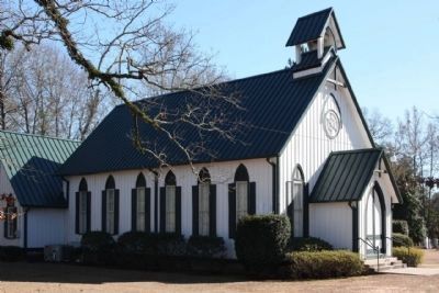
Photographed by Mike Stroud, January 19, 2010
5. Wedgefield Presbyterian Church
Credits. This page was last revised on June 16, 2016. It was originally submitted on February 7, 2010, by Mike Stroud of Bluffton, South Carolina. This page has been viewed 1,374 times since then and 32 times this year. Photos: 1, 2, 3, 4, 5. submitted on February 7, 2010, by Mike Stroud of Bluffton, South Carolina. • Craig Swain was the editor who published this page.
