Parowan in Iron County, Utah — The American Mountains (Southwest)
First Iron County Log School House
Photographed by James Hulse, April 6, 2025
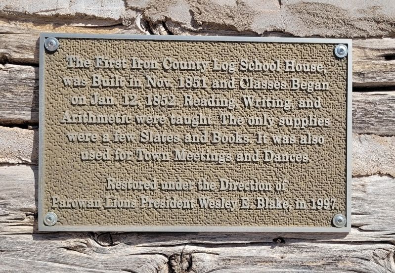
1. First Iron County Log School House Marker
Restored under the Direction of Parowan Lions President Wesley E. Blake, in 1997.
Topics. This historical marker is listed in this topic list: Notable Buildings. A significant historical date for this entry is January 12, 1852.
Location. 37° 50.344′ N, 112° 49.832′ W. Marker is in Parowan, Utah, in Iron County. It is at the intersection of W 200 S (State Road 143) and S 100 W, on the right when traveling west on W 200 S. The marker is located on the side of the log cabin building. Touch for map. Marker is at or near this postal address: 156 100 W, Paragonah UT 84760, United States of America. Touch for directions.

Regionally, this marker is in Color Country. It is also in the American Mountain West and on the Colorado Plateau. Globally, it is in North America, the Rocky Mountains, the Western Hemisphere, the Western World, and the Anglosphere. Historically, it finds itself in what was once
this page online
Other nearby markers. At least 8 other markers are within walking distance of this marker: Pioneer Industrial Center (here, next to this marker); Parowan Cotton Factory (within shouting distance of this marker); Center Creek Hydroelectric Power Plant (about 300 feet away, measured in a direct line); Parowan Adobe Fort (about 400 feet away); Jesse N. Smith Home (about 700 feet away); a different marker also named Jesse N. Smith Home (about 700 feet away); John C. Freemont Memorial (approx. 0.2 miles away); D.U.P. Relic Hall (approx. 0.2 miles away). Touch for a list and map of all markers in Parowan.
Photographed by James Hulse, April 6, 2025
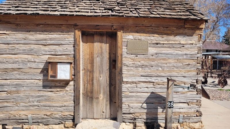
2. The First Iron County Log School House and Marker
Photographed by James Hulse, April 6, 2025
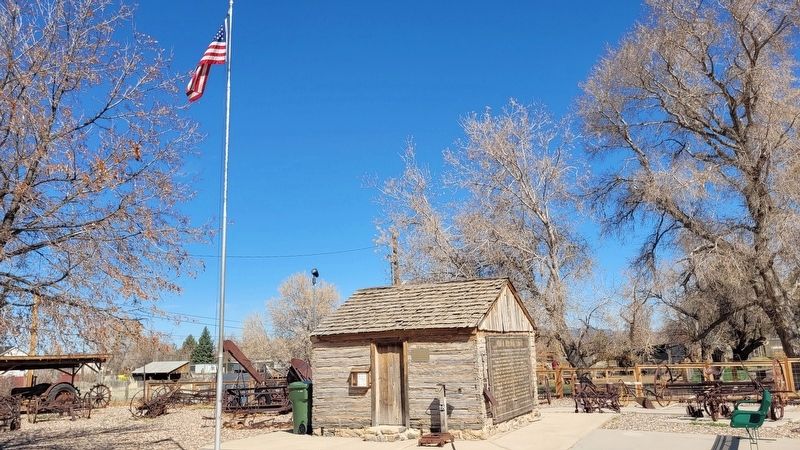
3. The view of the First Iron County Log School House and Marker from the street
Credits. This page was last revised on May 14, 2025. It was originally submitted on May 14, 2025, by James Hulse of Medina, Texas. This page has been viewed 141 times since then and 23 times this year. Photos: 1, 2, 3. submitted on May 14, 2025, by James Hulse of Medina, Texas.
