Parowan in Iron County, Utah — The American Mountains (Southwest)
Pioneer Industrial Center
Photographed by James Hulse, April 6, 2025
1. Pioneer Industrial Center Marker
Inscription.
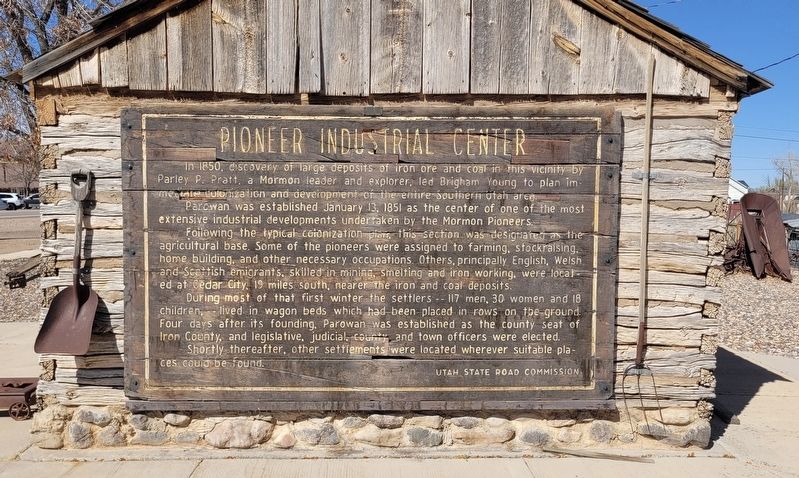
Pioneer Industrial Center. . In 1850, discovery of large deposits of iron ore and coal in this vicinity by Parley P. Pratt, a Mormon leader and explorer, led Brigham Young to plan immediate colonization and development of the entire Southern Utah area. Parowan was established January 13, 1851 as the center of one of the most extensive industrial developments undertaken by the Mormon Pioneers. Following the typical colonization plan, this section was designated as the agricultural base. Some of the pioneers were assigned to farming, stockraising, home building, and other necessary occupations. Others, principally English, Welsh and Scottish emigrants, skilled in mining, smelting and iron working, were located at Cedar City, 19 miles south, nearer the iron and coal deposits. During most of that first winter the settlers - 117 men, 30 women and 18 children, - lived in wagon beds which had been placed in rows on the ground. Four days after its founding, Parowan was established as the county seat of Iron County, and legislative, judicial county and town officers were elected. Shortly thereafter, other settlements were located wherever suitable places could be found.
In 1850, discovery of large deposits of iron ore and coal in this vicinity by Parley P. Pratt, a Mormon leader and explorer, led Brigham Young to plan immediate colonization and development of the entire Southern Utah area.
Parowan was established January 13, 1851 as the center of one of the most extensive industrial developments undertaken by the Mormon Pioneers.
Following the typical colonization plan, this section was designated as the agricultural base. Some of the pioneers were assigned to farming, stockraising, home building, and other necessary occupations. Others, principally English, Welsh and Scottish emigrants, skilled in mining, smelting and iron working, were located at Cedar City, 19 miles south, nearer the iron and coal deposits.
During most of that first winter the settlers - 117 men, 30 women and 18 children, - lived in wagon beds which had been placed in rows on the ground. Four days after its founding, Parowan was established as the county seat of Iron County, and legislative, judicial county and town officers were elected.
Shortly thereafter, other settlements were located wherever suitable
Click or scan to see this page online
places could be found.
Erected by Utah State Road Commission.
Topics. This historical marker is listed in these topic lists: Industry & Commerce • Settlements & Settlers. A significant historical date for this entry is January 13, 1851.
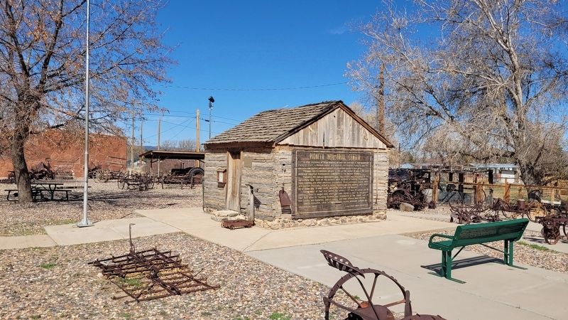
Location. 37° 50.346′ N, 112° 49.831′ W. Marker is in Parowan, Utah, in Iron County. It is at the intersection of W 200 S (State Road 143) and S 100 W, on the right when traveling west on W 200 S. The marker is located on the side of the log cabin building. Touch for map. Marker is at or near this postal address: 156 100 W, Parowan UT 84761, United States of America. Touch for directions.

Regionally, this marker is in Utah’s Color Country. It is also in the American Mountain West and in Colorado Plateau. Globally, it is in North America, the Rocky Mountains, the Western Hemisphere, the Western World, and the Anglosphere. Historically, it finds itself in what was once New Spain and also Mexicos Alta California.
Credits. This page was last revised on May 14, 2025. It was originally submitted on May 14, 2025, by James Hulse of Medina, Texas. This page has been viewed 149 times since then and 36 times this year. Photos:1, 2. submitted on May 14, 2025, by James Hulse of Medina, Texas.