
Portchester in Hampshire, England, United Kingdom — Northwestern Europe (the British Isles)
A Medieval Castle within a Roman Fort
Portchester Castle

Photographed by Ray Gurganus, April 4, 2025
1. A Medieval Castle within a Roman Fort Marker
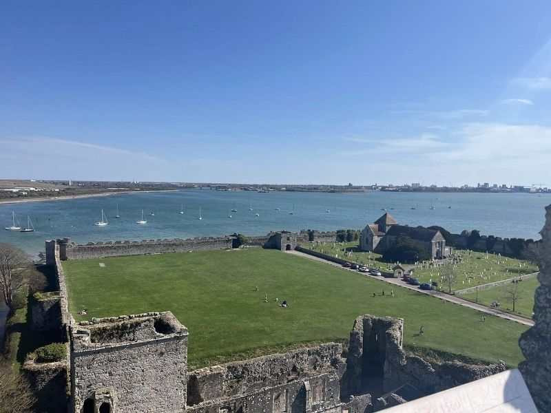
Portchester was one of a series of Roman forts, the so-called 'Forts of the Saxon Shore', that were built around the southern coast of Britain in the late 3rd century to defend it against raids by Saxon pirates. The outer walls remain almost complete. making this the best-preserved Roman fort north of the Alps.
In the 12th century Portchester was developed as a castle. with a keep and an inner bailey or courtyard in one corner of the Roman fort. You can climb to the top of the keep to enjoy the views.
The Fort's Founder
The fort at Portchester was built by Marcus Aurelius Carausius, who from AD 286 commanded the Roman empire's naval force in the English Channel.
The emperor Maximian distrusted him, however, and ordered his execution Carausius rebelled, with the support of the fleet and the three legions in Britain. He proclaimed himself emperor of the Roman province of Britain and controlled it until his deputy Allectus assassinated him in AD 293.
Erected by English Heritage.
Topics. This historical marker is listed in this topic list: Forts and Castles.
Location. 50° 50.256′ N,
this page online

Regionally, this marker is in the Greater South East. Globally, it is on the Atlantic Ocean, in the North Atlantic Region, in Europe, in Atlantic Europe, on one of the British Isles, in the Western World, and in the Anglosphere. Historically, it finds itself in what was once the Roman Empire.
Other nearby markers. At least 8 other markers are within 5 kilometers of this marker, measured as the crow flies: Richard II's Hall (within shouting distance of this marker); From Royal Castle to Prisoner of War Depot (about 90 meters away, measured in a direct line); Richard II's Palace (about 90 meters away); Charles Dickens Birthplace (approx. 3.9 kilometers away); Dickens Fellowship Trees (approx. 4 kilometers away); A Long Life (approx. 4 kilometers away); Ship Shape (approx. 4 kilometers away); Here Nelson Fell (approx. 4 kilometers away). Touch for a list and map of all markers
Photographed by Ray Gurganus, April 4, 2025
2. View from the castle of the surrounding Roman walls
Credits. This page was last revised on May 28, 2025. It was originally submitted on May 14, 2025, by Ray Gurganus of Washington, District of Columbia. This page has been viewed 119 times since then and 26 times this year. Photos: 1, 2. submitted on May 14, 2025, by Ray Gurganus of Washington, District of Columbia. • Bill Pfingsten was the editor who published this page.
