
Sault Ste. Marie in Algoma District, Ontario — Central Canada (North America)
The Sault's Industrial Heritage
⎯⎯⎯
Le patrimoine industriel du Sault

Photographed by Cosmos Mariner, June 11, 2024
1. The Sault's Industrial Heritage / Le patrimoine industriel du Sault Marker

Topics. This historical marker is listed in this topic list: Industry & Commerce.
Location. 46° 30.79′ N, 84° 21.015′ W. Marker is in Sault Ste. Marie, Ontario, in Algoma District. It can be reached
this page online

Regionally, this marker is in the Sault Ste. Marie and Algoma Area and in Northern Ontario. It is also in Central Canada. Globally, it is in North America, in the Great North Woods, on the Great Lakes, on Lake Superior’s North Shore, in the Western Hemisphere, in the Western World, and in the Anglosphere. Historically, it finds itself in what was once a British colony, the Viceroyalty of New France, the Haudenosaunee (Iroquois) Confederacy, and Rupert’s Land.
Other nearby markers. At least 8 other markers are within walking distance of this marker: Waterfront / Les Rives (here, next to this marker); Canal Under Construction, 1894 / Le canal en construction, 1894 (here, next to this marker); Celebrating Indigenous History and Heritage / Célébrons l'histoire et le patrimoine autochtones

SSMC collection
2. Marker detail: View looking north across the power canal at industrial complex
Vue en direction du nord, de l’autre côté du canal électrique d’un complexe industriel • • • inset photo: Francis H. Clergue (1856-1939) [Ontario Archives S 3843]
Also see . . .
1. Sault Ste. Marie Canal (Wikipedia).
Excerpt: The Sault Ste. Marie Canal is a National Historic Site, and is part of the national park system, managed by Parks Canada. It includes a lock to bypass the rapids on the St. Marys River. The first canal near the site was built in 1798, but was destroyed in 1814 during the War of 1812. The present canal dates to 1895, and formed part of the shipping route from the Atlantic Ocean to Lake Superior, along with the two locks on the US side of the river.(Submitted on May 16, 2025, by Cosmos Mariner of Cape Canaveral, Florida.)NAC PA-43396 Archive3. Marker detail: Sault Ste. Marie power plant interiorIntérieure de l’usine électrique de Sault Ste. Marie

2. Francis Hector Clergue (Wikipedia).
Excerpt: American businessman who became the leading industrialist of Sault Ste. Marie, Ontario, Canada, at the turn of the 20th century. Clergue expanded power generation at Sault Ste. Marie to a level where it could supply both municipal power and power for several industries and used hydropower as the nexus of a whirlwind of industrialization. In 1895, the Sault Ste. Marie Pulp and Paper Company (later St. Mary's Paper) was established. Clergue soon set his sights on the steel industry, but first he needed a ready supply of iron. With the 1897 discovery of hematite ore near Wawa in the northern part of Algoma District, Clergue quickly bought the mining claim and opened the Helen Mine, which was named after one of his sisters. To service the mine, he incorporated the Algoma Central Railway, one of the companies which is most associated with his legacy. In the east, near Sudbury, he purchased two nickel mining properties in 1899. In 1901, construction began on Clergue's steel mill at Sault Ste. Marie,(Submitted on May 16, 2025, by Cosmos Mariner of Cape Canaveral, Florida.)which would ultimately become Algoma Steel.SSMC Collection4. Marker detail: Modern view of industrial complex of buildings at the SaultVue moderne des bâtiments d’un complexe industriel au Sault

Photographed by Cosmos Mariner, June 11, 2024
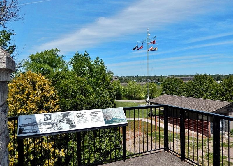
5. The Sault's Industrial Heritage / Le patrimoine industriel du Sault Marker
Looking north from the observation deck atop the old Canalmen's Shelter building.
Credits. This page was last revised on May 16, 2025. It was originally submitted on May 14, 2025, by Cosmos Mariner of Cape Canaveral, Florida. This page has been viewed 133 times since then and 16 times this year. Photos: 1, 2, 3, 4. submitted on May 15, 2025, by Cosmos Mariner of Cape Canaveral, Florida. 5. submitted on May 16, 2025, by Cosmos Mariner of Cape Canaveral, Florida.
